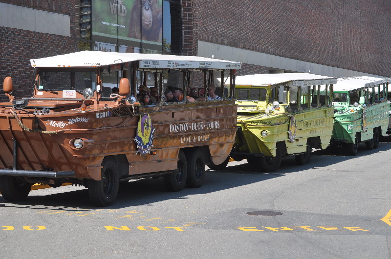
W.W.II style amphibious landing vehicle. First, you’ll be greeted by one of our legendary tour ConDUCKtors, who’ll be narrating your tour. Then you’re off on a journey like you’ve never had before. You’ll cruise by all the places that make Boston the birthplace of freedom and a city of firsts, from the golden-domed State House to Bunker Hill and the TD Banknorth Garden, Boston Common and Copley Square to the Big Dig, Government Center to fashionable Newbury Street, Quincy Market to the Prudential Tower, and more. And, as the best of Boston unfolds before your eyes, your ConDUCKtor will be giving you lots of little known facts and interesting insights about our unique and wonderful city. And just when you think you’ve seen it all, there’s more. It’s time for “Splashdown” as your ConDUCKtor splashes your DUCK right into the Charles River for a breathtaking view of the Boston and Cambridge skylines, the kind of view you just won’t get anywhere else.
We Started at The Museum of Science Museum of Science Charles River Esplanade Longfellow Bridge Hatch Shell Bunker Hill U.S.S. Constitution Old North Church/North End Rose Kennedy Greenway/North End Parks Holocaust Memorial Faneuil Hall/ Quincy Market Old State House King’s Chapel Granary Burying Ground Make Way for Ducklings Cheers Newbury Street Trinity Church Hancock Tower Boston Public Library Prudential Tower Christian Science Church Copley Place/ Arts Square New Old South Church Arlington Street Church Boston Common/ Public Gardens Swan Boats Beacon Hill State House Robert Gould Shaw Memorial Mary Dyer Old Scollay Square/ Government Center Old West Church West End TD Garden Zakim Bunker Hill Bridge 2012 Ashley Davidoff TheCommonVein.net 115002pb03.8 Arrival Early Am at the Museum of Science 115020p.8 Ashley Davidoff TheCommonVein.net Early Morning Greeting from the Dinosaur Outside 115008p.8 Ashley Davidoff TheCommonVein.net The Green One is Ours 115097p.8 s Ashley Davidoff TheCommonVein.net Espla Nadia is Her Name 115093p.8 Ashley Davidoff TheCommonVein.net This is What She Looks Like at the Captains Seat “Watch Your Knees and Legs” 115092p.8 Ashley Davidoff TheCommonVein.net Looking From the Museum of Science Eastward Toward the Zakim Bridge 115002pb01.8 Boston google map Duck tour map museum of science Zakim bridge Boston Sand and Gravel Route 93 North Station North End 2012 Ashley Davidoff TheCommonVein.net
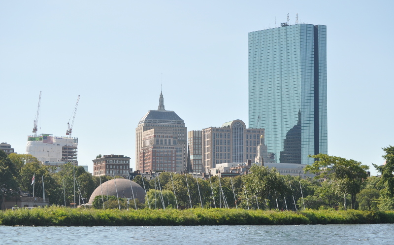
Waiting for Departure and Noting the Waterways Bridges and Arches Across the Street 115010p.8 Ashley Davidoff TheCommonVein.net
The Zakim Bridge is There 115002p.8 Ashley Davidoff TheCommonVein.net
The Zakim Bridge is There 115002p.8 Ashley Davidoff TheCommonVein.net
And Families Going for A Ride – are Also There
115100p.8 Ashley Davidoff TheCommonVein.net
A Better View of the Zakim Bridge
115005p.8 Ashley Davidoff TheCommonVein.net
And Nao and Dani Were Also There
115022p.8 Ashley Davidoff TheCommonVein.net
The Captain
A Former Truck Driver
115023p.8 Ashley Davidoff TheCommonVein.net
Bean Town Here We Come
115028p.8 Ashley Davidoff TheCommonVein.net
115182p.8
115182p.8 Ashley Davidoff TheCommonVein.net
The Old State House
The Old State House is an historic government building located at the intersection of Washington and State Streets in Boston, Massachusetts, USA. Built in 1713, it is the oldest surviving public building in Boston, and the seat of the state’s legislature until 1798. It is now a history museum operated by the Bostonian Society, a nonprofit organization whose primary focus is the museum. It is one of many historic landmarks that can be visited along the Freedom Trail. The Massachusetts Town House: seat of colony government 1713?1776 Today’s brick Old State House was built in 1712?13, possibly designed by Robert Twelves; the previous building, the wooden Town House of 1657, had burned in the fire of 1711.[3] One notable feature of the building was the pair of seven-foot tall wooden figures depicting a lion and a unicorn; The Lion and the Unicorn are symbols of the British monarchy.
115097p.8 Ashley Davidoff TheCommonVein.net
Boston Commons Commons ducklings
The Make Way for Ducklings sculpture is the Boston Public Garden’s most famous attraction. The statues of Mrs. Mallard and her 8 ducklings attract visitors from all over the world to this beautiful Victorian-era park right in the middle of the city.
Make Way for Ducklings is a children’s picture book written and illustrated by Robert McCloskey. First published in 1941, the book tells the story of a pair of mallard ducks who decide to raise their family on an island in the lagoon in Boston Public Garden, a park in the center of Boston, Massachusetts. Make Way for Ducklings won the 1942 Caldecott Medal for McCloskey’s illustrations, executed in charcoal then lithographed on zinc plates.[1][2][3] As of 2003, the book had sold over two million copies.[4] The book’s popularity led to the construction of a statue by Nancy Schön in the Public Garden of the mother duck and her eight ducklings, which is a popular destination for children and adults alike. In 1991, Barbara Bush gave a duplicate of this sculpture to Raisa Gorbachev as part of the START Treaty, and the work is displayed in Moscow’s Novodevichy Park.[5][6] The book is the official children’s book of the Commonwealth of Massachusetts.[7] Praise for the book is still high over 60 years since its first publication, mainly for the enhancing illustrations and effective pacing.[8] It was criticised for having a loose plot, however, as well as poor characterization.[2] The book is extremely popular worldwide.
Reference Wikipedia
115029p.8 Ashley Davidoff TheCommonVein.net
Trinity Church
Founded 1733
Trinity Church in the City of Boston, located in the Back Bay of Boston, Massachusetts, is a parish of the Episcopal Diocese of Massachusetts. The congregation, currently standing at approximately 3,000 households, was founded in 1733. Four services are offered each Sunday, and weekday services are offered three times a week from September through June. Trinity is considered “Low Church”, while continuing to be a Broad Church parish. In addition to worship, the parish is actively involved in service to the community, pastoral care, programs for children and teenagers, and Christian education for all ages. The church is home to several high-level choirs, including the Trinity Choir, Trinity Schola, Trinity Choristers, and Trinity Chamber Choir. After its former site on Summer Street burned in the Great Boston Fire of 1872, the current church complex was erected under the direction of Rector Phillips Brooks (1835?1893), one of the best-known and most charismatic preachers of his time. The church and parish house were designed by Henry Hobson Richardson and construction took place from 1872 to 1877, when the complex was consecrated. Situated on Copley Square in Back Bay, Trinity Church is the building that established Richardson’s reputation. It is the birthplace and archetype of the Richardsonian Romanesque style, characterized by a clay roof, polychromy, rough stone, heavy arches, and a massive tower. This style was soon adopted for a number of public buildings across the United States. Trinity Church is a masterpiece of American architecture. Dedicated in 1877, Trinity presented a bold, fresh new face and feeling for ecclesiastical architecture in America. The Church continues to be heralded today as a celebrated example of “Richardsonian Romanesque” design, named after its architect, H. H. Richardson. Episcopal community
Reference Wikipedia
115034p.8 Ashley Davidoff TheCommonVein.net
A Middle Aged Man
In Thought – a Hat and a Cigarette
115037p.8 Ashley Davidoff TheCommonVein.net
Casual Waiting fir a Bus and Reading
115042pb.8 Ashley Davidoff TheCommonVein.net
Refined
115041p.8 Ashley Davidoff TheCommonVein.net
Salt of the Earth
Long and Short of It
115044p.8 Ashley Davidoff TheCommonVein.net
Prime Femininity
Hormonally Driven
115105p.8 Ashley Davidoff TheCommonVein.net
Gotta Make a Living and Clean Up this Place
115122p.8 Ashley Davidoff TheCommonVein.net
Stepping Outside for A Smoke
Lean
115105p.8 Ashley Davidoff TheCommonVein.net
TD garden
TD Garden is the home of the Boston Celtics National Basketball Association team and the Boston Bruins National Hockey League team. The new garden opened in 1995, replacing the legendary original Boston Garden building (1928-1995). The Boston Celtics have won 18 NBA World Championships, accomplished by very successful dynasty teams in the 1960s (Bill Russell, John Havlicek +), and 1980s (Larry Bird, Robert Parish +). The Boston Bruins have won 6 NHL Stanley Cup Championships, with the 1970 team being the most famous in modern times (Bobby Orr, Phil Esposito+).
115111p.8 Boston Summer Duck tour Ashley Davidoff TheCommonVein.net
Bobby Orr
Robert Gordon “Bobby” Orr, OC (born March 20, 1948) is a Canadian former professional ice hockey player. Orr played in the National Hockey League (NHL) for his entire career, the first ten seasons with the Boston Bruins, joining the Chicago Black Hawks for two more. Orr is widely acknowledged to be one of the greatest hockey players of all time.[1][2] A defenceman, Orr used his ice skating speed and scoring and play-making abilities to revolutionize the position.[3] As of 2011, Orr remains the only defenceman to have won the league scoring title with two Art Ross Trophies and holds the record for most points and assists in a single season by a defenceman. Orr won a record eight consecutive Norris Trophies as the NHL’s best defenceman and three consecutive Hart Trophies as the league’s most valuable player (MVP). Orr was inducted into the Hockey Hall of Fame in 1979 at age 31, the youngest to that day to be inducted into the Hall. Orr started in organized hockey at age five. He first played as a forward, but was later moved to defence by his coach, Royce Tennant. Going against the standard practice of the time, Tennant felt that Orr’s offensive skills were best suited for a rushing defenceman role and he gave Orr the freedom to play that role despite its inherent risks. With Orr on defence, the Parry Sound Shamrocks had many successes. After Tennant, Bucko MacDonald coached Orr, and Orr continued to excel against small town Ontario provincial competition on defence. At fourteen, Orr joined the Oshawa Generals, the Bruins’ junior hockey affiliate, and he was an all-star for three of his four seasons. In 1966, Orr joined Boston, a team that had not won a Stanley Cup since 1941 and had not qualified for the playoffs since 1959. With Orr, the Bruins won the Stanley Cup twice, in 1970 and 1972, and lost in the 1974 Final. In both victories, Orr scored the clinching goal and was named the playoff MVP. In the final achievement of his career, he was the MVP of the 1976 Canada Cup international hockey tour
115110pb.8 Ashley Davidoff TheCommonVein.net
The Old and the New
115112p.8 Ashley Davidoff TheCommonVein.net
Custom House
Custom House Tower – now Marriott’s Custom House Hotel – is a skyscraper in McKinley Square, in the Financial District neighborhood of Boston, Massachusetts, in the United States. Construction began in the mid-19th century; the tower was added in the 1910s. Standing at 496 feet (151 m) tall, the tower is currently Boston’s 17th-tallest building.[citation needed] The tower is part of the Custom House District, added to the National Register of Historic Places in 1973.
115117p.8 Ashley Davidoff TheCommonVein.net
Renovating
Iron Skeleton
115116p.8 Ashley Davidoff TheCommonVein.net
Old Ironsides
USS Constitution
USS Constitution is a wooden-hulled, three-masted heavy frigate of the United States Navy. Named by President George Washington after the Constitution of the United States of America, she is the world’s oldest commissioned naval vessel afloat.[Note 1] Launched in 1797, Constitution was one of six original frigates authorized for construction by the Naval Act of 1794 and the third constructed. Joshua Humphreys designed the frigates to be the young Navy’s capital ships, and so Constitution and her sisters were larger and more heavily armed and built than standard frigates of the period. Built in Boston, Massachusetts, at Edmund Hartt’s shipyard, her first duties with the newly formed United States Navy were to provide protection for American merchant shipping during the Quasi-War with France and to defeat the Barbary pirates in the First Barbary War. Constitution is most famous for her actions during the War of 1812 against Great Britain, when she captured numerous merchant ships and defeated five British warships: HMS Guerriere, Java, Pictou, Cyane and Levant. The battle with Guerriere earned her the nickname of “Old Ironsides” and public adoration that has repeatedly saved her from scrapping. She continued to actively serve the nation as flagship in the Mediterranean and African squadrons, and circled the world in the 1840s. During the American Civil War she served as a training ship for the United States Naval Academy and carried artwork and industrial displays to the Paris Exposition of 1878. Retired from active service in 1881, she served as a receiving ship until designated a museum ship in 1907 and in 1934 she completed a three-year, 90-port tour of the nation. Constitution sailed under her own power for her 200th birthday in 1997, and again in August 2012, to commemorate the 200th anniversary of her victory over Guerriere. Constitution’s stated mission today is to promote understanding of the Navy?s role in war and peace through educational outreach, historic demonstration, and active partici
115048p.8 Ashley Davidoff TheCommonVein.net
115097p.8
115097p.8 Ashley Davidoff TheCommonVein.net
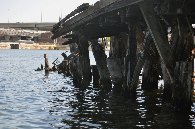
Talking Old and Rotting
115081p.8 Ashley Davidoff TheCommonVein.net
Beauty Among the Rocks on the Banks of the Charles
115055p.8 Ashley Davidoff TheCommonVein.net
Great Black Cormorant
or Shag
The Great Cormorant (Phalacrocorax carbo), known as the Great Black Cormorant across the Northern Hemisphere, the Black Cormorant in Australia, the Large Cormorant in India and the Black Shag further south in New Zealand, is a widespread member of the cormorant family of seabirds.[2] It breeds in much of the Old World and the Atlantic coast of North America. The Great Cormorant is a large black bird, but there is a wide variation in size in the species wide range. Weight is reported from 1.5 kg (3.3 lbs)[3] to 5.3 kg (11.7 lbs),[4] with a typical range from 2.6 to 3.7 kg (5.7?8.2 lbs).[5] Length can vary from 70 to 102 cm (28?40 in) and wingspan from 121 to 160 cm (48?63 in).[6][7] It has a longish tail and yellow throat-patch. Adults have white thigh patches in the breeding season. In European waters it can be distinguished from the Common Shag by its larger size, heavier build, thicker bill, lack of a crest and plumage without any green tinge. In eastern North America, it is similarly larger and bulkier than Double-crested Cormorant, and the latter species has more yellow on the throat and bill. Great Cormorants are mostly silent, but they make various guttural noises at their breeding colonies. bird cormorant shag
115058p.8 Ashley Davidoff TheCommonVein.net
The Science Museum and the Zakim Bridge from the Charles
115080p.8 Ashley Davidoff TheCommonVein.net
Salt and Pepper Bridge (Longfellow) and View of the Back Bay
115094p.8 Ashley Davidoff TheCommonVein.net
Hancock and Prudential
115095p.8 Ashley Davidoff TheCommonVein.net
Hancock Tower
Old and New
The John Hancock Tower, officially named Hancock Place and colloquially known as The Hancock, is a 60-story, 790-foot (241 m) skyscraper in Boston. The tower was designed by Henry N. Cobb of the firm I. M. Pei & Partners and was completed in 1976.[1] In 1977, the American Institute of Architects presented the firm with a National Honor Award for the building and in 2011 conferred on it the AIA Twenty-five Year Award. It has been the tallest building in Boston for more than 30 years, and is the tallest building in New England. Its street address is 200 Clarendon Street. The company uses both “Hancock Place” and “200 Clarendon Street” as mailing addresses for offices in the building. John Hancock Insurance was originally the main tenant of the building, but the insurance company announced in 2004 that some offices will relocate to a new building at 601 Congress Street, in Fort Point, Boston. The John Hancock Tower, officially named Hancock Place and colloquially known as The Hancock, is a 60-story, 790-foot (241 m) skyscraper in Boston. The tower was designed by Henry N. Cobb of the firm I. M. Pei & Partners and was completed in 1976.[1] In 1977, the American Institute of Architects presented the firm with a National Honor Award for the building and in 2011 conferred on it the AIA Twenty-five Year Award. It has been the tallest building in Boston for more than 30 years, and is the tallest building in New England. Its street address is 200 Clarendon Street. The company uses both “Hancock Place” and “200 Clarendon Street” as mailing addresses for offices in the building. John Hancock Insurance was originally the main tenant of the building, but the insurance company announced in 2004 that some offices will relocate to a new building at 601 Congress Street, in Fort Point, Boston.
Reference Wikipedia
115077p.8 Ashley Davidoff TheCommonVein.net
Hatch Shell
Not a Great View from the Water
115078p.8 Ashley Davidoff TheCommonVein.net
Citgo Sign and the Back Bay
The iconic CITGO sign has been a part of the Boston skyline since 1940. Located at 660 Beacon Street, on what was once a Cities Service divisional office, the sign originally featured the Cities Service logo, but was replaced with the famous CITGO ?trimark? of today when the CITGO brand was created for the marketing division of Cities Service in 1965. Efforts to remove the sign in the early 1980s faced fierce opposition and led CITGO to restore the sign, with groups even fighting to declare the sign a landmark. The CITGO Sign is held in particular high regard by Boston sports fans. Red Sox sluggers are enticed by the so called ?C-IT-GO? sign as they blast home runs over the left-field wall, and runners in the grueling Boston Marathon welcome its sight as the 20th mile mark. Its pulsing flash in the night sky has even been used by mothers-to-be at nearby Beth Israel to time their contractions. It?s no secret that the CITGO Sign in Boston?s Kenmore Square is beloved by people across the country and around the world. Not only has it become a major image of the city of Boston, featured in postcards and tourist brochures, but the sign was deemed an ?Objet d?Heart? by Time Magazine, was photographed by Life Magazine and featured in the New York Times. It has even become a source of inspiration for artists, musicians and filmmakers from around the world.
115075p.8 Ashley Davidoff TheCommonVein.net
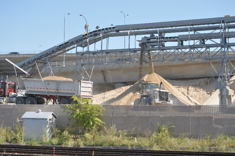
Boston Sand and Gravel
115091p.8 Ashley Davidoff TheCommonVein.net
Back Home at the Science Museum
115098p.8 Ashley Davidoff TheCommonVein.net
1. Prudential Tower
2. Christian Science Church
3. Copley Place/ Arts Square
4. New Old South Church
5. Arlington Street Church
6. Boston Common/ Public Gardens
7. Swan Boats
8. Beacon Hill
9. State House
10. Robert Gould Shaw Memorial
11. Mary Dyer
12. Old Scollay Square/ Government Center
13. Old West Church
14. West End
15. TD Garden
16. Zakim Bunker Hill Bridge
17. Museum of Science
18. Charles River
19. Esplanade
20. Longfellow Bridge
21. Hatch Shell
22. Bunker Hill
23. U.S.S. Constitution
24. Old North Church/North End
25. Rose Kennedy Greenway/North End Parks
26. Holocaust Memorial
27. Faneuil Hall/ Quincy Market
28. Old State House
29. King’s Chapel
30. Granary Burying Ground
31. Make Way for Ducklings
32. Cheers
33. Newbury Street
34. Trinity Church
35. Hancock Tower
36. Boston Public Library
Backbay
Introduction
Abstracted from Wikipedia
Back Bay is an officially recognized neighborhood of Boston, Massachusetts famous for its rows of Victorian brownstone homes ? considered one of the best-preserved examples of 19th-century urban design in the United States ? as well as numerous architecturally significant individual buildings and important cultural institutions such as the Boston Public Library. It is also a fashionable shopping destination, and home to some of Boston’s tallest office buildings, the Hynes Convention Center, and numerous major hotels.
Prior to a monumental 19th-century filling project, what is now the Back Bay was a literal bay. Today, along with neighboring Beacon Hill, it is one of Boston’s two most expensive residential neighborhoods.[2][3][4]
The Neighborhood Association of the Back Bay considers the neighborhood’s bounds to be “Charles River on the North; Arlington Street to Park Square on the East; Columbus Avenue to the New York New Haven and Hartford right-of-way (South of Stuart Street and Copley Place), Huntington Avenue, Dalton Street, and the Massachusetts Turnpike on the South; Charlesgate East on the West.”[5][6]
Before its transformation into buildable land by a 19th-century filling project, the Back Bay was literally a bay, located west of the Shawmut Peninsula (on the far side from Boston Harbor) between Boston and Cambridge, with the Charles River entering from the west. This bay was tidal: the water rose and fell several feet over the course of each day, and at low tide much of the bay’s bed was exposed as a marshy flat. As early as 5,200 years before present, Native Americans built fish weirs here, evidence of which was discovered during subway construction in 1913 (see Ancient Fishweir Project and Boylston Street Fishweir).
In 1814, the Boston and Roxbury Mill Corporation was chartered to construct a milldam, which would also serve as a toll road connecting Boston to Watertown, bypassing Boston Neck. However, the project was an economic failure,[citation needed] and in 1857 a massive project was begun to “make land” by filling the area enclosed by the dam.
The firm of Goss and Munson built 6 miles (9.7 km) of railroad from quarries in Needham, Massachusetts; 35-car trains arrived in the Back Bay 16 times each day, carrying gravel and other fill. (William Dean Howells recalled “the beginnings of Commonwealth Avenue, and the other streets of the Back Bay, laid out with their basements left hollowed in the made land, which the gravel trains were yet making out of the westward hills.”) [7] Present-day Back Bay itself was filled by 1882; the project reached existing land at what is now Kenmore Square in 1890, and finished in the Fens[vague] in 1900.[8] Much of the old mill dam remains buried under present-day Beacon Street.[9] The project was the largest of a number of land reclamation projects which, beginning in 1820, more than doubled the size of the original Shawmut Peninsula.
Completion, in 1910, of the Charles River Dam converted the former Charles estuary into a freshwater basin; the Charles River Esplanade was constructed to capitalize on the river’s newly enhanced recreational value.[vague][10] The Esplanade has since undergone several changes, including the construction of Storrow Drive.[11]
A Cold Day in the Back Bay
02076p Ashley Davidoff TheCommonVein.net
Backbay from Cambridge
The line is mostly vertical, with the Back Bay in the foreground and the downtown buildings of Boston in the back seen through the metal frame of a window across the Charles river in Cambridge Mass.
Ashley Davidoff TheCommonVein.net 02135p
Beacon Hill
Author
Assistant
Introduction
Beacon Hill is a historic neighborhood of Boston, Massachusetts, that along with the neighboring Back Bay is home to about 26,000 people.[3] It is a neighborhood of Federal-style rowhouses and is known for its narrow, gas-lit streets and brick sidewalks. Today, Beacon Hill is regarded as one of the most desirable and expensive neighborhoods in Boston.[4]
The Beacon Hill area is located just north of Boston Common and the Boston Public Garden and is bounded generally by Beacon Street on the south, Somerset Street on the east, Cambridge Street to the north and Storrow Drive along the riverfront of the Charles River Esplanade to the west. The block bounded by Beacon, Tremont and Park Streets is included as well, as is the Boston Common itself. The level section of the neighborhood west of Charles Street, on landfill, is known locally as the “Flat of the Hill.”
Because the Massachusetts State House is in a prominent location at the top of the hill, the term “Beacon Hill” is also often used as a metonym in the local news media to refer to the state government or the legislature.
History
Like many similarly named areas, the neighborhood is named for the location of a former beacon atop the highest point in central Boston, once located just behind the current site of the Massachusetts State House. The hill and two other hills nearby, Pemberton Hill and Mount Vernon, were substantially reduced in height to allow the development of housing in the area[citation needed] and to use the earth to create land by filling the Mill Pond, to the northeast.
The entire hill was once owned by William Blaxton (also spelled Blackstone), the first European settler of Boston, from 1625 to 1635; he eventually sold his land to the Puritans.[citation needed] The south slope of Beacon Hill facing the Common was the socially desirable side in the 19th century.[citation needed] Black Beacon Hill was on the north slope.[citation needed] Many famous black abolitionists, including Frederick Douglass, Harriet Tubman, David Walker and Sojourner Truth, spoke at the African Meeting House on Joy Street. Rebecca Lee Crumpler, who lived for a time on Joy Street, was the first African-American woman to become a physician in the United States. In 1860 she was admitted to the New England Female Medical College (which later merged with Boston University) to earn her M.D. degree. Her publication of A Book of Medical Discourses in 1883 was one of the first by an African American about medicine. Both Beacon Hill and Black Beacon Hill were largely united on the subject of Abolition. Beacon Hill was one of the staunchest centers of the anti-slavery movement in the Antebellum era.[citation needed]
Beacon Hill’s north slope was called “Mount Whoredom” as early as 1715 (see Judge Samuel Sewall’s journal).[citation needed]
Published in 1937, the Pulitzer-Prize-winning novel The Late George Apley by John Phillips Marquand satirizes the upper-class white residents of Beacon Hill.
Until a major urban renewal project of the late 1950s, the red-light district of Scollay Square (an extension of “Mount Whoredom”) flourished just to the east of Beacon Hill, as did the West End neighborhood to the north.[citation needed]
Beacon Hill was designated a National Historic Landmark on December 19, 1962.
3 people cooling off in the pond at the Boston Commons
02089p Ashley Davidoff TheCommonVein.net
Boston Public Library
Introduction
The Boston Public Library (est.1848) is a municipal public library system in Boston, Massachusetts, United States. It was the first publicly supported municipal library in the United States, the first large library open to the public in the United States, and the first public library to allow people to borrow books and other materials and take them home to read and use. The Boston Public Library is also the library of last recourse[3] of the Commonwealth of Massachusetts; all adult residents of the commonwealth are entitled to borrowing and research privileges, and the library receives state funding. The Boston Public Library contains 8.9 million books and A/V (approximately 24 million items encompassing all formats),[4] making it the second-largest public library in the United States, according to the American Library Association.[5] In fiscal year 2009, the city of Boston spent 1% ($23,253,996) of its budget on the library ? some $36 per person.[6]
The Bunker Hill Monument was built to commemorate the Battle of Bunker Hill. The 221 foot (67 m) granite obelisk was erected between 1827 and 1843 in Charlestown, Massachusetts, with granite from Quincy, Massachusetts, conveyed to the site via the Granite Railway, built specially for that purpose, followed by a trip by barge. There are 294 steps to the top.
The Bunker Hill Monument is not on Bunker Hill but instead on Breed’s Hill, where most of the fighting in the misnamed Battle of Bunker Hill actually took place. The Monument Association, which had purchased the battlefield site, was forced to sell off all but the hill’s summit in order to complete the monument.
The monument, one of the first in the United States, was erected to commemorate the Battle of Bunker Hill, the first major conflict between British and Patriot forces in the American Revolutionary War, fought there June 17, 1775. The first monument at the site was created in memory of Mason and fallen Bunker Hill hero Dr. Joseph Warren in 1794 by King Solomon’s Lodge of Masons and was initially an 18 foot (5.5 m) wooden pillar topped with a gilt urn. In front of the obelisk is a statue of Col. William Prescott, a native of Groton, another hero of Bunker Hill. During the battle, according to popular stories, he coined the famous Revolutionary War phrase, “Don’t fire until you see the whites of their eyes”. However, it is uncertain as to who said it, since various writers attribute it to Putnam, Stark, Prescott or Gridley. Doubts have also been expressed as to how original it was, and whether it was said at all.
An exhibit lodge built adjacent to the monument in the late 19th century houses a statue of Warren and a diorama of the battle. Bunker Hill is one of the sites along the Freedom Trail and is part of Boston National Historical Park.
The monument site reopened on April 2, 2007, after completion of a $3.7 million renovation that included repairs, handicap accessibility improvements, and new lighting for the Bunker Hill Monument that was switched on for the first time on April 20, 2007. The Bunker Hill Museum, across the street from the Monument, was dedicated on June 17, 2007, and includes many exhibits about the battle. No admission charge applies to this attraction.
The Battle of Bunker Hill
The Battle of Bunker Hill took place on June 17, 1775, mostly on and around Breed’s Hill, during the Siege of Boston early in the American Revolutionary War. The battle is named after the adjacent Bunker Hill, which was peripherally involved in the battle and was the original objective of both colonial and British troops, and is occasionally referred to as the “Battle of Breed’s Hill.”
On June 13, 1775, the leaders of the colonial forces besieging Boston learned that the British generals were planning to send troops out from the city to occupy the unoccupied hills surrounding the city. In response to this intelligence, 1,200 colonial troops under the command of William Prescott stealthily occupied Bunker Hill and Breed’s Hill, constructed an earthen redoubt on Breed’s Hill, and built lightly fortified lines across most of the Charlestown Peninsula.
When the British were alerted to the presence of the new position the next day, they mounted an attack against them. After two assaults on the colonial lines were repulsed with significant British casualties, the British finally captured the positions on the third assault, after the defenders in the redoubt ran out of ammunition. The colonial forces retreated to Cambridge over Bunker Hill, suffering their most significant losses on Bunker Hill.
While the result was a victory for the British, they suffered heavy losses: over 800 wounded and 226 killed, including a notably large number of officers. The battle is seen as an example of a Pyrrhic victory, because the immediate gain (the capture of Bunker Hill) was modest and did not significantly change the state of the siege, while the cost (the loss of nearly a third of the deployed forces) was high. Meanwhile, colonial forces were able to retreat and regroup in good order having suffered fewer casualties. Furthermore, the battle demonstrated that relatively inexperienced colonial forces were willing and able to stand up to regular army troops in a pitched battle.
Charles River is an 80 mi (129 km) long river that flows in an overall northeasterly direction in eastern Massachusetts. From its source in Hopkinton, the river travels through 22 cities and towns until reaching the Atlantic Ocean at Boston. It is also sometimes called the River Charles or simply the Charles.
Brandeis University, Harvard University, Boston University, and the Massachusetts Institute of Technology are all located along the Charles River. Near its mouth, it forms the border between downtown Boston and Cambridge and Charlestown. The river opens into a broad basin and is lined by the parks of the Charles River Reservation. On the Charles River Esplanade stands the Hatch Shell, where concerts are given in summer evenings. The basin is especially known for its Independence Day celebration. The middle section of the river between the Watertown Dam and Wellesley is partially protected by the properties of the Upper Charles River Reservation and other state parks, including the Hemlock Gorge Reservation, Cutler Park, and the Elm Bank Reservation.
Recreation
The river is well known for its rowing, sculling, dragonboating, and sailing, both recreational and competitive. The river may also be kayaked; depending on the season, however, kayakers can only navigate the Charles by getting out and dragging their kayaks for significant stretches. The “Lower Basin” between the Longfellow and Harvard bridges is home to Community Boating, the Harvard University Sailing Center, and the MIT Sailing Pavilion. The Head of the Charles Regatta is held here every October. In early June, the annual Hong Kong Boston Dragon boat Festival is held in Cambridge, near the Weeks Footbridge.
The Charles River Bike Path runs 23 miles (37 km) along the banks of the Charles, starting at the Museum of Science and passing the campuses of MIT, Harvard and Boston University. The path is popular with runners and bikers. Many runners gauge their distance and speed by keeping track of the mileage between the bridges along the route.[2]
For a number of years, the Charles River Speedway operated along part of the river.
115002pb03.8
Boston Duck tour map route Prudential Tower Christian Science Church Copley Place/ Arts Square New Old South Church Arlington Street Church Boston Common/ Public Gardens Swan Boats Beacon Hill State House Robert Gould Shaw Memorial Mary Dyer Old Scollay Square/ Government Center Old West Church West End TD Garden Zakim Bunker Hill Bridge Museum of Science Charles River Esplanade Longfellow Bridge Hatch Shell Bunker Hill U.S.S. Constitution Old North Church/North End Rose Kennedy Greenway/North End Parks Holocaust Memorial Faneuil Hall/ Quincy Market Old State House King’s Chapel Granary Burying Ground Make Way for Ducklings Cheers Newbury Street Trinity Church Hancock Tower Boston Public Library 2012
115002pb03.8 Ashley Davidoff TheCommonVein.net
This is a photograph taken from the air on a landing approach to Boston Logan airport showing two major rivers joining prior to entering the sea. Ashley Davidoff TheCommonVein.net 13300
Upstream from the Science Museum
115096p.8 Ashley Davidoff TheCommonVein.net
Entry into the Charles by the Duck Boats
115190p.8 Ashley Davidoff TheCommonVein.net
The Entre into the Charles River on the Duck Tour
115082p.8 Boston Summer Duck tour bridges time old new Charles River 2012 Ashley Davidoff TheCommonVein.net
115005p.8
115005p.8 Boston Summer Zakim bridge strings Charles River 2012 Ashley Davidoff TheCommonVein.net
115080p.8
115080p.8 Boston Summer Duck tour Zakim bridge Museum of Science Charles River 2012 Davidoff family photographyAshley Davidoff TheCommonVein.net
Hatch Shell
115078p.8 Boston Summer Duck tour Hatch Shell Charles River 2012 Davidoff family photography Ashley Davidoff TheCommonVein.net
Back Bay
115079p.8 wiki The Edward A. Hatch Memorial Shell (commonly referred to as the “Hatch Shell”) is an outdoor concert venue adjacent to the Charles River Esplanade near downtown Boston. The Hatch Shell is best known for hosting the Boston Pops Orchestra annually for the Boston Fourth of July celebration, but is also used for free concerts most weekends and many weeknights during the summer months. The grass pavilion in front of the stage has no permanent seating. There is a memorial to Arthur Fiedler, first permanent conductor of the Pops, nearby. The original, wooden shell was built in 1928 as a temporary venue for the Pops with expectations of construction of a permanent structure in the near future. It was first used for a concert on July 4, 1929, with Arthur Fiedler conducting the Boston Pops Orchestra. A second, temporary shell, made of metal, was built in 1934, but owing to sparse funding throughout the Great Depression, construction of a permanent Hatch Shell was delayed until 1939-1940. Today’s permanent shell was designed by architect Richard J. Shaw, given by Maria Hatch in memory of her brother, and dedicated on July 2, 1940. In preparation for its 50th anniversary in 1991, it underwent significant renovation and repair along with modernization of its acoustics. Bostonian Howard Brickman, a master craftsman specializing in wood floors, re-created the intricate interior paneling of the shell by hand. One of the most memorable shows at the venue was on September 9, 1994 when Green Day held a free concert. The event was touted as the Welcome Back Weekend show for college students, and was sponsored by WFNX Radio. Tens of thousands of people showed up, and during the song, “Longview”, Green Day’s frontman, Billie Joe Armstrong, began ripping up a flowerbed and the crowd began violently rioting.[1] Police formed a human chain, and eventually pushed the remaining fans off the Esplanade. Calm was restored after about two hours. The Hatch Shell was the venue for what has been claimed[by whom?] to be th
The Back Bay
115095p.8 Boston Summer Duck tour Prudential Tower Hancock Towr Logfellow bridge Salt and pepper Bridge Charles River 111 Huntington Avenue (arches) 2012 Davidoff family photography Ashley Davidoff TheCommonVein.net
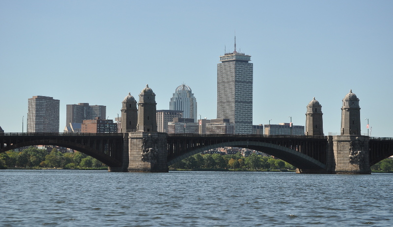
Longfellow bridge
aka Salt and Pepper Bridge
83567.800 Charles river Boston Massachusetts Salt and Pepper Bridge order TCV The Common VEin Davidoff photography Ashley Davidoff TheCommonVein.net
115066p.8
115066p.8 Wiki The Prudential Tower, also known as the Prudential Building or, colloquially, The Pru,[1][2] is a skyscraper in Boston, Massachusetts. The building, a part of the Prudential Center complex, currently stands as the 2nd-tallest building in Boston, behind the John Hancock Tower. The Prudential Tower was designed by Charles Luckman and Associates for Prudential Insurance. Completed in 1964, the building is 749 feet (228 m) tall, with 52 floors. It contains 1.2 million square feet (111,484 m²) of commercial and retail space. Including its radio mast, the tower stands as the tallest building in Boston and is tied with others as the 77th-tallest in the United States, rising to 907 feet (276 m) in height. A 50th-floor observation deck, called the “Prudential Skywalk”, is currently the highest observation deck in New England that is open to the public, as the higher observation deck of the John Hancock Tower has been closed since the terror attacks of September 11, 2001. The building also has a restaurant on the 52nd floor, called Top of the Hub. Boston Summer Duck tour Prudential tower The pru Prudentoial building The Prudential Tower began construction in 1960. Upon its completion in 1964, the Prudential was the tallest building in the world outside of New York City, surpassing the Terminal Tower in Cleveland, Ohio. It dwarfed the 1947 John Hancock building, seen at the left in the photo. This spurred the rival insurance company to build the 1975 John Hancock Tower, which is just slightly taller at 790 feet (240 m). Today, the Prudential is no longer even among the fifty tallest buildings in the USA in architectural height. Within Boston, in addition to the nearby John Hancock tower, many other tall buildings have since been built in the financial district, including the 614-foot (187 m) Federal Reserve Bank. The Prudential and John Hancock towers still dominate the Back Bay skyline, but other tall buildings have arisen there since the late 1990s, perhaps most notably 111 Huntington
The Cambridge Side
115063p.8 Ashley Davidoff TheCommonVein.net
The Great Comorant
115058p.8 Wiki The Great Cormorant (Phalacrocorax carbo), known as the Great Black Cormorant across the Northern Hemisphere, the Black Cormorant in Australia, the Large Cormorant in India and the Black Shag further south in New Zealand, is a widespread member of the cormorant family of seabirds.[2] It breeds in much of the Old World and the Atlantic coast of North America. The Great Cormorant is a large black bird, but there is a wide variation in size in the species wide range. Weight is reported from 1.5 kg (3.3 lbs)[3] to 5.3 kg (11.7 lbs),[4] with a typical range from 2.6 to 3.7 kg (5.7?8.2 lbs).[5] Length can vary from 70 to 102 cm (28?40 in) and wingspan from 121 to 160 cm (48?63 in).[6][7] It has a longish tail and yellow throat-patch. Adults have white thigh patches in the breeding season. In European waters it can be distinguished from the Common Shag by its larger size, heavier build, thicker bill, lack of a crest and plumage without any green tinge. In eastern North America, it is similarly larger and bulkier than Double-crested Cormorant, and the latter species has more yellow on the throat and bill. Great Cormorants are mostly silent, but they make various guttural noises at their breeding colonies. bird cormorant shag Boston Summer Duck tour 2012 Davidoff family photography Ashley Davidoff TheCommonVein.net
From the Cambridge Side
The line is mostly vertical, with the Back Bay in the foreground and the downtown buildings of Boston in the back seen through the metal frame of a window across the Charles river in Cambridge Mass. 02135 Ashley Davidoff TheCommonVein.net
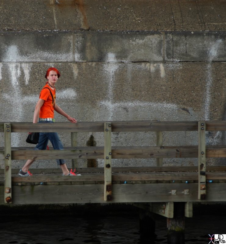
Walks Along the Charles
84286p.800 person in orange Charles River people color personality Ashley Davidoff TheCommonVein.net
Kenmore Square
115075p.8 The iconic CITGO sign has been a part of the Boston skyline since 1940. Located at 660 Beacon Street, on what was once a Cities Service divisional office, the sign originally featured the Cities Service logo, but was replaced with the famous CITGO ?trimark? of today when the CITGO brand was created for the marketing division of Cities Service in 1965. Efforts to remove the sign in the early 1980s faced fierce opposition and led CITGO to restore the sign, with groups even fighting to declare the sign a landmark. The CITGO Sign is held in particular high regard by Boston sports fans. Red Sox sluggers are enticed by the so called ?C-IT-GO? sign as they blast home runs over the left-field wall, and runners in the grueling Boston Marathon welcome its sight as the 20th mile mark. Its pulsing flash in the night sky has even been used by mothers-to-be at nearby Beth Israel to time their contractions. It?s no secret that the CITGO Sign in Boston?s Kenmore Square is beloved by people across the country and around the world. Not only has it become a major image of the city of Boston, featured in postcards and tourist brochures, but the sign was deemed an ?Objet d?Heart? by Time Magazine, was photographed by Life Magazine and featured in the New York Times. It has even become a source of inspiration for artists, musicians and filmmakers from around the world. Boston Summer Duck tour Citgo sign 2012 Davidoff family Ashley Davidoff TheCommonVein.net
The First Church of Christ, Scientist, in Boston, Massachusetts in the United States is The Mother Church and administrative headquarters of the Christian Science Church, and is located in the Christian Science Plaza in the Back Bay neighborhood of Boston. Surrounding a plaza and built over many years beginning in 1894, it consists of seven structures: the Original Mother Church, Mother Church Extension, Christian Science Publishing House, Mary Baker Eddy Library, 177 Huntington Avenue (former Administration Building), 101 Belvidere (former Church Colonnade Building), and Reflection Hall, formerly the Sunday School Building.[1]
The Original Mother Church edifice, designed by Franklin I. Welch, was built in 1894, eight years after the first Christian Science Church in the world was built in Oconto, Wisconsin.[2][3][4][5] Although fairly large for the time, this Romanesque Revival stone structure is often overlooked by casual visitors as it is dwarfed by the much larger domed Mother Church Extension. Designed to fit on an odd kite-shaped lot, it features an octagonal auditorium that seats 1100 people and a massive 126-foot (38 m) steeple. It is built of granite from New Hampshire, Mary Baker Eddy’s home state.[6]
Added in 1904-1906, the Mother Church Extension was originally designed by architect Charles Brigham, but substantially modified by S.S. Beman when he took over construction in 1905 as a result of Brigham’s illness. In particular, Beman minimized the Ottoman and Byzantine elements, bringing the domed structure into line with the Classical architectural style that Beman favored as most appropriate for Christian Science churches.[7] It boasts one of the world’s largest pipe organs, built in 1952 by the Aeolian-Skinner Company of Boston.
The Mary Baker Eddy Library is housed on the Plaza in an 11-story structure originally built for The Christian Science Publishing Society. Constructed between 1932 and 1934, the neoclassical style building with its Mapparium has become an historic landmark in Boston?s Back Bay. Restoration of the Library?s 81,000-square foot portion of the building began in 1998, and the final renovation and additional construction were completed in 2002.
Designed in the 1960s by the firm of noted architect I.M. Pei, the 14-acre (57,000 m2) Christian Science Plaza along Huntington Avenue includes a large administration building, a colonnade, a reflecting pool, Reflection Hall, and fountain that together make it one of Boston’s most visually recognizable sites and a popular tourist attraction.[8]
In accord with the Manual of The Mother Church, the title of the Mother Church is “The First Church of Christ, Scientist,” and while its branch churches may call themselves, “First Church of Christ, Scientist,” or “Second Church of Christ, Scientist,” and so on, they are prohibited from using “The” in front of their names. Only The Mother Church can do so.[9]
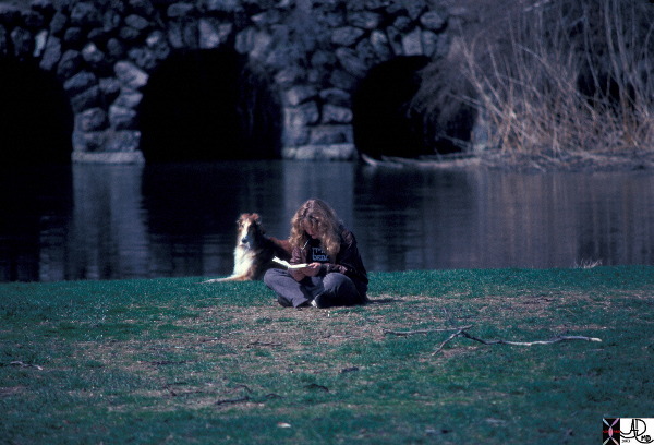
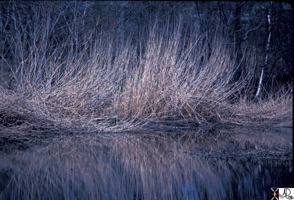
Reflection of dry grass at the beginning of the Spring waiting for a green sprig to surface. Fenway park Boston.
02111p02
Ashley Davidoff TheCommonVein.net
Freedom Trail
Gardner Museum
Government Center
Hancock Tower
Hatch Shell – Esplanade
Haymarket
Holocaust Memorial
Kenmore Square
Kennedy Library
King’s Chapel
Longfellow Bridge
Museum of Fine Arts
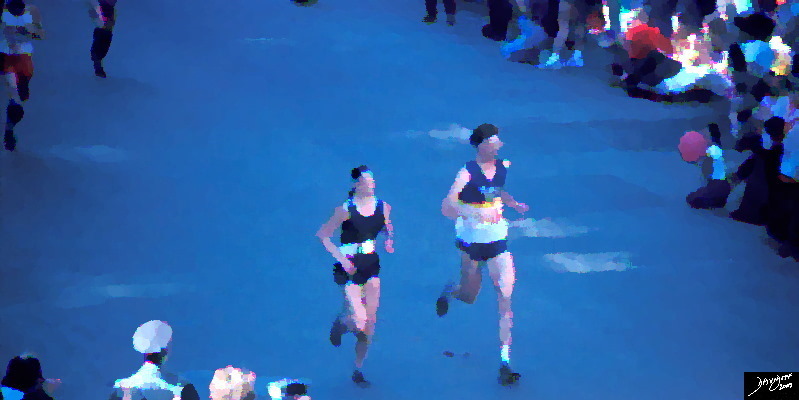
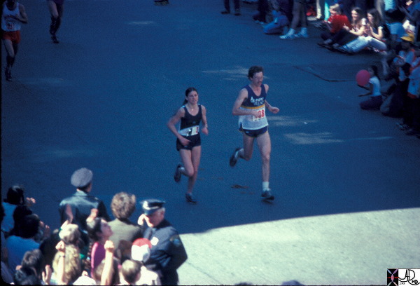
Marathon
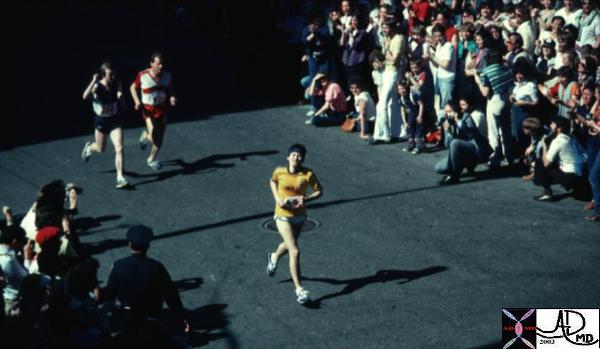
Final Stages
These runners have just entered the final stages of the 26 mile Boston marathon following years of practice and hours of pounding their full weight on their feet. Marathon running is not an uncommon cause of stress fractures.
Rosie Ruiz, age 26, finishes first in the women?s division of the Boston Marathon with a time of 2:31:56 on April 21, 1980. She was rewarded with a medal, a laurel wreath and a silver bowl; however, eight days later Ruiz is stripped of her victory after race officials learned she jumped into the race about a mile before the finish line.
The Cuban-born Ruiz, an administrative assistant from New York City, qualified for the 84th Boston Marathon by submitting her time for running the 1979 New York City Marathon. Although Ruiz never explained why she cheated, it has been suggested her boss was so impressed she qualified for the prestigious Boston race that he offered to pay her way. It?s believed that Ruiz intended to jump into the middle of the pack of runners but miscalculated when she joined the marathon one mile from the end, not realizing she was ahead of the other 448 female competitors.
Ruiz was unknown in the running world and her victory raised suspicions because it was a 25-minute improvement over her New York City Marathon time. Additionally, her winning time was then the third-fastest marathon time in history for a woman. After studying race photographs–Ruiz didn?t appear in any of them until the very end–and conducting interviews, Boston Marathon officials stripped Ruiz of her title on April 29, 1980, and named Jacqueline Gareau of Canada the women?s division champion with a time of 2:34:28. Ruiz?s New York time was later invalidated when officials discovered she had taken the subway during part of the race.
The controversy surrounding Ruiz overshadowed Bill Rogers, who won the men?s division of the 1980 Boston Marathon for a record fourth year in a row. At the 2005 Boston Marathon, Jacqueline Gareau served as grand marshal and re-enacted her 1980 marathon performance by breaking the tape. After her cheating was revealed, Ruiz, who maintained she had won the Boston Marathon fairly, lost her job in New York. She encountered further trouble in 1982 when she was accused of stealing money from an employer. The following year, she was caught selling drugs to undercover officers in Florida. In both cases, Ruiz served brief stints in jail.
The first Boston Marathon was run on April 19, 1897. Women were officially allowed to compete in the race starting in 1972. Following the Ruiz incident, race officials instituted tighter security measures to prevent future episodes of cheating.
Boston marathon – close to the finishing line in the Back Bay. Ashley Davidoff TheCommonVein.net 10332
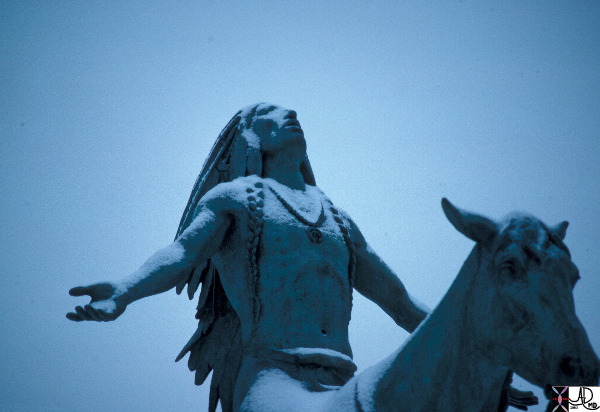
Native American Indian
Sculpture Outside the Museum
02072p winter snow native American
Ashley Davidoff TheCommonVein.net
Museum of Science
Newbury Street
New England Aquarium
Boston
Introduction
Abstracted from Wikipedia
The New England Aquarium is an aquarium located in Boston, Massachusetts.
In addition to the main aquarium building, attractions at the New England Aquarium include the Simons IMAX Theatre and the New England Aquarium Whale Watch, which operates from April through November.[5] The aquarium has more than 22,000 members[6] and hosts more than 1.3 million visitors each year.
Located in the central open atrium of the main building, the principal feature of the Aquarium is the Giant Ocean Tank, a cylindrical 200,000-US-gallon (760,000 l) tank simulating a Caribbean coral reef. This tank houses sharks, sea turtles, stingrays, eels, barracuda, and many smaller reef-living fish. Open at the top, the concrete tank is surrounded by a walkway that spirals down, allowing visitors access to 52 windows that offer views of the reef from every angle and level.[17]
At the bottom, the tank stands in a large, square 150,000-US-gallon (570,000 l) penguin exhibit, hosting African penguins, Northern and Southern rockhopper penguins and little blue penguins. The penguin exhibit can be seen from the spiral walkway of the central tank or from elevated viewing areas that completely surround the perimeter. The penguins live on several artificial rock islands in the exhibit.[18]
Surrounding the atrium are three levels of smaller exhibits including:
The Thinking Gallery, also known as the Temperate Gallery, featuring Goliath grouper, ancient fishes, rare sea dragons,[19] coastal environments, and thousands of schooling fish.
The Freshwater Gallery focuses on freshwater habitats in South America compared to New England river systems. This gallery features piranhas, anacondas, electric eels, and Atlantic salmon.
The Edge of the Sea tide pool. Visitors are allowed to touch New England tide pool animals including sea stars, sea urchins, snails, hermit crabs, and horseshoe crabs.[20]
The Northern Waters of the World Gallery focuses on New England marine habitats compared to Pacific Northwest habitats. The gallery features shorebirds, colored lobsters, goosefish, Giant Pacific Octopus, and countless other invertebrates.
The Tropical Gallery features many colorful tropical fish, cuttlefish, venomous fish including lionfish, scorpionfish, and living corals.
The Animal Medical Center gives visitors a behind-the-scenes view of what it takes to care for thousands of creatures including fish, reptiles, mammals, and birds.
In front of the Aquarium is a harbor seal exhibit. It can be seen for free without going into the building.[21] Seven Northern fur seals are on exhibit behind the Aquarium in the open-air New Balance Foundation Marine Mammal Center on the harborside terrace, which opened in 2009 with views of Boston Harbor.[22] All the New England Aquarium’s marine mammals participate in daily training sessions that are open for public viewing and participation.
The Amazing Jellies exhibit in the West Wing features moon jellies, sea nettles, upside-down jellies, Palauan Lagoon jellies and Australian spotted jellies, all from diverse habitats around the world.[23] In 2011, the Trust Family Foundation Shark and Ray Touch Tank opened in the West Wing. At 25,000 US gallons (95,000 l), it is the largest on the east coast. Some of the species in the exhibit include cownose rays, yellow rays and chain dog fish. It is a permanent exhibit that will allow for more interaction between the animals and the visitors.[24]
The statue outside the Prudential centre in downtown Boston Massachusetts of a man leaping with full stretch.
02077p Ashley Davidoff TheCommonVein.net
Abstraction
An abstract version of the statue outside the Prudential centre in downtown Boston Massachusetts of a man leaping.
02078p Ashley Davidoff TheCommonVein.net
Quincy Market
Rose Kennedy Garden
State House
TD Garden
Old State House
Trinity Church
USS Constitution Zakim Bridge
Old Ironsides
Boston
DOMElement Object
(
    [schemaTypeInfo] =>
    [tagName] => table
    [firstElementChild] => (object value omitted)
    [lastElementChild] => (object value omitted)
    [childElementCount] => 1
    [previousElementSibling] => (object value omitted)
    [nextElementSibling] => (object value omitted)
    [nodeName] => table
    [nodeValue] =>


Abstraction


An abstract version of the statue outside the Prudential centre in downtown Boston Massachusetts of a man leaping.
02078p Ashley Davidoff TheCommonVein.net


    [nodeType] => 1
    [parentNode] => (object value omitted)
    [childNodes] => (object value omitted)
    [firstChild] => (object value omitted)
    [lastChild] => (object value omitted)
    [previousSibling] => (object value omitted)
    [nextSibling] => (object value omitted)
    [attributes] => (object value omitted)
    [ownerDocument] => (object value omitted)
    [namespaceURI] =>
    [prefix] =>
    [localName] => table
    [baseURI] =>
    [textContent] =>


Abstraction


An abstract version of the statue outside the Prudential centre in downtown Boston Massachusetts of a man leaping.
02078p Ashley Davidoff TheCommonVein.net


)
DOMElement Object
(
    [schemaTypeInfo] =>
    [tagName] => td
    [firstElementChild] => (object value omitted)
    [lastElementChild] => (object value omitted)
    [childElementCount] => 1
    [previousElementSibling] =>
    [nextElementSibling] =>
    [nodeName] => td
    [nodeValue] => An abstract version of the statue outside the Prudential centre in downtown Boston Massachusetts of a man leaping.
02078p Ashley Davidoff TheCommonVein.net

    [nodeType] => 1
    [parentNode] => (object value omitted)
    [childNodes] => (object value omitted)
    [firstChild] => (object value omitted)
    [lastChild] => (object value omitted)
    [previousSibling] => (object value omitted)
    [nextSibling] => (object value omitted)
    [attributes] => (object value omitted)
    [ownerDocument] => (object value omitted)
    [namespaceURI] =>
    [prefix] =>
    [localName] => td
    [baseURI] =>
    [textContent] => An abstract version of the statue outside the Prudential centre in downtown Boston Massachusetts of a man leaping.
02078p Ashley Davidoff TheCommonVein.net

)
DOMElement Object
(
    [schemaTypeInfo] =>
    [tagName] => td
    [firstElementChild] => (object value omitted)
    [lastElementChild] => (object value omitted)
    [childElementCount] => 2
    [previousElementSibling] =>
    [nextElementSibling] =>
    [nodeName] => td
    [nodeValue] =>
Abstraction

    [nodeType] => 1
    [parentNode] => (object value omitted)
    [childNodes] => (object value omitted)
    [firstChild] => (object value omitted)
    [lastChild] => (object value omitted)
    [previousSibling] => (object value omitted)
    [nextSibling] => (object value omitted)
    [attributes] => (object value omitted)
    [ownerDocument] => (object value omitted)
    [namespaceURI] =>
    [prefix] =>
    [localName] => td
    [baseURI] =>
    [textContent] =>
Abstraction

)
DOMElement Object
(
    [schemaTypeInfo] =>
    [tagName] => table
    [firstElementChild] => (object value omitted)
    [lastElementChild] => (object value omitted)
    [childElementCount] => 1
    [previousElementSibling] => (object value omitted)
    [nextElementSibling] => (object value omitted)
    [nodeName] => table
    [nodeValue] =>


The Athlete Outside the Pru


The statue outside the Prudential centre in downtown Boston Massachusetts of a man leaping with full stretch.
02077p Ashley Davidoff TheCommonVein.net


    [nodeType] => 1
    [parentNode] => (object value omitted)
    [childNodes] => (object value omitted)
    [firstChild] => (object value omitted)
    [lastChild] => (object value omitted)
    [previousSibling] => (object value omitted)
    [nextSibling] => (object value omitted)
    [attributes] => (object value omitted)
    [ownerDocument] => (object value omitted)
    [namespaceURI] =>
    [prefix] =>
    [localName] => table
    [baseURI] =>
    [textContent] =>


The Athlete Outside the Pru


The statue outside the Prudential centre in downtown Boston Massachusetts of a man leaping with full stretch.
02077p Ashley Davidoff TheCommonVein.net


)
DOMElement Object
(
    [schemaTypeInfo] =>
    [tagName] => td
    [firstElementChild] => (object value omitted)
    [lastElementChild] => (object value omitted)
    [childElementCount] => 1
    [previousElementSibling] =>
    [nextElementSibling] =>
    [nodeName] => td
    [nodeValue] => The statue outside the Prudential centre in downtown Boston Massachusetts of a man leaping with full stretch.
02077p Ashley Davidoff TheCommonVein.net

    [nodeType] => 1
    [parentNode] => (object value omitted)
    [childNodes] => (object value omitted)
    [firstChild] => (object value omitted)
    [lastChild] => (object value omitted)
    [previousSibling] => (object value omitted)
    [nextSibling] => (object value omitted)
    [attributes] => (object value omitted)
    [ownerDocument] => (object value omitted)
    [namespaceURI] =>
    [prefix] =>
    [localName] => td
    [baseURI] =>
    [textContent] => The statue outside the Prudential centre in downtown Boston Massachusetts of a man leaping with full stretch.
02077p Ashley Davidoff TheCommonVein.net

)
DOMElement Object
(
    [schemaTypeInfo] =>
    [tagName] => td
    [firstElementChild] => (object value omitted)
    [lastElementChild] => (object value omitted)
    [childElementCount] => 2
    [previousElementSibling] =>
    [nextElementSibling] =>
    [nodeName] => td
    [nodeValue] =>
The Athlete Outside the Pru

    [nodeType] => 1
    [parentNode] => (object value omitted)
    [childNodes] => (object value omitted)
    [firstChild] => (object value omitted)
    [lastChild] => (object value omitted)
    [previousSibling] => (object value omitted)
    [nextSibling] => (object value omitted)
    [attributes] => (object value omitted)
    [ownerDocument] => (object value omitted)
    [namespaceURI] =>
    [prefix] =>
    [localName] => td
    [baseURI] =>
    [textContent] =>
The Athlete Outside the Pru

)
DOMElement Object
(
    [schemaTypeInfo] =>
    [tagName] => table
    [firstElementChild] => (object value omitted)
    [lastElementChild] => (object value omitted)
    [childElementCount] => 1
    [previousElementSibling] => (object value omitted)
    [nextElementSibling] => (object value omitted)
    [nodeName] => table
    [nodeValue] =>


Native American Indian
Sculpture Outside the Museum


02072p winter snow native American
Ashley Davidoff TheCommonVein.net


    [nodeType] => 1
    [parentNode] => (object value omitted)
    [childNodes] => (object value omitted)
    [firstChild] => (object value omitted)
    [lastChild] => (object value omitted)
    [previousSibling] => (object value omitted)
    [nextSibling] => (object value omitted)
    [attributes] => (object value omitted)
    [ownerDocument] => (object value omitted)
    [namespaceURI] =>
    [prefix] =>
    [localName] => table
    [baseURI] =>
    [textContent] =>


Native American Indian
Sculpture Outside the Museum


02072p winter snow native American
Ashley Davidoff TheCommonVein.net


)
DOMElement Object
(
    [schemaTypeInfo] =>
    [tagName] => td
    [firstElementChild] => (object value omitted)
    [lastElementChild] => (object value omitted)
    [childElementCount] => 1
    [previousElementSibling] =>
    [nextElementSibling] =>
    [nodeName] => td
    [nodeValue] => 02072p winter snow native American
Ashley Davidoff TheCommonVein.net
    [nodeType] => 1
    [parentNode] => (object value omitted)
    [childNodes] => (object value omitted)
    [firstChild] => (object value omitted)
    [lastChild] => (object value omitted)
    [previousSibling] => (object value omitted)
    [nextSibling] => (object value omitted)
    [attributes] => (object value omitted)
    [ownerDocument] => (object value omitted)
    [namespaceURI] =>
    [prefix] =>
    [localName] => td
    [baseURI] =>
    [textContent] => 02072p winter snow native American
Ashley Davidoff TheCommonVein.net
)
DOMElement Object
(
    [schemaTypeInfo] =>
    [tagName] => td
    [firstElementChild] => (object value omitted)
    [lastElementChild] => (object value omitted)
    [childElementCount] => 3
    [previousElementSibling] =>
    [nextElementSibling] =>
    [nodeName] => td
    [nodeValue] =>
Native American Indian
Sculpture Outside the Museum

    [nodeType] => 1
    [parentNode] => (object value omitted)
    [childNodes] => (object value omitted)
    [firstChild] => (object value omitted)
    [lastChild] => (object value omitted)
    [previousSibling] => (object value omitted)
    [nextSibling] => (object value omitted)
    [attributes] => (object value omitted)
    [ownerDocument] => (object value omitted)
    [namespaceURI] =>
    [prefix] =>
    [localName] => td
    [baseURI] =>
    [textContent] =>
Native American Indian
Sculpture Outside the Museum

)
DOMElement Object
(
    [schemaTypeInfo] =>
    [tagName] => table
    [firstElementChild] => (object value omitted)
    [lastElementChild] => (object value omitted)
    [childElementCount] => 1
    [previousElementSibling] => (object value omitted)
    [nextElementSibling] => (object value omitted)
    [nodeName] => table
    [nodeValue] =>


Rosie Ruiz
The Fake of 1980


From This Day in History
Rosie Ruiz, age 26, finishes first in the women?s division of the Boston Marathon with a time of 2:31:56 on April 21, 1980. She was rewarded with a medal, a laurel wreath and a silver bowl; however, eight days later Ruiz is stripped of her victory after race officials learned she jumped into the race about a mile before the finish line.
The Cuban-born Ruiz, an administrative assistant from New York City, qualified for the 84th Boston Marathon by submitting her time for running the 1979 New York City Marathon. Although Ruiz never explained why she cheated, it has been suggested her boss was so impressed she qualified for the prestigious Boston race that he offered to pay her way. It?s believed that Ruiz intended to jump into the middle of the pack of runners but miscalculated when she joined the marathon one mile from the end, not realizing she was ahead of the other 448 female competitors.
Ruiz was unknown in the running world and her victory raised suspicions because it was a 25-minute improvement over her New York City Marathon time. Additionally, her winning time was then the third-fastest marathon time in history for a woman. After studying race photographs–Ruiz didn?t appear in any of them until the very end–and conducting interviews, Boston Marathon officials stripped Ruiz of her title on April 29, 1980, and named Jacqueline Gareau of Canada the women?s division champion with a time of 2:34:28. Ruiz?s New York time was later invalidated when officials discovered she had taken the subway during part of the race.
The controversy surrounding Ruiz overshadowed Bill Rogers, who won the men?s division of the 1980 Boston Marathon for a record fourth year in a row. At the 2005 Boston Marathon, Jacqueline Gareau served as grand marshal and re-enacted her 1980 marathon performance by breaking the tape. After her cheating was revealed, Ruiz, who maintained she had won the Boston Marathon fairly, lost her job in New York. She encountered further trouble in 1982 when she was accused of stealing money from an employer. The following year, she was caught selling drugs to undercover officers in Florida. In both cases, Ruiz served brief stints in jail.
The first Boston Marathon was run on April 19, 1897. Women were officially allowed to compete in the race starting in 1972. Following the Ruiz incident, race officials instituted tighter security measures to prevent future episodes of cheating.
Boston marathon – close to the finishing line in the Back Bay. Ashley Davidoff TheCommonVein.net 10332


    [nodeType] => 1
    [parentNode] => (object value omitted)
    [childNodes] => (object value omitted)
    [firstChild] => (object value omitted)
    [lastChild] => (object value omitted)
    [previousSibling] => (object value omitted)
    [nextSibling] => (object value omitted)
    [attributes] => (object value omitted)
    [ownerDocument] => (object value omitted)
    [namespaceURI] =>
    [prefix] =>
    [localName] => table
    [baseURI] =>
    [textContent] =>


Rosie Ruiz
The Fake of 1980


From This Day in History
Rosie Ruiz, age 26, finishes first in the women?s division of the Boston Marathon with a time of 2:31:56 on April 21, 1980. She was rewarded with a medal, a laurel wreath and a silver bowl; however, eight days later Ruiz is stripped of her victory after race officials learned she jumped into the race about a mile before the finish line.
The Cuban-born Ruiz, an administrative assistant from New York City, qualified for the 84th Boston Marathon by submitting her time for running the 1979 New York City Marathon. Although Ruiz never explained why she cheated, it has been suggested her boss was so impressed she qualified for the prestigious Boston race that he offered to pay her way. It?s believed that Ruiz intended to jump into the middle of the pack of runners but miscalculated when she joined the marathon one mile from the end, not realizing she was ahead of the other 448 female competitors.
Ruiz was unknown in the running world and her victory raised suspicions because it was a 25-minute improvement over her New York City Marathon time. Additionally, her winning time was then the third-fastest marathon time in history for a woman. After studying race photographs–Ruiz didn?t appear in any of them until the very end–and conducting interviews, Boston Marathon officials stripped Ruiz of her title on April 29, 1980, and named Jacqueline Gareau of Canada the women?s division champion with a time of 2:34:28. Ruiz?s New York time was later invalidated when officials discovered she had taken the subway during part of the race.
The controversy surrounding Ruiz overshadowed Bill Rogers, who won the men?s division of the 1980 Boston Marathon for a record fourth year in a row. At the 2005 Boston Marathon, Jacqueline Gareau served as grand marshal and re-enacted her 1980 marathon performance by breaking the tape. After her cheating was revealed, Ruiz, who maintained she had won the Boston Marathon fairly, lost her job in New York. She encountered further trouble in 1982 when she was accused of stealing money from an employer. The following year, she was caught selling drugs to undercover officers in Florida. In both cases, Ruiz served brief stints in jail.
The first Boston Marathon was run on April 19, 1897. Women were officially allowed to compete in the race starting in 1972. Following the Ruiz incident, race officials instituted tighter security measures to prevent future episodes of cheating.
Boston marathon – close to the finishing line in the Back Bay. Ashley Davidoff TheCommonVein.net 10332


)
DOMElement Object
(
    [schemaTypeInfo] =>
    [tagName] => td
    [firstElementChild] => (object value omitted)
    [lastElementChild] => (object value omitted)
    [childElementCount] => 7
    [previousElementSibling] =>
    [nextElementSibling] =>
    [nodeName] => td
    [nodeValue] => From This Day in History
Rosie Ruiz, age 26, finishes first in the women?s division of the Boston Marathon with a time of 2:31:56 on April 21, 1980. She was rewarded with a medal, a laurel wreath and a silver bowl; however, eight days later Ruiz is stripped of her victory after race officials learned she jumped into the race about a mile before the finish line.
The Cuban-born Ruiz, an administrative assistant from New York City, qualified for the 84th Boston Marathon by submitting her time for running the 1979 New York City Marathon. Although Ruiz never explained why she cheated, it has been suggested her boss was so impressed she qualified for the prestigious Boston race that he offered to pay her way. It?s believed that Ruiz intended to jump into the middle of the pack of runners but miscalculated when she joined the marathon one mile from the end, not realizing she was ahead of the other 448 female competitors.
Ruiz was unknown in the running world and her victory raised suspicions because it was a 25-minute improvement over her New York City Marathon time. Additionally, her winning time was then the third-fastest marathon time in history for a woman. After studying race photographs–Ruiz didn?t appear in any of them until the very end–and conducting interviews, Boston Marathon officials stripped Ruiz of her title on April 29, 1980, and named Jacqueline Gareau of Canada the women?s division champion with a time of 2:34:28. Ruiz?s New York time was later invalidated when officials discovered she had taken the subway during part of the race.
The controversy surrounding Ruiz overshadowed Bill Rogers, who won the men?s division of the 1980 Boston Marathon for a record fourth year in a row. At the 2005 Boston Marathon, Jacqueline Gareau served as grand marshal and re-enacted her 1980 marathon performance by breaking the tape. After her cheating was revealed, Ruiz, who maintained she had won the Boston Marathon fairly, lost her job in New York. She encountered further trouble in 1982 when she was accused of stealing money from an employer. The following year, she was caught selling drugs to undercover officers in Florida. In both cases, Ruiz served brief stints in jail.
The first Boston Marathon was run on April 19, 1897. Women were officially allowed to compete in the race starting in 1972. Following the Ruiz incident, race officials instituted tighter security measures to prevent future episodes of cheating.
Boston marathon – close to the finishing line in the Back Bay. Ashley Davidoff TheCommonVein.net 10332
    [nodeType] => 1
    [parentNode] => (object value omitted)
    [childNodes] => (object value omitted)
    [firstChild] => (object value omitted)
    [lastChild] => (object value omitted)
    [previousSibling] => (object value omitted)
    [nextSibling] => (object value omitted)
    [attributes] => (object value omitted)
    [ownerDocument] => (object value omitted)
    [namespaceURI] =>
    [prefix] =>
    [localName] => td
    [baseURI] =>
    [textContent] => From This Day in History
Rosie Ruiz, age 26, finishes first in the women?s division of the Boston Marathon with a time of 2:31:56 on April 21, 1980. She was rewarded with a medal, a laurel wreath and a silver bowl; however, eight days later Ruiz is stripped of her victory after race officials learned she jumped into the race about a mile before the finish line.
The Cuban-born Ruiz, an administrative assistant from New York City, qualified for the 84th Boston Marathon by submitting her time for running the 1979 New York City Marathon. Although Ruiz never explained why she cheated, it has been suggested her boss was so impressed she qualified for the prestigious Boston race that he offered to pay her way. It?s believed that Ruiz intended to jump into the middle of the pack of runners but miscalculated when she joined the marathon one mile from the end, not realizing she was ahead of the other 448 female competitors.
Ruiz was unknown in the running world and her victory raised suspicions because it was a 25-minute improvement over her New York City Marathon time. Additionally, her winning time was then the third-fastest marathon time in history for a woman. After studying race photographs–Ruiz didn?t appear in any of them until the very end–and conducting interviews, Boston Marathon officials stripped Ruiz of her title on April 29, 1980, and named Jacqueline Gareau of Canada the women?s division champion with a time of 2:34:28. Ruiz?s New York time was later invalidated when officials discovered she had taken the subway during part of the race.
The controversy surrounding Ruiz overshadowed Bill Rogers, who won the men?s division of the 1980 Boston Marathon for a record fourth year in a row. At the 2005 Boston Marathon, Jacqueline Gareau served as grand marshal and re-enacted her 1980 marathon performance by breaking the tape. After her cheating was revealed, Ruiz, who maintained she had won the Boston Marathon fairly, lost her job in New York. She encountered further trouble in 1982 when she was accused of stealing money from an employer. The following year, she was caught selling drugs to undercover officers in Florida. In both cases, Ruiz served brief stints in jail.
The first Boston Marathon was run on April 19, 1897. Women were officially allowed to compete in the race starting in 1972. Following the Ruiz incident, race officials instituted tighter security measures to prevent future episodes of cheating.
Boston marathon – close to the finishing line in the Back Bay. Ashley Davidoff TheCommonVein.net 10332
)
DOMElement Object
(
    [schemaTypeInfo] =>
    [tagName] => td
    [firstElementChild] => (object value omitted)
    [lastElementChild] => (object value omitted)
    [childElementCount] => 3
    [previousElementSibling] =>
    [nextElementSibling] =>
    [nodeName] => td
    [nodeValue] =>
Rosie Ruiz
The Fake of 1980

    [nodeType] => 1
    [parentNode] => (object value omitted)
    [childNodes] => (object value omitted)
    [firstChild] => (object value omitted)
    [lastChild] => (object value omitted)
    [previousSibling] => (object value omitted)
    [nextSibling] => (object value omitted)
    [attributes] => (object value omitted)
    [ownerDocument] => (object value omitted)
    [namespaceURI] =>
    [prefix] =>
    [localName] => td
    [baseURI] =>
    [textContent] =>
Rosie Ruiz
The Fake of 1980

)
DOMElement Object
(
    [schemaTypeInfo] =>
    [tagName] => table
    [firstElementChild] => (object value omitted)
    [lastElementChild] => (object value omitted)
    [childElementCount] => 1
    [previousElementSibling] => (object value omitted)
    [nextElementSibling] => (object value omitted)
    [nodeName] => table
    [nodeValue] =>


About 1978


02011p Ashley Davidoff TheCommonVein.net


    [nodeType] => 1
    [parentNode] => (object value omitted)
    [childNodes] => (object value omitted)
    [firstChild] => (object value omitted)
    [lastChild] => (object value omitted)
    [previousSibling] => (object value omitted)
    [nextSibling] => (object value omitted)
    [attributes] => (object value omitted)
    [ownerDocument] => (object value omitted)
    [namespaceURI] =>
    [prefix] =>
    [localName] => table
    [baseURI] =>
    [textContent] =>


About 1978


02011p Ashley Davidoff TheCommonVein.net


)
DOMElement Object
(
    [schemaTypeInfo] =>
    [tagName] => td
    [firstElementChild] => (object value omitted)
    [lastElementChild] => (object value omitted)
    [childElementCount] => 1
    [previousElementSibling] =>
    [nextElementSibling] =>
    [nodeName] => td
    [nodeValue] => 02011p Ashley Davidoff TheCommonVein.net
    [nodeType] => 1
    [parentNode] => (object value omitted)
    [childNodes] => (object value omitted)
    [firstChild] => (object value omitted)
    [lastChild] => (object value omitted)
    [previousSibling] => (object value omitted)
    [nextSibling] => (object value omitted)
    [attributes] => (object value omitted)
    [ownerDocument] => (object value omitted)
    [namespaceURI] =>
    [prefix] =>
    [localName] => td
    [baseURI] =>
    [textContent] => 02011p Ashley Davidoff TheCommonVein.net
)
DOMElement Object
(
    [schemaTypeInfo] =>
    [tagName] => td
    [firstElementChild] => (object value omitted)
    [lastElementChild] => (object value omitted)
    [childElementCount] => 2
    [previousElementSibling] =>
    [nextElementSibling] =>
    [nodeName] => td
    [nodeValue] =>
About 1978

    [nodeType] => 1
    [parentNode] => (object value omitted)
    [childNodes] => (object value omitted)
    [firstChild] => (object value omitted)
    [lastChild] => (object value omitted)
    [previousSibling] => (object value omitted)
    [nextSibling] => (object value omitted)
    [attributes] => (object value omitted)
    [ownerDocument] => (object value omitted)
    [namespaceURI] =>
    [prefix] =>
    [localName] => td
    [baseURI] =>
    [textContent] =>
About 1978

)
DOMElement Object
(
    [schemaTypeInfo] =>
    [tagName] => table
    [firstElementChild] => (object value omitted)
    [lastElementChild] => (object value omitted)
    [childElementCount] => 1
    [previousElementSibling] => (object value omitted)
    [nextElementSibling] => (object value omitted)
    [nodeName] => table
    [nodeValue] =>


Final Stages


These runners have just entered the final stages of the 26 mile Boston marathon following years of practice and hours of pounding their full weight on their feet. Marathon running is not an uncommon cause of stress fractures.
Ashley Davidoff TheCommonVein.net  02011pi.8s


    [nodeType] => 1
    [parentNode] => (object value omitted)
    [childNodes] => (object value omitted)
    [firstChild] => (object value omitted)
    [lastChild] => (object value omitted)
    [previousSibling] => (object value omitted)
    [nextSibling] => (object value omitted)
    [attributes] => (object value omitted)
    [ownerDocument] => (object value omitted)
    [namespaceURI] =>
    [prefix] =>
    [localName] => table
    [baseURI] =>
    [textContent] =>


Final Stages


These runners have just entered the final stages of the 26 mile Boston marathon following years of practice and hours of pounding their full weight on their feet. Marathon running is not an uncommon cause of stress fractures.
Ashley Davidoff TheCommonVein.net  02011pi.8s


)
DOMElement Object
(
    [schemaTypeInfo] =>
    [tagName] => td
    [firstElementChild] => (object value omitted)
    [lastElementChild] => (object value omitted)
    [childElementCount] => 2
    [previousElementSibling] =>
    [nextElementSibling] =>
    [nodeName] => td
    [nodeValue] =>
These runners have just entered the final stages of the 26 mile Boston marathon following years of practice and hours of pounding their full weight on their feet. Marathon running is not an uncommon cause of stress fractures.
Ashley Davidoff TheCommonVein.net  02011pi.8s

    [nodeType] => 1
    [parentNode] => (object value omitted)
    [childNodes] => (object value omitted)
    [firstChild] => (object value omitted)
    [lastChild] => (object value omitted)
    [previousSibling] => (object value omitted)
    [nextSibling] => (object value omitted)
    [attributes] => (object value omitted)
    [ownerDocument] => (object value omitted)
    [namespaceURI] =>
    [prefix] =>
    [localName] => td
    [baseURI] =>
    [textContent] =>
These runners have just entered the final stages of the 26 mile Boston marathon following years of practice and hours of pounding their full weight on their feet. Marathon running is not an uncommon cause of stress fractures.
Ashley Davidoff TheCommonVein.net  02011pi.8s

)
DOMElement Object
(
    [schemaTypeInfo] =>
    [tagName] => td
    [firstElementChild] => (object value omitted)
    [lastElementChild] => (object value omitted)
    [childElementCount] => 2
    [previousElementSibling] =>
    [nextElementSibling] =>
    [nodeName] => td
    [nodeValue] =>
Final Stages

    [nodeType] => 1
    [parentNode] => (object value omitted)
    [childNodes] => (object value omitted)
    [firstChild] => (object value omitted)
    [lastChild] => (object value omitted)
    [previousSibling] => (object value omitted)
    [nextSibling] => (object value omitted)
    [attributes] => (object value omitted)
    [ownerDocument] => (object value omitted)
    [namespaceURI] =>
    [prefix] =>
    [localName] => td
    [baseURI] =>
    [textContent] =>
Final Stages

)
DOMElement Object
(
    [schemaTypeInfo] =>
    [tagName] => table
    [firstElementChild] => (object value omitted)
    [lastElementChild] => (object value omitted)
    [childElementCount] => 1
    [previousElementSibling] => (object value omitted)
    [nextElementSibling] => (object value omitted)
    [nodeName] => table
    [nodeValue] =>


Early Spring at the Fenway
About 1978


Reflection of dry grass at the beginning of the Spring waiting for a green sprig to surface. Fenway park Boston.
02111p02
Ashley Davidoff TheCommonVein.net


    [nodeType] => 1
    [parentNode] => (object value omitted)
    [childNodes] => (object value omitted)
    [firstChild] => (object value omitted)
    [lastChild] => (object value omitted)
    [previousSibling] => (object value omitted)
    [nextSibling] => (object value omitted)
    [attributes] => (object value omitted)
    [ownerDocument] => (object value omitted)
    [namespaceURI] =>
    [prefix] =>
    [localName] => table
    [baseURI] =>
    [textContent] =>


Early Spring at the Fenway
About 1978


Reflection of dry grass at the beginning of the Spring waiting for a green sprig to surface. Fenway park Boston.
02111p02
Ashley Davidoff TheCommonVein.net


)
DOMElement Object
(
    [schemaTypeInfo] =>
    [tagName] => td
    [firstElementChild] => (object value omitted)
    [lastElementChild] => (object value omitted)
    [childElementCount] => 3
    [previousElementSibling] =>
    [nextElementSibling] =>
    [nodeName] => td
    [nodeValue] =>
Reflection of dry grass at the beginning of the Spring waiting for a green sprig to surface. Fenway park Boston.
02111p02
Ashley Davidoff TheCommonVein.net
    [nodeType] => 1
    [parentNode] => (object value omitted)
    [childNodes] => (object value omitted)
    [firstChild] => (object value omitted)
    [lastChild] => (object value omitted)
    [previousSibling] => (object value omitted)
    [nextSibling] => (object value omitted)
    [attributes] => (object value omitted)
    [ownerDocument] => (object value omitted)
    [namespaceURI] =>
    [prefix] =>
    [localName] => td
    [baseURI] =>
    [textContent] =>
Reflection of dry grass at the beginning of the Spring waiting for a green sprig to surface. Fenway park Boston.
02111p02
Ashley Davidoff TheCommonVein.net
)
DOMElement Object
(
    [schemaTypeInfo] =>
    [tagName] => td
    [firstElementChild] => (object value omitted)
    [lastElementChild] => (object value omitted)
    [childElementCount] => 3
    [previousElementSibling] =>
    [nextElementSibling] =>
    [nodeName] => td
    [nodeValue] =>
Early Spring at the Fenway
About 1978

    [nodeType] => 1
    [parentNode] => (object value omitted)
    [childNodes] => (object value omitted)
    [firstChild] => (object value omitted)
    [lastChild] => (object value omitted)
    [previousSibling] => (object value omitted)
    [nextSibling] => (object value omitted)
    [attributes] => (object value omitted)
    [ownerDocument] => (object value omitted)
    [namespaceURI] =>
    [prefix] =>
    [localName] => td
    [baseURI] =>
    [textContent] =>
Early Spring at the Fenway
About 1978

)
DOMElement Object
(
    [schemaTypeInfo] =>
    [tagName] => table
    [firstElementChild] => (object value omitted)
    [lastElementChild] => (object value omitted)
    [childElementCount] => 1
    [previousElementSibling] => (object value omitted)
    [nextElementSibling] => (object value omitted)
    [nodeName] => table
    [nodeValue] =>


Late Winter Early Spring


02704pi.8s Courtesy Ashley Davidoff MD. Davidoff photography


    [nodeType] => 1
    [parentNode] => (object value omitted)
    [childNodes] => (object value omitted)
    [firstChild] => (object value omitted)
    [lastChild] => (object value omitted)
    [previousSibling] => (object value omitted)
    [nextSibling] => (object value omitted)
    [attributes] => (object value omitted)
    [ownerDocument] => (object value omitted)
    [namespaceURI] =>
    [prefix] =>
    [localName] => table
    [baseURI] =>
    [textContent] =>


Late Winter Early Spring


02704pi.8s Courtesy Ashley Davidoff MD. Davidoff photography


)
DOMElement Object
(
    [schemaTypeInfo] =>
    [tagName] => td
    [firstElementChild] => (object value omitted)
    [lastElementChild] => (object value omitted)
    [childElementCount] => 2
    [previousElementSibling] =>
    [nextElementSibling] =>
    [nodeName] => td
    [nodeValue] =>
Late Winter Early Spring

    [nodeType] => 1
    [parentNode] => (object value omitted)
    [childNodes] => (object value omitted)
    [firstChild] => (object value omitted)
    [lastChild] => (object value omitted)
    [previousSibling] => (object value omitted)
    [nextSibling] => (object value omitted)
    [attributes] => (object value omitted)
    [ownerDocument] => (object value omitted)
    [namespaceURI] =>
    [prefix] =>
    [localName] => td
    [baseURI] =>
    [textContent] =>
Late Winter Early Spring

)
DOMElement Object
(
    [schemaTypeInfo] =>
    [tagName] => table
    [firstElementChild] => (object value omitted)
    [lastElementChild] => (object value omitted)
    [childElementCount] => 1
    [previousElementSibling] => (object value omitted)
    [nextElementSibling] => (object value omitted)
    [nodeName] => table
    [nodeValue] =>


Fenway in the Spring


A young woman with a remarkable resemblance in hair color to her dog reads a book on a beautiful spring morning in the Fenway – Boston Mass.
02093p
Ashley Davidoff TheCommonVein.net


    [nodeType] => 1
    [parentNode] => (object value omitted)
    [childNodes] => (object value omitted)
    [firstChild] => (object value omitted)
    [lastChild] => (object value omitted)
    [previousSibling] => (object value omitted)
    [nextSibling] => (object value omitted)
    [attributes] => (object value omitted)
    [ownerDocument] => (object value omitted)
    [namespaceURI] =>
    [prefix] =>
    [localName] => table
    [baseURI] =>
    [textContent] =>


Fenway in the Spring


A young woman with a remarkable resemblance in hair color to her dog reads a book on a beautiful spring morning in the Fenway – Boston Mass.
02093p
Ashley Davidoff TheCommonVein.net


)
DOMElement Object
(
    [schemaTypeInfo] =>
    [tagName] => td
    [firstElementChild] => (object value omitted)
    [lastElementChild] => (object value omitted)
    [childElementCount] => 2
    [previousElementSibling] =>
    [nextElementSibling] =>
    [nodeName] => td
    [nodeValue] => A young woman with a remarkable resemblance in hair color to her dog reads a book on a beautiful spring morning in the Fenway – Boston Mass.
02093p
Ashley Davidoff TheCommonVein.net
    [nodeType] => 1
    [parentNode] => (object value omitted)
    [childNodes] => (object value omitted)
    [firstChild] => (object value omitted)
    [lastChild] => (object value omitted)
    [previousSibling] => (object value omitted)
    [nextSibling] => (object value omitted)
    [attributes] => (object value omitted)
    [ownerDocument] => (object value omitted)
    [namespaceURI] =>
    [prefix] =>
    [localName] => td
    [baseURI] =>
    [textContent] => A young woman with a remarkable resemblance in hair color to her dog reads a book on a beautiful spring morning in the Fenway – Boston Mass.
02093p
Ashley Davidoff TheCommonVein.net
)
DOMElement Object
(
    [schemaTypeInfo] =>
    [tagName] => td
    [firstElementChild] => (object value omitted)
    [lastElementChild] => (object value omitted)
    [childElementCount] => 2
    [previousElementSibling] =>
    [nextElementSibling] =>
    [nodeName] => td
    [nodeValue] =>
Fenway in the Spring

    [nodeType] => 1
    [parentNode] => (object value omitted)
    [childNodes] => (object value omitted)
    [firstChild] => (object value omitted)
    [lastChild] => (object value omitted)
    [previousSibling] => (object value omitted)
    [nextSibling] => (object value omitted)
    [attributes] => (object value omitted)
    [ownerDocument] => (object value omitted)
    [namespaceURI] =>
    [prefix] =>
    [localName] => td
    [baseURI] =>
    [textContent] =>
Fenway in the Spring

)
DOMElement Object
(
    [schemaTypeInfo] =>
    [tagName] => table
    [firstElementChild] => (object value omitted)
    [lastElementChild] => (object value omitted)
    [childElementCount] => 1
    [previousElementSibling] => (object value omitted)
    [nextElementSibling] => (object value omitted)
    [nodeName] => table
    [nodeValue] =>


Walk in Red


02601pbi.8s
Ashley Davidoff TheCommonVein.net


    [nodeType] => 1
    [parentNode] => (object value omitted)
    [childNodes] => (object value omitted)
    [firstChild] => (object value omitted)
    [lastChild] => (object value omitted)
    [previousSibling] => (object value omitted)
    [nextSibling] => (object value omitted)
    [attributes] => (object value omitted)
    [ownerDocument] => (object value omitted)
    [namespaceURI] =>
    [prefix] =>
    [localName] => table
    [baseURI] =>
    [textContent] =>


Walk in Red


02601pbi.8s
Ashley Davidoff TheCommonVein.net


)
DOMElement Object
(
    [schemaTypeInfo] =>
    [tagName] => td
    [firstElementChild] => (object value omitted)
    [lastElementChild] => (object value omitted)
    [childElementCount] => 1
    [previousElementSibling] =>
    [nextElementSibling] =>
    [nodeName] => td
    [nodeValue] => 02601pbi.8s
Ashley Davidoff TheCommonVein.net
    [nodeType] => 1
    [parentNode] => (object value omitted)
    [childNodes] => (object value omitted)
    [firstChild] => (object value omitted)
    [lastChild] => (object value omitted)
    [previousSibling] => (object value omitted)
    [nextSibling] => (object value omitted)
    [attributes] => (object value omitted)
    [ownerDocument] => (object value omitted)
    [namespaceURI] =>
    [prefix] =>
    [localName] => td
    [baseURI] =>
    [textContent] => 02601pbi.8s
Ashley Davidoff TheCommonVein.net
)
DOMElement Object
(
    [schemaTypeInfo] =>
    [tagName] => td
    [firstElementChild] => (object value omitted)
    [lastElementChild] => (object value omitted)
    [childElementCount] => 2
    [previousElementSibling] =>
    [nextElementSibling] =>
    [nodeName] => td
    [nodeValue] =>
Walk in Red

    [nodeType] => 1
    [parentNode] => (object value omitted)
    [childNodes] => (object value omitted)
    [firstChild] => (object value omitted)
    [lastChild] => (object value omitted)
    [previousSibling] => (object value omitted)
    [nextSibling] => (object value omitted)
    [attributes] => (object value omitted)
    [ownerDocument] => (object value omitted)
    [namespaceURI] =>
    [prefix] =>
    [localName] => td
    [baseURI] =>
    [textContent] =>
Walk in Red

)
DOMElement Object
(
    [schemaTypeInfo] =>
    [tagName] => table
    [firstElementChild] => (object value omitted)
    [lastElementChild] => (object value omitted)
    [childElementCount] => 1
    [previousElementSibling] => (object value omitted)
    [nextElementSibling] => (object value omitted)
    [nodeName] => table
    [nodeValue] =>


Rowing


02016p Charles river row rowing
Ashley Davidoff TheCommonVein.net


    [nodeType] => 1
    [parentNode] => (object value omitted)
    [childNodes] => (object value omitted)
    [firstChild] => (object value omitted)
    [lastChild] => (object value omitted)
    [previousSibling] => (object value omitted)
    [nextSibling] => (object value omitted)
    [attributes] => (object value omitted)
    [ownerDocument] => (object value omitted)
    [namespaceURI] =>
    [prefix] =>
    [localName] => table
    [baseURI] =>
    [textContent] =>


Rowing


02016p Charles river row rowing
Ashley Davidoff TheCommonVein.net


)
DOMElement Object
(
    [schemaTypeInfo] =>
    [tagName] => td
    [firstElementChild] => (object value omitted)
    [lastElementChild] => (object value omitted)
    [childElementCount] => 1
    [previousElementSibling] =>
    [nextElementSibling] =>
    [nodeName] => td
    [nodeValue] => 02016p Charles river row rowing
Ashley Davidoff TheCommonVein.net
    [nodeType] => 1
    [parentNode] => (object value omitted)
    [childNodes] => (object value omitted)
    [firstChild] => (object value omitted)
    [lastChild] => (object value omitted)
    [previousSibling] => (object value omitted)
    [nextSibling] => (object value omitted)
    [attributes] => (object value omitted)
    [ownerDocument] => (object value omitted)
    [namespaceURI] =>
    [prefix] =>
    [localName] => td
    [baseURI] =>
    [textContent] => 02016p Charles river row rowing
Ashley Davidoff TheCommonVein.net
)
DOMElement Object
(
    [schemaTypeInfo] =>
    [tagName] => td
    [firstElementChild] => (object value omitted)
    [lastElementChild] => (object value omitted)
    [childElementCount] => 2
    [previousElementSibling] =>
    [nextElementSibling] =>
    [nodeName] => td
    [nodeValue] =>
Rowing
    [nodeType] => 1
    [parentNode] => (object value omitted)
    [childNodes] => (object value omitted)
    [firstChild] => (object value omitted)
    [lastChild] => (object value omitted)
    [previousSibling] => (object value omitted)
    [nextSibling] => (object value omitted)
    [attributes] => (object value omitted)
    [ownerDocument] => (object value omitted)
    [namespaceURI] =>
    [prefix] =>
    [localName] => td
    [baseURI] =>
    [textContent] =>
Rowing
)
DOMElement Object
(
    [schemaTypeInfo] =>
    [tagName] => table
    [firstElementChild] => (object value omitted)
    [lastElementChild] => (object value omitted)
    [childElementCount] => 1
    [previousElementSibling] => (object value omitted)
    [nextElementSibling] => (object value omitted)
    [nodeName] => table
    [nodeValue] =>


Kenmore Square


115075p.8 The iconic CITGO sign has been a part of the Boston skyline since 1940. Located at 660 Beacon Street, on what was once a Cities Service divisional office, the sign originally featured the Cities Service logo, but was replaced with the famous CITGO ?trimark? of today when the CITGO brand was created for the marketing division of Cities Service in 1965. Efforts to remove the sign in the early 1980s faced fierce opposition and led CITGO to restore the sign, with groups even fighting to declare the sign a landmark. The CITGO Sign is held in particular high regard by Boston sports fans. Red Sox sluggers are enticed by the so called ?C-IT-GO? sign as they blast home runs over the left-field wall, and runners in the grueling Boston Marathon welcome its sight as the 20th mile mark. Its pulsing flash in the night sky has even been used by mothers-to-be at nearby Beth Israel to time their contractions. It?s no secret that the CITGO Sign in Boston?s Kenmore Square is beloved by people across the country and around the world. Not only has it become a major image of the city of Boston, featured in postcards and tourist brochures, but the sign was deemed an ?Objet d?Heart? by Time Magazine, was photographed by Life Magazine and featured in the New York Times. It has even become a source of inspiration for artists, musicians and filmmakers from around the world. Boston Summer Duck tour Citgo sign 2012 Davidoff family Ashley Davidoff TheCommonVein.net


    [nodeType] => 1
    [parentNode] => (object value omitted)
    [childNodes] => (object value omitted)
    [firstChild] => (object value omitted)
    [lastChild] => (object value omitted)
    [previousSibling] => (object value omitted)
    [nextSibling] => (object value omitted)
    [attributes] => (object value omitted)
    [ownerDocument] => (object value omitted)
    [namespaceURI] =>
    [prefix] =>
    [localName] => table
    [baseURI] =>
    [textContent] =>


Kenmore Square


115075p.8 The iconic CITGO sign has been a part of the Boston skyline since 1940. Located at 660 Beacon Street, on what was once a Cities Service divisional office, the sign originally featured the Cities Service logo, but was replaced with the famous CITGO ?trimark? of today when the CITGO brand was created for the marketing division of Cities Service in 1965. Efforts to remove the sign in the early 1980s faced fierce opposition and led CITGO to restore the sign, with groups even fighting to declare the sign a landmark. The CITGO Sign is held in particular high regard by Boston sports fans. Red Sox sluggers are enticed by the so called ?C-IT-GO? sign as they blast home runs over the left-field wall, and runners in the grueling Boston Marathon welcome its sight as the 20th mile mark. Its pulsing flash in the night sky has even been used by mothers-to-be at nearby Beth Israel to time their contractions. It?s no secret that the CITGO Sign in Boston?s Kenmore Square is beloved by people across the country and around the world. Not only has it become a major image of the city of Boston, featured in postcards and tourist brochures, but the sign was deemed an ?Objet d?Heart? by Time Magazine, was photographed by Life Magazine and featured in the New York Times. It has even become a source of inspiration for artists, musicians and filmmakers from around the world. Boston Summer Duck tour Citgo sign 2012 Davidoff family Ashley Davidoff TheCommonVein.net


)
DOMElement Object
(
    [schemaTypeInfo] =>
    [tagName] => td
    [firstElementChild] => (object value omitted)
    [lastElementChild] => (object value omitted)
    [childElementCount] => 1
    [previousElementSibling] =>
    [nextElementSibling] =>
    [nodeName] => td
    [nodeValue] => 115075p.8 The iconic CITGO sign has been a part of the Boston skyline since 1940. Located at 660 Beacon Street, on what was once a Cities Service divisional office, the sign originally featured the Cities Service logo, but was replaced with the famous CITGO ?trimark? of today when the CITGO brand was created for the marketing division of Cities Service in 1965. Efforts to remove the sign in the early 1980s faced fierce opposition and led CITGO to restore the sign, with groups even fighting to declare the sign a landmark. The CITGO Sign is held in particular high regard by Boston sports fans. Red Sox sluggers are enticed by the so called ?C-IT-GO? sign as they blast home runs over the left-field wall, and runners in the grueling Boston Marathon welcome its sight as the 20th mile mark. Its pulsing flash in the night sky has even been used by mothers-to-be at nearby Beth Israel to time their contractions. It?s no secret that the CITGO Sign in Boston?s Kenmore Square is beloved by people across the country and around the world. Not only has it become a major image of the city of Boston, featured in postcards and tourist brochures, but the sign was deemed an ?Objet d?Heart? by Time Magazine, was photographed by Life Magazine and featured in the New York Times. It has even become a source of inspiration for artists, musicians and filmmakers from around the world. Boston Summer Duck tour Citgo sign 2012 Davidoff family Ashley Davidoff TheCommonVein.net
    [nodeType] => 1
    [parentNode] => (object value omitted)
    [childNodes] => (object value omitted)
    [firstChild] => (object value omitted)
    [lastChild] => (object value omitted)
    [previousSibling] => (object value omitted)
    [nextSibling] => (object value omitted)
    [attributes] => (object value omitted)
    [ownerDocument] => (object value omitted)
    [namespaceURI] =>
    [prefix] =>
    [localName] => td
    [baseURI] =>
    [textContent] => 115075p.8 The iconic CITGO sign has been a part of the Boston skyline since 1940. Located at 660 Beacon Street, on what was once a Cities Service divisional office, the sign originally featured the Cities Service logo, but was replaced with the famous CITGO ?trimark? of today when the CITGO brand was created for the marketing division of Cities Service in 1965. Efforts to remove the sign in the early 1980s faced fierce opposition and led CITGO to restore the sign, with groups even fighting to declare the sign a landmark. The CITGO Sign is held in particular high regard by Boston sports fans. Red Sox sluggers are enticed by the so called ?C-IT-GO? sign as they blast home runs over the left-field wall, and runners in the grueling Boston Marathon welcome its sight as the 20th mile mark. Its pulsing flash in the night sky has even been used by mothers-to-be at nearby Beth Israel to time their contractions. It?s no secret that the CITGO Sign in Boston?s Kenmore Square is beloved by people across the country and around the world. Not only has it become a major image of the city of Boston, featured in postcards and tourist brochures, but the sign was deemed an ?Objet d?Heart? by Time Magazine, was photographed by Life Magazine and featured in the New York Times. It has even become a source of inspiration for artists, musicians and filmmakers from around the world. Boston Summer Duck tour Citgo sign 2012 Davidoff family Ashley Davidoff TheCommonVein.net
)
DOMElement Object
(
    [schemaTypeInfo] =>
    [tagName] => td
    [firstElementChild] => (object value omitted)
    [lastElementChild] => (object value omitted)
    [childElementCount] => 2
    [previousElementSibling] =>
    [nextElementSibling] =>
    [nodeName] => td
    [nodeValue] =>
Kenmore Square

    [nodeType] => 1
    [parentNode] => (object value omitted)
    [childNodes] => (object value omitted)
    [firstChild] => (object value omitted)
    [lastChild] => (object value omitted)
    [previousSibling] => (object value omitted)
    [nextSibling] => (object value omitted)
    [attributes] => (object value omitted)
    [ownerDocument] => (object value omitted)
    [namespaceURI] =>
    [prefix] =>
    [localName] => td
    [baseURI] =>
    [textContent] =>
Kenmore Square

)
DOMElement Object
(
    [schemaTypeInfo] =>
    [tagName] => table
    [firstElementChild] => (object value omitted)
    [lastElementChild] => (object value omitted)
    [childElementCount] => 1
    [previousElementSibling] => (object value omitted)
    [nextElementSibling] => (object value omitted)
    [nodeName] => table
    [nodeValue] =>


Walks Along the Charles


84286p.800 person in orange Charles River people color personality Ashley Davidoff TheCommonVein.net


    [nodeType] => 1
    [parentNode] => (object value omitted)
    [childNodes] => (object value omitted)
    [firstChild] => (object value omitted)
    [lastChild] => (object value omitted)
    [previousSibling] => (object value omitted)
    [nextSibling] => (object value omitted)
    [attributes] => (object value omitted)
    [ownerDocument] => (object value omitted)
    [namespaceURI] =>
    [prefix] =>
    [localName] => table
    [baseURI] =>
    [textContent] =>


Walks Along the Charles


84286p.800 person in orange Charles River people color personality Ashley Davidoff TheCommonVein.net


)
DOMElement Object
(
    [schemaTypeInfo] =>
    [tagName] => td
    [firstElementChild] => (object value omitted)
    [lastElementChild] => (object value omitted)
    [childElementCount] => 1
    [previousElementSibling] =>
    [nextElementSibling] =>
    [nodeName] => td
    [nodeValue] => 84286p.800 person in orange Charles River people color personality Ashley Davidoff TheCommonVein.net
    [nodeType] => 1
    [parentNode] => (object value omitted)
    [childNodes] => (object value omitted)
    [firstChild] => (object value omitted)
    [lastChild] => (object value omitted)
    [previousSibling] => (object value omitted)
    [nextSibling] => (object value omitted)
    [attributes] => (object value omitted)
    [ownerDocument] => (object value omitted)
    [namespaceURI] =>
    [prefix] =>
    [localName] => td
    [baseURI] =>
    [textContent] => 84286p.800 person in orange Charles River people color personality Ashley Davidoff TheCommonVein.net
)
DOMElement Object
(
    [schemaTypeInfo] =>
    [tagName] => td
    [firstElementChild] => (object value omitted)
    [lastElementChild] => (object value omitted)
    [childElementCount] => 2
    [previousElementSibling] =>
    [nextElementSibling] =>
    [nodeName] => td
    [nodeValue] =>
Walks Along the Charles

    [nodeType] => 1
    [parentNode] => (object value omitted)
    [childNodes] => (object value omitted)
    [firstChild] => (object value omitted)
    [lastChild] => (object value omitted)
    [previousSibling] => (object value omitted)
    [nextSibling] => (object value omitted)
    [attributes] => (object value omitted)
    [ownerDocument] => (object value omitted)
    [namespaceURI] =>
    [prefix] =>
    [localName] => td
    [baseURI] =>
    [textContent] =>
Walks Along the Charles

)
DOMElement Object
(
    [schemaTypeInfo] =>
    [tagName] => table
    [firstElementChild] => (object value omitted)
    [lastElementChild] => (object value omitted)
    [childElementCount] => 1
    [previousElementSibling] => (object value omitted)
    [nextElementSibling] => (object value omitted)
    [nodeName] => table
    [nodeValue] =>


From the Cambridge Side


The line is mostly vertical, with the Back Bay in the foreground and the downtown buildings of Boston in the back seen through the metal frame of a window across the Charles river in Cambridge Mass.  02135 Ashley Davidoff TheCommonVein.net


    [nodeType] => 1
    [parentNode] => (object value omitted)
    [childNodes] => (object value omitted)
    [firstChild] => (object value omitted)
    [lastChild] => (object value omitted)
    [previousSibling] => (object value omitted)
    [nextSibling] => (object value omitted)
    [attributes] => (object value omitted)
    [ownerDocument] => (object value omitted)
    [namespaceURI] =>
    [prefix] =>
    [localName] => table
    [baseURI] =>
    [textContent] =>


From the Cambridge Side


The line is mostly vertical, with the Back Bay in the foreground and the downtown buildings of Boston in the back seen through the metal frame of a window across the Charles river in Cambridge Mass.  02135 Ashley Davidoff TheCommonVein.net


)
DOMElement Object
(
    [schemaTypeInfo] =>
    [tagName] => td
    [firstElementChild] => (object value omitted)
    [lastElementChild] => (object value omitted)
    [childElementCount] => 1
    [previousElementSibling] =>
    [nextElementSibling] =>
    [nodeName] => td
    [nodeValue] => The line is mostly vertical, with the Back Bay in the foreground and the downtown buildings of Boston in the back seen through the metal frame of a window across the Charles river in Cambridge Mass.  02135 Ashley Davidoff TheCommonVein.net
    [nodeType] => 1
    [parentNode] => (object value omitted)
    [childNodes] => (object value omitted)
    [firstChild] => (object value omitted)
    [lastChild] => (object value omitted)
    [previousSibling] => (object value omitted)
    [nextSibling] => (object value omitted)
    [attributes] => (object value omitted)
    [ownerDocument] => (object value omitted)
    [namespaceURI] =>
    [prefix] =>
    [localName] => td
    [baseURI] =>
    [textContent] => The line is mostly vertical, with the Back Bay in the foreground and the downtown buildings of Boston in the back seen through the metal frame of a window across the Charles river in Cambridge Mass.  02135 Ashley Davidoff TheCommonVein.net
)
DOMElement Object
(
    [schemaTypeInfo] =>
    [tagName] => td
    [firstElementChild] => (object value omitted)
    [lastElementChild] => (object value omitted)
    [childElementCount] => 2
    [previousElementSibling] =>
    [nextElementSibling] =>
    [nodeName] => td
    [nodeValue] =>
From the Cambridge Side

    [nodeType] => 1
    [parentNode] => (object value omitted)
    [childNodes] => (object value omitted)
    [firstChild] => (object value omitted)
    [lastChild] => (object value omitted)
    [previousSibling] => (object value omitted)
    [nextSibling] => (object value omitted)
    [attributes] => (object value omitted)
    [ownerDocument] => (object value omitted)
    [namespaceURI] =>
    [prefix] =>
    [localName] => td
    [baseURI] =>
    [textContent] =>
From the Cambridge Side

)
DOMElement Object
(
    [schemaTypeInfo] =>
    [tagName] => table
    [firstElementChild] => (object value omitted)
    [lastElementChild] => (object value omitted)
    [childElementCount] => 1
    [previousElementSibling] => (object value omitted)
    [nextElementSibling] => (object value omitted)
    [nodeName] => table
    [nodeValue] =>


The Great Comorant


115058p.8 Wiki The Great Cormorant (Phalacrocorax carbo), known as the Great Black Cormorant across the Northern Hemisphere, the Black Cormorant in Australia, the Large Cormorant in India and the Black Shag further south in New Zealand, is a widespread member of the cormorant family of seabirds.[2] It breeds in much of the Old World and the Atlantic coast of North America. The Great Cormorant is a large black bird, but there is a wide variation in size in the species wide range. Weight is reported from 1.5 kg (3.3 lbs)[3] to 5.3 kg (11.7 lbs),[4] with a typical range from 2.6 to 3.7 kg (5.7?8.2 lbs).[5] Length can vary from 70 to 102 cm (28?40 in) and wingspan from 121 to 160 cm (48?63 in).[6][7] It has a longish tail and yellow throat-patch. Adults have white thigh patches in the breeding season. In European waters it can be distinguished from the Common Shag by its larger size, heavier build, thicker bill, lack of a crest and plumage without any green tinge. In eastern North America, it is similarly larger and bulkier than Double-crested Cormorant, and the latter species has more yellow on the throat and bill. Great Cormorants are mostly silent, but they make various guttural noises at their breeding colonies. bird cormorant shag Boston Summer Duck tour 2012 Davidoff family photography Ashley Davidoff TheCommonVein.net


    [nodeType] => 1
    [parentNode] => (object value omitted)
    [childNodes] => (object value omitted)
    [firstChild] => (object value omitted)
    [lastChild] => (object value omitted)
    [previousSibling] => (object value omitted)
    [nextSibling] => (object value omitted)
    [attributes] => (object value omitted)
    [ownerDocument] => (object value omitted)
    [namespaceURI] =>
    [prefix] =>
    [localName] => table
    [baseURI] =>
    [textContent] =>


The Great Comorant


115058p.8 Wiki The Great Cormorant (Phalacrocorax carbo), known as the Great Black Cormorant across the Northern Hemisphere, the Black Cormorant in Australia, the Large Cormorant in India and the Black Shag further south in New Zealand, is a widespread member of the cormorant family of seabirds.[2] It breeds in much of the Old World and the Atlantic coast of North America. The Great Cormorant is a large black bird, but there is a wide variation in size in the species wide range. Weight is reported from 1.5 kg (3.3 lbs)[3] to 5.3 kg (11.7 lbs),[4] with a typical range from 2.6 to 3.7 kg (5.7?8.2 lbs).[5] Length can vary from 70 to 102 cm (28?40 in) and wingspan from 121 to 160 cm (48?63 in).[6][7] It has a longish tail and yellow throat-patch. Adults have white thigh patches in the breeding season. In European waters it can be distinguished from the Common Shag by its larger size, heavier build, thicker bill, lack of a crest and plumage without any green tinge. In eastern North America, it is similarly larger and bulkier than Double-crested Cormorant, and the latter species has more yellow on the throat and bill. Great Cormorants are mostly silent, but they make various guttural noises at their breeding colonies. bird cormorant shag Boston Summer Duck tour 2012 Davidoff family photography Ashley Davidoff TheCommonVein.net


)
DOMElement Object
(
    [schemaTypeInfo] =>
    [tagName] => td
    [firstElementChild] => (object value omitted)
    [lastElementChild] => (object value omitted)
    [childElementCount] => 1
    [previousElementSibling] =>
    [nextElementSibling] =>
    [nodeName] => td
    [nodeValue] => 115058p.8 Wiki The Great Cormorant (Phalacrocorax carbo), known as the Great Black Cormorant across the Northern Hemisphere, the Black Cormorant in Australia, the Large Cormorant in India and the Black Shag further south in New Zealand, is a widespread member of the cormorant family of seabirds.[2] It breeds in much of the Old World and the Atlantic coast of North America. The Great Cormorant is a large black bird, but there is a wide variation in size in the species wide range. Weight is reported from 1.5 kg (3.3 lbs)[3] to 5.3 kg (11.7 lbs),[4] with a typical range from 2.6 to 3.7 kg (5.7?8.2 lbs).[5] Length can vary from 70 to 102 cm (28?40 in) and wingspan from 121 to 160 cm (48?63 in).[6][7] It has a longish tail and yellow throat-patch. Adults have white thigh patches in the breeding season. In European waters it can be distinguished from the Common Shag by its larger size, heavier build, thicker bill, lack of a crest and plumage without any green tinge. In eastern North America, it is similarly larger and bulkier than Double-crested Cormorant, and the latter species has more yellow on the throat and bill. Great Cormorants are mostly silent, but they make various guttural noises at their breeding colonies. bird cormorant shag Boston Summer Duck tour 2012 Davidoff family photography Ashley Davidoff TheCommonVein.net
    [nodeType] => 1
    [parentNode] => (object value omitted)
    [childNodes] => (object value omitted)
    [firstChild] => (object value omitted)
    [lastChild] => (object value omitted)
    [previousSibling] => (object value omitted)
    [nextSibling] => (object value omitted)
    [attributes] => (object value omitted)
    [ownerDocument] => (object value omitted)
    [namespaceURI] =>
    [prefix] =>
    [localName] => td
    [baseURI] =>
    [textContent] => 115058p.8 Wiki The Great Cormorant (Phalacrocorax carbo), known as the Great Black Cormorant across the Northern Hemisphere, the Black Cormorant in Australia, the Large Cormorant in India and the Black Shag further south in New Zealand, is a widespread member of the cormorant family of seabirds.[2] It breeds in much of the Old World and the Atlantic coast of North America. The Great Cormorant is a large black bird, but there is a wide variation in size in the species wide range. Weight is reported from 1.5 kg (3.3 lbs)[3] to 5.3 kg (11.7 lbs),[4] with a typical range from 2.6 to 3.7 kg (5.7?8.2 lbs).[5] Length can vary from 70 to 102 cm (28?40 in) and wingspan from 121 to 160 cm (48?63 in).[6][7] It has a longish tail and yellow throat-patch. Adults have white thigh patches in the breeding season. In European waters it can be distinguished from the Common Shag by its larger size, heavier build, thicker bill, lack of a crest and plumage without any green tinge. In eastern North America, it is similarly larger and bulkier than Double-crested Cormorant, and the latter species has more yellow on the throat and bill. Great Cormorants are mostly silent, but they make various guttural noises at their breeding colonies. bird cormorant shag Boston Summer Duck tour 2012 Davidoff family photography Ashley Davidoff TheCommonVein.net
)
DOMElement Object
(
    [schemaTypeInfo] =>
    [tagName] => td
    [firstElementChild] => (object value omitted)
    [lastElementChild] => (object value omitted)
    [childElementCount] => 2
    [previousElementSibling] =>
    [nextElementSibling] =>
    [nodeName] => td
    [nodeValue] =>
The Great Comorant

    [nodeType] => 1
    [parentNode] => (object value omitted)
    [childNodes] => (object value omitted)
    [firstChild] => (object value omitted)
    [lastChild] => (object value omitted)
    [previousSibling] => (object value omitted)
    [nextSibling] => (object value omitted)
    [attributes] => (object value omitted)
    [ownerDocument] => (object value omitted)
    [namespaceURI] =>
    [prefix] =>
    [localName] => td
    [baseURI] =>
    [textContent] =>
The Great Comorant

)
DOMElement Object
(
    [schemaTypeInfo] =>
    [tagName] => table
    [firstElementChild] => (object value omitted)
    [lastElementChild] => (object value omitted)
    [childElementCount] => 1
    [previousElementSibling] => (object value omitted)
    [nextElementSibling] => (object value omitted)
    [nodeName] => table
    [nodeValue] =>


The Cambridge Side


115063p.8 Ashley Davidoff TheCommonVein.net


    [nodeType] => 1
    [parentNode] => (object value omitted)
    [childNodes] => (object value omitted)
    [firstChild] => (object value omitted)
    [lastChild] => (object value omitted)
    [previousSibling] => (object value omitted)
    [nextSibling] => (object value omitted)
    [attributes] => (object value omitted)
    [ownerDocument] => (object value omitted)
    [namespaceURI] =>
    [prefix] =>
    [localName] => table
    [baseURI] =>
    [textContent] =>


The Cambridge Side


115063p.8 Ashley Davidoff TheCommonVein.net


)
DOMElement Object
(
    [schemaTypeInfo] =>
    [tagName] => td
    [firstElementChild] => (object value omitted)
    [lastElementChild] => (object value omitted)
    [childElementCount] => 1
    [previousElementSibling] =>
    [nextElementSibling] =>
    [nodeName] => td
    [nodeValue] => 115063p.8 Ashley Davidoff TheCommonVein.net
    [nodeType] => 1
    [parentNode] => (object value omitted)
    [childNodes] => (object value omitted)
    [firstChild] => (object value omitted)
    [lastChild] => (object value omitted)
    [previousSibling] => (object value omitted)
    [nextSibling] => (object value omitted)
    [attributes] => (object value omitted)
    [ownerDocument] => (object value omitted)
    [namespaceURI] =>
    [prefix] =>
    [localName] => td
    [baseURI] =>
    [textContent] => 115063p.8 Ashley Davidoff TheCommonVein.net
)
DOMElement Object
(
    [schemaTypeInfo] =>
    [tagName] => td
    [firstElementChild] => (object value omitted)
    [lastElementChild] => (object value omitted)
    [childElementCount] => 2
    [previousElementSibling] =>
    [nextElementSibling] =>
    [nodeName] => td
    [nodeValue] =>
The Cambridge Side

    [nodeType] => 1
    [parentNode] => (object value omitted)
    [childNodes] => (object value omitted)
    [firstChild] => (object value omitted)
    [lastChild] => (object value omitted)
    [previousSibling] => (object value omitted)
    [nextSibling] => (object value omitted)
    [attributes] => (object value omitted)
    [ownerDocument] => (object value omitted)
    [namespaceURI] =>
    [prefix] =>
    [localName] => td
    [baseURI] =>
    [textContent] =>
The Cambridge Side

)
DOMElement Object
(
    [schemaTypeInfo] =>
    [tagName] => table
    [firstElementChild] => (object value omitted)
    [lastElementChild] => (object value omitted)
    [childElementCount] => 1
    [previousElementSibling] => (object value omitted)
    [nextElementSibling] => (object value omitted)
    [nodeName] => table
    [nodeValue] =>


115066p.8


115066p.8 Wiki The Prudential Tower, also known as the Prudential Building or, colloquially, The Pru,[1][2] is a skyscraper in Boston, Massachusetts. The building, a part of the Prudential Center complex, currently stands as the 2nd-tallest building in Boston, behind the John Hancock Tower. The Prudential Tower was designed by Charles Luckman and Associates for Prudential Insurance. Completed in 1964, the building is 749 feet (228 m) tall, with 52 floors. It contains 1.2 million square feet (111,484 m²) of commercial and retail space. Including its radio mast, the tower stands as the tallest building in Boston and is tied with others as the 77th-tallest in the United States, rising to 907 feet (276 m) in height. A 50th-floor observation deck, called the “Prudential Skywalk”, is currently the highest observation deck in New England that is open to the public, as the higher observation deck of the John Hancock Tower has been closed since the terror attacks of September 11, 2001. The building also has a restaurant on the 52nd floor, called Top of the Hub. Boston Summer Duck tour Prudential tower The pru Prudentoial building The Prudential Tower began construction in 1960. Upon its completion in 1964, the Prudential was the tallest building in the world outside of New York City, surpassing the Terminal Tower in Cleveland, Ohio. It dwarfed the 1947 John Hancock building, seen at the left in the photo. This spurred the rival insurance company to build the 1975 John Hancock Tower, which is just slightly taller at 790 feet (240 m). Today, the Prudential is no longer even among the fifty tallest buildings in the USA in architectural height. Within Boston, in addition to the nearby John Hancock tower, many other tall buildings have since been built in the financial district, including the 614-foot (187 m) Federal Reserve Bank. The Prudential and John Hancock towers still dominate the Back Bay skyline, but other tall buildings have arisen there since the late 1990s, perhaps most notably 111 Huntington


    [nodeType] => 1
    [parentNode] => (object value omitted)
    [childNodes] => (object value omitted)
    [firstChild] => (object value omitted)
    [lastChild] => (object value omitted)
    [previousSibling] => (object value omitted)
    [nextSibling] => (object value omitted)
    [attributes] => (object value omitted)
    [ownerDocument] => (object value omitted)
    [namespaceURI] =>
    [prefix] =>
    [localName] => table
    [baseURI] =>
    [textContent] =>


115066p.8


115066p.8 Wiki The Prudential Tower, also known as the Prudential Building or, colloquially, The Pru,[1][2] is a skyscraper in Boston, Massachusetts. The building, a part of the Prudential Center complex, currently stands as the 2nd-tallest building in Boston, behind the John Hancock Tower. The Prudential Tower was designed by Charles Luckman and Associates for Prudential Insurance. Completed in 1964, the building is 749 feet (228 m) tall, with 52 floors. It contains 1.2 million square feet (111,484 m²) of commercial and retail space. Including its radio mast, the tower stands as the tallest building in Boston and is tied with others as the 77th-tallest in the United States, rising to 907 feet (276 m) in height. A 50th-floor observation deck, called the “Prudential Skywalk”, is currently the highest observation deck in New England that is open to the public, as the higher observation deck of the John Hancock Tower has been closed since the terror attacks of September 11, 2001. The building also has a restaurant on the 52nd floor, called Top of the Hub. Boston Summer Duck tour Prudential tower The pru Prudentoial building The Prudential Tower began construction in 1960. Upon its completion in 1964, the Prudential was the tallest building in the world outside of New York City, surpassing the Terminal Tower in Cleveland, Ohio. It dwarfed the 1947 John Hancock building, seen at the left in the photo. This spurred the rival insurance company to build the 1975 John Hancock Tower, which is just slightly taller at 790 feet (240 m). Today, the Prudential is no longer even among the fifty tallest buildings in the USA in architectural height. Within Boston, in addition to the nearby John Hancock tower, many other tall buildings have since been built in the financial district, including the 614-foot (187 m) Federal Reserve Bank. The Prudential and John Hancock towers still dominate the Back Bay skyline, but other tall buildings have arisen there since the late 1990s, perhaps most notably 111 Huntington


)
DOMElement Object
(
    [schemaTypeInfo] =>
    [tagName] => td
    [firstElementChild] =>
    [lastElementChild] =>
    [childElementCount] => 0
    [previousElementSibling] =>
    [nextElementSibling] =>
    [nodeName] => td
    [nodeValue] => 115066p.8 Wiki The Prudential Tower, also known as the Prudential Building or, colloquially, The Pru,[1][2] is a skyscraper in Boston, Massachusetts. The building, a part of the Prudential Center complex, currently stands as the 2nd-tallest building in Boston, behind the John Hancock Tower. The Prudential Tower was designed by Charles Luckman and Associates for Prudential Insurance. Completed in 1964, the building is 749 feet (228 m) tall, with 52 floors. It contains 1.2 million square feet (111,484 m²) of commercial and retail space. Including its radio mast, the tower stands as the tallest building in Boston and is tied with others as the 77th-tallest in the United States, rising to 907 feet (276 m) in height. A 50th-floor observation deck, called the “Prudential Skywalk”, is currently the highest observation deck in New England that is open to the public, as the higher observation deck of the John Hancock Tower has been closed since the terror attacks of September 11, 2001. The building also has a restaurant on the 52nd floor, called Top of the Hub. Boston Summer Duck tour Prudential tower The pru Prudentoial building The Prudential Tower began construction in 1960. Upon its completion in 1964, the Prudential was the tallest building in the world outside of New York City, surpassing the Terminal Tower in Cleveland, Ohio. It dwarfed the 1947 John Hancock building, seen at the left in the photo. This spurred the rival insurance company to build the 1975 John Hancock Tower, which is just slightly taller at 790 feet (240 m). Today, the Prudential is no longer even among the fifty tallest buildings in the USA in architectural height. Within Boston, in addition to the nearby John Hancock tower, many other tall buildings have since been built in the financial district, including the 614-foot (187 m) Federal Reserve Bank. The Prudential and John Hancock towers still dominate the Back Bay skyline, but other tall buildings have arisen there since the late 1990s, perhaps most notably 111 Huntington
    [nodeType] => 1
    [parentNode] => (object value omitted)
    [childNodes] => (object value omitted)
    [firstChild] => (object value omitted)
    [lastChild] => (object value omitted)
    [previousSibling] => (object value omitted)
    [nextSibling] => (object value omitted)
    [attributes] => (object value omitted)
    [ownerDocument] => (object value omitted)
    [namespaceURI] =>
    [prefix] =>
    [localName] => td
    [baseURI] =>
    [textContent] => 115066p.8 Wiki The Prudential Tower, also known as the Prudential Building or, colloquially, The Pru,[1][2] is a skyscraper in Boston, Massachusetts. The building, a part of the Prudential Center complex, currently stands as the 2nd-tallest building in Boston, behind the John Hancock Tower. The Prudential Tower was designed by Charles Luckman and Associates for Prudential Insurance. Completed in 1964, the building is 749 feet (228 m) tall, with 52 floors. It contains 1.2 million square feet (111,484 m²) of commercial and retail space. Including its radio mast, the tower stands as the tallest building in Boston and is tied with others as the 77th-tallest in the United States, rising to 907 feet (276 m) in height. A 50th-floor observation deck, called the “Prudential Skywalk”, is currently the highest observation deck in New England that is open to the public, as the higher observation deck of the John Hancock Tower has been closed since the terror attacks of September 11, 2001. The building also has a restaurant on the 52nd floor, called Top of the Hub. Boston Summer Duck tour Prudential tower The pru Prudentoial building The Prudential Tower began construction in 1960. Upon its completion in 1964, the Prudential was the tallest building in the world outside of New York City, surpassing the Terminal Tower in Cleveland, Ohio. It dwarfed the 1947 John Hancock building, seen at the left in the photo. This spurred the rival insurance company to build the 1975 John Hancock Tower, which is just slightly taller at 790 feet (240 m). Today, the Prudential is no longer even among the fifty tallest buildings in the USA in architectural height. Within Boston, in addition to the nearby John Hancock tower, many other tall buildings have since been built in the financial district, including the 614-foot (187 m) Federal Reserve Bank. The Prudential and John Hancock towers still dominate the Back Bay skyline, but other tall buildings have arisen there since the late 1990s, perhaps most notably 111 Huntington
)
DOMElement Object
(
    [schemaTypeInfo] =>
    [tagName] => td
    [firstElementChild] => (object value omitted)
    [lastElementChild] => (object value omitted)
    [childElementCount] => 2
    [previousElementSibling] =>
    [nextElementSibling] =>
    [nodeName] => td
    [nodeValue] =>
115066p.8

    [nodeType] => 1
    [parentNode] => (object value omitted)
    [childNodes] => (object value omitted)
    [firstChild] => (object value omitted)
    [lastChild] => (object value omitted)
    [previousSibling] => (object value omitted)
    [nextSibling] => (object value omitted)
    [attributes] => (object value omitted)
    [ownerDocument] => (object value omitted)
    [namespaceURI] =>
    [prefix] =>
    [localName] => td
    [baseURI] =>
    [textContent] =>
115066p.8

)
DOMElement Object
(
    [schemaTypeInfo] =>
    [tagName] => table
    [firstElementChild] => (object value omitted)
    [lastElementChild] => (object value omitted)
    [childElementCount] => 1
    [previousElementSibling] => (object value omitted)
    [nextElementSibling] => (object value omitted)
    [nodeName] => table
    [nodeValue] =>


Longfellow bridge
aka Salt and Pepper Bridge


83567.800 Charles river Boston Massachusetts Salt and Pepper Bridge order TCV The Common VEin Davidoff photography Ashley Davidoff TheCommonVein.net


    [nodeType] => 1
    [parentNode] => (object value omitted)
    [childNodes] => (object value omitted)
    [firstChild] => (object value omitted)
    [lastChild] => (object value omitted)
    [previousSibling] => (object value omitted)
    [nextSibling] => (object value omitted)
    [attributes] => (object value omitted)
    [ownerDocument] => (object value omitted)
    [namespaceURI] =>
    [prefix] =>
    [localName] => table
    [baseURI] =>
    [textContent] =>


Longfellow bridge
aka Salt and Pepper Bridge


83567.800 Charles river Boston Massachusetts Salt and Pepper Bridge order TCV The Common VEin Davidoff photography Ashley Davidoff TheCommonVein.net


)
DOMElement Object
(
    [schemaTypeInfo] =>
    [tagName] => td
    [firstElementChild] => (object value omitted)
    [lastElementChild] => (object value omitted)
    [childElementCount] => 1
    [previousElementSibling] =>
    [nextElementSibling] =>
    [nodeName] => td
    [nodeValue] => 83567.800 Charles river Boston Massachusetts Salt and Pepper Bridge order TCV The Common VEin Davidoff photography Ashley Davidoff TheCommonVein.net
    [nodeType] => 1
    [parentNode] => (object value omitted)
    [childNodes] => (object value omitted)
    [firstChild] => (object value omitted)
    [lastChild] => (object value omitted)
    [previousSibling] => (object value omitted)
    [nextSibling] => (object value omitted)
    [attributes] => (object value omitted)
    [ownerDocument] => (object value omitted)
    [namespaceURI] =>
    [prefix] =>
    [localName] => td
    [baseURI] =>
    [textContent] => 83567.800 Charles river Boston Massachusetts Salt and Pepper Bridge order TCV The Common VEin Davidoff photography Ashley Davidoff TheCommonVein.net
)
DOMElement Object
(
    [schemaTypeInfo] =>
    [tagName] => td
    [firstElementChild] => (object value omitted)
    [lastElementChild] => (object value omitted)
    [childElementCount] => 3
    [previousElementSibling] =>
    [nextElementSibling] =>
    [nodeName] => td
    [nodeValue] =>
Longfellow bridge
aka Salt and Pepper Bridge

    [nodeType] => 1
    [parentNode] => (object value omitted)
    [childNodes] => (object value omitted)
    [firstChild] => (object value omitted)
    [lastChild] => (object value omitted)
    [previousSibling] => (object value omitted)
    [nextSibling] => (object value omitted)
    [attributes] => (object value omitted)
    [ownerDocument] => (object value omitted)
    [namespaceURI] =>
    [prefix] =>
    [localName] => td
    [baseURI] =>
    [textContent] =>
Longfellow bridge
aka Salt and Pepper Bridge

)
DOMElement Object
(
    [schemaTypeInfo] =>
    [tagName] => table
    [firstElementChild] => (object value omitted)
    [lastElementChild] => (object value omitted)
    [childElementCount] => 1
    [previousElementSibling] => (object value omitted)
    [nextElementSibling] => (object value omitted)
    [nodeName] => table
    [nodeValue] =>


The Back Bay


115095p.8 Boston Summer Duck tour Prudential Tower Hancock Towr Logfellow bridge Salt and pepper Bridge Charles River 111 Huntington Avenue (arches) 2012 Davidoff family photography Ashley Davidoff TheCommonVein.net


    [nodeType] => 1
    [parentNode] => (object value omitted)
    [childNodes] => (object value omitted)
    [firstChild] => (object value omitted)
    [lastChild] => (object value omitted)
    [previousSibling] => (object value omitted)
    [nextSibling] => (object value omitted)
    [attributes] => (object value omitted)
    [ownerDocument] => (object value omitted)
    [namespaceURI] =>
    [prefix] =>
    [localName] => table
    [baseURI] =>
    [textContent] =>


The Back Bay


115095p.8 Boston Summer Duck tour Prudential Tower Hancock Towr Logfellow bridge Salt and pepper Bridge Charles River 111 Huntington Avenue (arches) 2012 Davidoff family photography Ashley Davidoff TheCommonVein.net


)
DOMElement Object
(
    [schemaTypeInfo] =>
    [tagName] => td
    [firstElementChild] => (object value omitted)
    [lastElementChild] => (object value omitted)
    [childElementCount] => 1
    [previousElementSibling] =>
    [nextElementSibling] =>
    [nodeName] => td
    [nodeValue] => 115095p.8 Boston Summer Duck tour Prudential Tower Hancock Towr Logfellow bridge Salt and pepper Bridge Charles River 111 Huntington Avenue (arches) 2012 Davidoff family photography Ashley Davidoff TheCommonVein.net
    [nodeType] => 1
    [parentNode] => (object value omitted)
    [childNodes] => (object value omitted)
    [firstChild] => (object value omitted)
    [lastChild] => (object value omitted)
    [previousSibling] => (object value omitted)
    [nextSibling] => (object value omitted)
    [attributes] => (object value omitted)
    [ownerDocument] => (object value omitted)
    [namespaceURI] =>
    [prefix] =>
    [localName] => td
    [baseURI] =>
    [textContent] => 115095p.8 Boston Summer Duck tour Prudential Tower Hancock Towr Logfellow bridge Salt and pepper Bridge Charles River 111 Huntington Avenue (arches) 2012 Davidoff family photography Ashley Davidoff TheCommonVein.net
)
DOMElement Object
(
    [schemaTypeInfo] =>
    [tagName] => td
    [firstElementChild] => (object value omitted)
    [lastElementChild] => (object value omitted)
    [childElementCount] => 2
    [previousElementSibling] =>
    [nextElementSibling] =>
    [nodeName] => td
    [nodeValue] =>
The Back Bay

    [nodeType] => 1
    [parentNode] => (object value omitted)
    [childNodes] => (object value omitted)
    [firstChild] => (object value omitted)
    [lastChild] => (object value omitted)
    [previousSibling] => (object value omitted)
    [nextSibling] => (object value omitted)
    [attributes] => (object value omitted)
    [ownerDocument] => (object value omitted)
    [namespaceURI] =>
    [prefix] =>
    [localName] => td
    [baseURI] =>
    [textContent] =>
The Back Bay

)
DOMElement Object
(
    [schemaTypeInfo] =>
    [tagName] => table
    [firstElementChild] => (object value omitted)
    [lastElementChild] => (object value omitted)
    [childElementCount] => 1
    [previousElementSibling] => (object value omitted)
    [nextElementSibling] => (object value omitted)
    [nodeName] => table
    [nodeValue] =>


Back Bay


115079p.8 wiki The Edward A. Hatch Memorial Shell (commonly referred to as the “Hatch Shell”) is an outdoor concert venue adjacent to the Charles River Esplanade near downtown Boston. The Hatch Shell is best known for hosting the Boston Pops Orchestra annually for the Boston Fourth of July celebration, but is also used for free concerts most weekends and many weeknights during the summer months. The grass pavilion in front of the stage has no permanent seating. There is a memorial to Arthur Fiedler, first permanent conductor of the Pops, nearby. The original, wooden shell was built in 1928 as a temporary venue for the Pops with expectations of construction of a permanent structure in the near future. It was first used for a concert on July 4, 1929, with Arthur Fiedler conducting the Boston Pops Orchestra. A second, temporary shell, made of metal, was built in 1934, but owing to sparse funding throughout the Great Depression, construction of a permanent Hatch Shell was delayed until 1939-1940. Today’s permanent shell was designed by architect Richard J. Shaw, given by Maria Hatch in memory of her brother, and dedicated on July 2, 1940. In preparation for its 50th anniversary in 1991, it underwent significant renovation and repair along with modernization of its acoustics. Bostonian Howard Brickman, a master craftsman specializing in wood floors, re-created the intricate interior paneling of the shell by hand. One of the most memorable shows at the venue was on September 9, 1994 when Green Day held a free concert. The event was touted as the Welcome Back Weekend show for college students, and was sponsored by WFNX Radio. Tens of thousands of people showed up, and during the song, “Longview”, Green Day’s frontman, Billie Joe Armstrong, began ripping up a flowerbed and the crowd began violently rioting.[1] Police formed a human chain, and eventually pushed the remaining fans off the Esplanade. Calm was restored after about two hours. The Hatch Shell was the venue for what has been claimed[by whom?] to be th


    [nodeType] => 1
    [parentNode] => (object value omitted)
    [childNodes] => (object value omitted)
    [firstChild] => (object value omitted)
    [lastChild] => (object value omitted)
    [previousSibling] => (object value omitted)
    [nextSibling] => (object value omitted)
    [attributes] => (object value omitted)
    [ownerDocument] => (object value omitted)
    [namespaceURI] =>
    [prefix] =>
    [localName] => table
    [baseURI] =>
    [textContent] =>


Back Bay


115079p.8 wiki The Edward A. Hatch Memorial Shell (commonly referred to as the “Hatch Shell”) is an outdoor concert venue adjacent to the Charles River Esplanade near downtown Boston. The Hatch Shell is best known for hosting the Boston Pops Orchestra annually for the Boston Fourth of July celebration, but is also used for free concerts most weekends and many weeknights during the summer months. The grass pavilion in front of the stage has no permanent seating. There is a memorial to Arthur Fiedler, first permanent conductor of the Pops, nearby. The original, wooden shell was built in 1928 as a temporary venue for the Pops with expectations of construction of a permanent structure in the near future. It was first used for a concert on July 4, 1929, with Arthur Fiedler conducting the Boston Pops Orchestra. A second, temporary shell, made of metal, was built in 1934, but owing to sparse funding throughout the Great Depression, construction of a permanent Hatch Shell was delayed until 1939-1940. Today’s permanent shell was designed by architect Richard J. Shaw, given by Maria Hatch in memory of her brother, and dedicated on July 2, 1940. In preparation for its 50th anniversary in 1991, it underwent significant renovation and repair along with modernization of its acoustics. Bostonian Howard Brickman, a master craftsman specializing in wood floors, re-created the intricate interior paneling of the shell by hand. One of the most memorable shows at the venue was on September 9, 1994 when Green Day held a free concert. The event was touted as the Welcome Back Weekend show for college students, and was sponsored by WFNX Radio. Tens of thousands of people showed up, and during the song, “Longview”, Green Day’s frontman, Billie Joe Armstrong, began ripping up a flowerbed and the crowd began violently rioting.[1] Police formed a human chain, and eventually pushed the remaining fans off the Esplanade. Calm was restored after about two hours. The Hatch Shell was the venue for what has been claimed[by whom?] to be th


)
DOMElement Object
(
    [schemaTypeInfo] =>
    [tagName] => td
    [firstElementChild] =>
    [lastElementChild] =>
    [childElementCount] => 0
    [previousElementSibling] =>
    [nextElementSibling] =>
    [nodeName] => td
    [nodeValue] => 115079p.8 wiki The Edward A. Hatch Memorial Shell (commonly referred to as the “Hatch Shell”) is an outdoor concert venue adjacent to the Charles River Esplanade near downtown Boston. The Hatch Shell is best known for hosting the Boston Pops Orchestra annually for the Boston Fourth of July celebration, but is also used for free concerts most weekends and many weeknights during the summer months. The grass pavilion in front of the stage has no permanent seating. There is a memorial to Arthur Fiedler, first permanent conductor of the Pops, nearby. The original, wooden shell was built in 1928 as a temporary venue for the Pops with expectations of construction of a permanent structure in the near future. It was first used for a concert on July 4, 1929, with Arthur Fiedler conducting the Boston Pops Orchestra. A second, temporary shell, made of metal, was built in 1934, but owing to sparse funding throughout the Great Depression, construction of a permanent Hatch Shell was delayed until 1939-1940. Today’s permanent shell was designed by architect Richard J. Shaw, given by Maria Hatch in memory of her brother, and dedicated on July 2, 1940. In preparation for its 50th anniversary in 1991, it underwent significant renovation and repair along with modernization of its acoustics. Bostonian Howard Brickman, a master craftsman specializing in wood floors, re-created the intricate interior paneling of the shell by hand. One of the most memorable shows at the venue was on September 9, 1994 when Green Day held a free concert. The event was touted as the Welcome Back Weekend show for college students, and was sponsored by WFNX Radio. Tens of thousands of people showed up, and during the song, “Longview”, Green Day’s frontman, Billie Joe Armstrong, began ripping up a flowerbed and the crowd began violently rioting.[1] Police formed a human chain, and eventually pushed the remaining fans off the Esplanade. Calm was restored after about two hours. The Hatch Shell was the venue for what has been claimed[by whom?] to be th
    [nodeType] => 1
    [parentNode] => (object value omitted)
    [childNodes] => (object value omitted)
    [firstChild] => (object value omitted)
    [lastChild] => (object value omitted)
    [previousSibling] => (object value omitted)
    [nextSibling] => (object value omitted)
    [attributes] => (object value omitted)
    [ownerDocument] => (object value omitted)
    [namespaceURI] =>
    [prefix] =>
    [localName] => td
    [baseURI] =>
    [textContent] => 115079p.8 wiki The Edward A. Hatch Memorial Shell (commonly referred to as the “Hatch Shell”) is an outdoor concert venue adjacent to the Charles River Esplanade near downtown Boston. The Hatch Shell is best known for hosting the Boston Pops Orchestra annually for the Boston Fourth of July celebration, but is also used for free concerts most weekends and many weeknights during the summer months. The grass pavilion in front of the stage has no permanent seating. There is a memorial to Arthur Fiedler, first permanent conductor of the Pops, nearby. The original, wooden shell was built in 1928 as a temporary venue for the Pops with expectations of construction of a permanent structure in the near future. It was first used for a concert on July 4, 1929, with Arthur Fiedler conducting the Boston Pops Orchestra. A second, temporary shell, made of metal, was built in 1934, but owing to sparse funding throughout the Great Depression, construction of a permanent Hatch Shell was delayed until 1939-1940. Today’s permanent shell was designed by architect Richard J. Shaw, given by Maria Hatch in memory of her brother, and dedicated on July 2, 1940. In preparation for its 50th anniversary in 1991, it underwent significant renovation and repair along with modernization of its acoustics. Bostonian Howard Brickman, a master craftsman specializing in wood floors, re-created the intricate interior paneling of the shell by hand. One of the most memorable shows at the venue was on September 9, 1994 when Green Day held a free concert. The event was touted as the Welcome Back Weekend show for college students, and was sponsored by WFNX Radio. Tens of thousands of people showed up, and during the song, “Longview”, Green Day’s frontman, Billie Joe Armstrong, began ripping up a flowerbed and the crowd began violently rioting.[1] Police formed a human chain, and eventually pushed the remaining fans off the Esplanade. Calm was restored after about two hours. The Hatch Shell was the venue for what has been claimed[by whom?] to be th
)
DOMElement Object
(
    [schemaTypeInfo] =>
    [tagName] => td
    [firstElementChild] => (object value omitted)
    [lastElementChild] => (object value omitted)
    [childElementCount] => 2
    [previousElementSibling] =>
    [nextElementSibling] =>
    [nodeName] => td
    [nodeValue] =>
Back Bay

    [nodeType] => 1
    [parentNode] => (object value omitted)
    [childNodes] => (object value omitted)
    [firstChild] => (object value omitted)
    [lastChild] => (object value omitted)
    [previousSibling] => (object value omitted)
    [nextSibling] => (object value omitted)
    [attributes] => (object value omitted)
    [ownerDocument] => (object value omitted)
    [namespaceURI] =>
    [prefix] =>
    [localName] => td
    [baseURI] =>
    [textContent] =>
Back Bay

)
DOMElement Object
(
    [schemaTypeInfo] =>
    [tagName] => table
    [firstElementChild] => (object value omitted)
    [lastElementChild] => (object value omitted)
    [childElementCount] => 1
    [previousElementSibling] => (object value omitted)
    [nextElementSibling] => (object value omitted)
    [nodeName] => table
    [nodeValue] =>


Hatch Shell


115078p.8 Boston Summer Duck tour Hatch Shell Charles River 2012 Davidoff family photography Ashley Davidoff TheCommonVein.net


    [nodeType] => 1
    [parentNode] => (object value omitted)
    [childNodes] => (object value omitted)
    [firstChild] => (object value omitted)
    [lastChild] => (object value omitted)
    [previousSibling] => (object value omitted)
    [nextSibling] => (object value omitted)
    [attributes] => (object value omitted)
    [ownerDocument] => (object value omitted)
    [namespaceURI] =>
    [prefix] =>
    [localName] => table
    [baseURI] =>
    [textContent] =>


Hatch Shell


115078p.8 Boston Summer Duck tour Hatch Shell Charles River 2012 Davidoff family photography Ashley Davidoff TheCommonVein.net


)
DOMElement Object
(
    [schemaTypeInfo] =>
    [tagName] => td
    [firstElementChild] => (object value omitted)
    [lastElementChild] => (object value omitted)
    [childElementCount] => 1
    [previousElementSibling] =>
    [nextElementSibling] =>
    [nodeName] => td
    [nodeValue] => 115078p.8 Boston Summer Duck tour Hatch Shell Charles River 2012 Davidoff family photography Ashley Davidoff TheCommonVein.net
    [nodeType] => 1
    [parentNode] => (object value omitted)
    [childNodes] => (object value omitted)
    [firstChild] => (object value omitted)
    [lastChild] => (object value omitted)
    [previousSibling] => (object value omitted)
    [nextSibling] => (object value omitted)
    [attributes] => (object value omitted)
    [ownerDocument] => (object value omitted)
    [namespaceURI] =>
    [prefix] =>
    [localName] => td
    [baseURI] =>
    [textContent] => 115078p.8 Boston Summer Duck tour Hatch Shell Charles River 2012 Davidoff family photography Ashley Davidoff TheCommonVein.net
)
DOMElement Object
(
    [schemaTypeInfo] =>
    [tagName] => td
    [firstElementChild] => (object value omitted)
    [lastElementChild] => (object value omitted)
    [childElementCount] => 2
    [previousElementSibling] =>
    [nextElementSibling] =>
    [nodeName] => td
    [nodeValue] =>
Hatch Shell

    [nodeType] => 1
    [parentNode] => (object value omitted)
    [childNodes] => (object value omitted)
    [firstChild] => (object value omitted)
    [lastChild] => (object value omitted)
    [previousSibling] => (object value omitted)
    [nextSibling] => (object value omitted)
    [attributes] => (object value omitted)
    [ownerDocument] => (object value omitted)
    [namespaceURI] =>
    [prefix] =>
    [localName] => td
    [baseURI] =>
    [textContent] =>
Hatch Shell

)
DOMElement Object
(
    [schemaTypeInfo] =>
    [tagName] => table
    [firstElementChild] => (object value omitted)
    [lastElementChild] => (object value omitted)
    [childElementCount] => 1
    [previousElementSibling] => (object value omitted)
    [nextElementSibling] => (object value omitted)
    [nodeName] => table
    [nodeValue] =>


115080p.8


115080p.8 Boston Summer Duck tour Zakim bridge Museum of Science Charles River 2012 Davidoff family photographyAshley Davidoff TheCommonVein.net


    [nodeType] => 1
    [parentNode] => (object value omitted)
    [childNodes] => (object value omitted)
    [firstChild] => (object value omitted)
    [lastChild] => (object value omitted)
    [previousSibling] => (object value omitted)
    [nextSibling] => (object value omitted)
    [attributes] => (object value omitted)
    [ownerDocument] => (object value omitted)
    [namespaceURI] =>
    [prefix] =>
    [localName] => table
    [baseURI] =>
    [textContent] =>


115080p.8


115080p.8 Boston Summer Duck tour Zakim bridge Museum of Science Charles River 2012 Davidoff family photographyAshley Davidoff TheCommonVein.net


)
DOMElement Object
(
    [schemaTypeInfo] =>
    [tagName] => td
    [firstElementChild] => (object value omitted)
    [lastElementChild] => (object value omitted)
    [childElementCount] => 1
    [previousElementSibling] =>
    [nextElementSibling] =>
    [nodeName] => td
    [nodeValue] => 115080p.8 Boston Summer Duck tour Zakim bridge Museum of Science Charles River 2012 Davidoff family photographyAshley Davidoff TheCommonVein.net
    [nodeType] => 1
    [parentNode] => (object value omitted)
    [childNodes] => (object value omitted)
    [firstChild] => (object value omitted)
    [lastChild] => (object value omitted)
    [previousSibling] => (object value omitted)
    [nextSibling] => (object value omitted)
    [attributes] => (object value omitted)
    [ownerDocument] => (object value omitted)
    [namespaceURI] =>
    [prefix] =>
    [localName] => td
    [baseURI] =>
    [textContent] => 115080p.8 Boston Summer Duck tour Zakim bridge Museum of Science Charles River 2012 Davidoff family photographyAshley Davidoff TheCommonVein.net
)
DOMElement Object
(
    [schemaTypeInfo] =>
    [tagName] => td
    [firstElementChild] => (object value omitted)
    [lastElementChild] => (object value omitted)
    [childElementCount] => 2
    [previousElementSibling] =>
    [nextElementSibling] =>
    [nodeName] => td
    [nodeValue] =>
115080p.8

    [nodeType] => 1
    [parentNode] => (object value omitted)
    [childNodes] => (object value omitted)
    [firstChild] => (object value omitted)
    [lastChild] => (object value omitted)
    [previousSibling] => (object value omitted)
    [nextSibling] => (object value omitted)
    [attributes] => (object value omitted)
    [ownerDocument] => (object value omitted)
    [namespaceURI] =>
    [prefix] =>
    [localName] => td
    [baseURI] =>
    [textContent] =>
115080p.8

)
DOMElement Object
(
    [schemaTypeInfo] =>
    [tagName] => table
    [firstElementChild] => (object value omitted)
    [lastElementChild] => (object value omitted)
    [childElementCount] => 1
    [previousElementSibling] => (object value omitted)
    [nextElementSibling] => (object value omitted)
    [nodeName] => table
    [nodeValue] =>


115005p.8


115005p.8 Boston Summer Zakim bridge strings Charles River 2012 Ashley Davidoff TheCommonVein.net


    [nodeType] => 1
    [parentNode] => (object value omitted)
    [childNodes] => (object value omitted)
    [firstChild] => (object value omitted)
    [lastChild] => (object value omitted)
    [previousSibling] => (object value omitted)
    [nextSibling] => (object value omitted)
    [attributes] => (object value omitted)
    [ownerDocument] => (object value omitted)
    [namespaceURI] =>
    [prefix] =>
    [localName] => table
    [baseURI] =>
    [textContent] =>


115005p.8


115005p.8 Boston Summer Zakim bridge strings Charles River 2012 Ashley Davidoff TheCommonVein.net


)
DOMElement Object
(
    [schemaTypeInfo] =>
    [tagName] => td
    [firstElementChild] => (object value omitted)
    [lastElementChild] => (object value omitted)
    [childElementCount] => 1
    [previousElementSibling] =>
    [nextElementSibling] =>
    [nodeName] => td
    [nodeValue] => 115005p.8 Boston Summer Zakim bridge strings Charles River 2012 Ashley Davidoff TheCommonVein.net
    [nodeType] => 1
    [parentNode] => (object value omitted)
    [childNodes] => (object value omitted)
    [firstChild] => (object value omitted)
    [lastChild] => (object value omitted)
    [previousSibling] => (object value omitted)
    [nextSibling] => (object value omitted)
    [attributes] => (object value omitted)
    [ownerDocument] => (object value omitted)
    [namespaceURI] =>
    [prefix] =>
    [localName] => td
    [baseURI] =>
    [textContent] => 115005p.8 Boston Summer Zakim bridge strings Charles River 2012 Ashley Davidoff TheCommonVein.net
)
DOMElement Object
(
    [schemaTypeInfo] =>
    [tagName] => td
    [firstElementChild] => (object value omitted)
    [lastElementChild] => (object value omitted)
    [childElementCount] => 2
    [previousElementSibling] =>
    [nextElementSibling] =>
    [nodeName] => td
    [nodeValue] =>
115005p.8

    [nodeType] => 1
    [parentNode] => (object value omitted)
    [childNodes] => (object value omitted)
    [firstChild] => (object value omitted)
    [lastChild] => (object value omitted)
    [previousSibling] => (object value omitted)
    [nextSibling] => (object value omitted)
    [attributes] => (object value omitted)
    [ownerDocument] => (object value omitted)
    [namespaceURI] =>
    [prefix] =>
    [localName] => td
    [baseURI] =>
    [textContent] =>
115005p.8

)
DOMElement Object
(
    [schemaTypeInfo] =>
    [tagName] => table
    [firstElementChild] => (object value omitted)
    [lastElementChild] => (object value omitted)
    [childElementCount] => 1
    [previousElementSibling] => (object value omitted)
    [nextElementSibling] => (object value omitted)
    [nodeName] => table
    [nodeValue] =>


The Entre into the Charles River on the Duck Tour


115082p.8 Boston Summer Duck tour bridges time old new Charles River 2012 Ashley Davidoff TheCommonVein.net


    [nodeType] => 1
    [parentNode] => (object value omitted)
    [childNodes] => (object value omitted)
    [firstChild] => (object value omitted)
    [lastChild] => (object value omitted)
    [previousSibling] => (object value omitted)
    [nextSibling] => (object value omitted)
    [attributes] => (object value omitted)
    [ownerDocument] => (object value omitted)
    [namespaceURI] =>
    [prefix] =>
    [localName] => table
    [baseURI] =>
    [textContent] =>


The Entre into the Charles River on the Duck Tour


115082p.8 Boston Summer Duck tour bridges time old new Charles River 2012 Ashley Davidoff TheCommonVein.net


)
DOMElement Object
(
    [schemaTypeInfo] =>
    [tagName] => td
    [firstElementChild] => (object value omitted)
    [lastElementChild] => (object value omitted)
    [childElementCount] => 1
    [previousElementSibling] =>
    [nextElementSibling] =>
    [nodeName] => td
    [nodeValue] => 115082p.8 Boston Summer Duck tour bridges time old new Charles River 2012 Ashley Davidoff TheCommonVein.net
    [nodeType] => 1
    [parentNode] => (object value omitted)
    [childNodes] => (object value omitted)
    [firstChild] => (object value omitted)
    [lastChild] => (object value omitted)
    [previousSibling] => (object value omitted)
    [nextSibling] => (object value omitted)
    [attributes] => (object value omitted)
    [ownerDocument] => (object value omitted)
    [namespaceURI] =>
    [prefix] =>
    [localName] => td
    [baseURI] =>
    [textContent] => 115082p.8 Boston Summer Duck tour bridges time old new Charles River 2012 Ashley Davidoff TheCommonVein.net
)
DOMElement Object
(
    [schemaTypeInfo] =>
    [tagName] => td
    [firstElementChild] => (object value omitted)
    [lastElementChild] => (object value omitted)
    [childElementCount] => 2
    [previousElementSibling] =>
    [nextElementSibling] =>
    [nodeName] => td
    [nodeValue] =>
The Entre into the Charles River on the Duck Tour

    [nodeType] => 1
    [parentNode] => (object value omitted)
    [childNodes] => (object value omitted)
    [firstChild] => (object value omitted)
    [lastChild] => (object value omitted)
    [previousSibling] => (object value omitted)
    [nextSibling] => (object value omitted)
    [attributes] => (object value omitted)
    [ownerDocument] => (object value omitted)
    [namespaceURI] =>
    [prefix] =>
    [localName] => td
    [baseURI] =>
    [textContent] =>
The Entre into the Charles River on the Duck Tour

)
DOMElement Object
(
    [schemaTypeInfo] =>
    [tagName] => table
    [firstElementChild] => (object value omitted)
    [lastElementChild] => (object value omitted)
    [childElementCount] => 1
    [previousElementSibling] => (object value omitted)
    [nextElementSibling] => (object value omitted)
    [nodeName] => table
    [nodeValue] =>


Entry into the Charles by the Duck Boats


115190p.8 Ashley Davidoff TheCommonVein.net


    [nodeType] => 1
    [parentNode] => (object value omitted)
    [childNodes] => (object value omitted)
    [firstChild] => (object value omitted)
    [lastChild] => (object value omitted)
    [previousSibling] => (object value omitted)
    [nextSibling] => (object value omitted)
    [attributes] => (object value omitted)
    [ownerDocument] => (object value omitted)
    [namespaceURI] =>
    [prefix] =>
    [localName] => table
    [baseURI] =>
    [textContent] =>


Entry into the Charles by the Duck Boats


115190p.8 Ashley Davidoff TheCommonVein.net


)
DOMElement Object
(
    [schemaTypeInfo] =>
    [tagName] => td
    [firstElementChild] => (object value omitted)
    [lastElementChild] => (object value omitted)
    [childElementCount] => 1
    [previousElementSibling] =>
    [nextElementSibling] =>
    [nodeName] => td
    [nodeValue] => 115190p.8 Ashley Davidoff TheCommonVein.net
    [nodeType] => 1
    [parentNode] => (object value omitted)
    [childNodes] => (object value omitted)
    [firstChild] => (object value omitted)
    [lastChild] => (object value omitted)
    [previousSibling] => (object value omitted)
    [nextSibling] => (object value omitted)
    [attributes] => (object value omitted)
    [ownerDocument] => (object value omitted)
    [namespaceURI] =>
    [prefix] =>
    [localName] => td
    [baseURI] =>
    [textContent] => 115190p.8 Ashley Davidoff TheCommonVein.net
)
DOMElement Object
(
    [schemaTypeInfo] =>
    [tagName] => td
    [firstElementChild] => (object value omitted)
    [lastElementChild] => (object value omitted)
    [childElementCount] => 2
    [previousElementSibling] =>
    [nextElementSibling] =>
    [nodeName] => td
    [nodeValue] =>
Entry into the Charles by the Duck Boats

    [nodeType] => 1
    [parentNode] => (object value omitted)
    [childNodes] => (object value omitted)
    [firstChild] => (object value omitted)
    [lastChild] => (object value omitted)
    [previousSibling] => (object value omitted)
    [nextSibling] => (object value omitted)
    [attributes] => (object value omitted)
    [ownerDocument] => (object value omitted)
    [namespaceURI] =>
    [prefix] =>
    [localName] => td
    [baseURI] =>
    [textContent] =>
Entry into the Charles by the Duck Boats

)
DOMElement Object
(
    [schemaTypeInfo] =>
    [tagName] => table
    [firstElementChild] => (object value omitted)
    [lastElementChild] => (object value omitted)
    [childElementCount] => 1
    [previousElementSibling] => (object value omitted)
    [nextElementSibling] => (object value omitted)
    [nodeName] => table
    [nodeValue] =>


Upstream from the Science Museum


115096p.8 Ashley Davidoff TheCommonVein.net


    [nodeType] => 1
    [parentNode] => (object value omitted)
    [childNodes] => (object value omitted)
    [firstChild] => (object value omitted)
    [lastChild] => (object value omitted)
    [previousSibling] => (object value omitted)
    [nextSibling] => (object value omitted)
    [attributes] => (object value omitted)
    [ownerDocument] => (object value omitted)
    [namespaceURI] =>
    [prefix] =>
    [localName] => table
    [baseURI] =>
    [textContent] =>


Upstream from the Science Museum


115096p.8 Ashley Davidoff TheCommonVein.net


)
DOMElement Object
(
    [schemaTypeInfo] =>
    [tagName] => td
    [firstElementChild] => (object value omitted)
    [lastElementChild] => (object value omitted)
    [childElementCount] => 1
    [previousElementSibling] =>
    [nextElementSibling] =>
    [nodeName] => td
    [nodeValue] => 115096p.8 Ashley Davidoff TheCommonVein.net
    [nodeType] => 1
    [parentNode] => (object value omitted)
    [childNodes] => (object value omitted)
    [firstChild] => (object value omitted)
    [lastChild] => (object value omitted)
    [previousSibling] => (object value omitted)
    [nextSibling] => (object value omitted)
    [attributes] => (object value omitted)
    [ownerDocument] => (object value omitted)
    [namespaceURI] =>
    [prefix] =>
    [localName] => td
    [baseURI] =>
    [textContent] => 115096p.8 Ashley Davidoff TheCommonVein.net
)
DOMElement Object
(
    [schemaTypeInfo] =>
    [tagName] => td
    [firstElementChild] => (object value omitted)
    [lastElementChild] => (object value omitted)
    [childElementCount] => 2
    [previousElementSibling] =>
    [nextElementSibling] =>
    [nodeName] => td
    [nodeValue] =>
Upstream from the Science Museum

    [nodeType] => 1
    [parentNode] => (object value omitted)
    [childNodes] => (object value omitted)
    [firstChild] => (object value omitted)
    [lastChild] => (object value omitted)
    [previousSibling] => (object value omitted)
    [nextSibling] => (object value omitted)
    [attributes] => (object value omitted)
    [ownerDocument] => (object value omitted)
    [namespaceURI] =>
    [prefix] =>
    [localName] => td
    [baseURI] =>
    [textContent] =>
Upstream from the Science Museum

)
DOMElement Object
(
    [schemaTypeInfo] =>
    [tagName] => table
    [firstElementChild] => (object value omitted)
    [lastElementChild] => (object value omitted)
    [childElementCount] => 1
    [previousElementSibling] => (object value omitted)
    [nextElementSibling] => (object value omitted)
    [nodeName] => table
    [nodeValue] =>


This is a photograph taken from the air on a landing approach to Boston Logan airport showing two major rivers joining prior to entering the sea. Ashley Davidoff TheCommonVein.net 13300


    [nodeType] => 1
    [parentNode] => (object value omitted)
    [childNodes] => (object value omitted)
    [firstChild] => (object value omitted)
    [lastChild] => (object value omitted)
    [previousSibling] => (object value omitted)
    [nextSibling] => (object value omitted)
    [attributes] => (object value omitted)
    [ownerDocument] => (object value omitted)
    [namespaceURI] =>
    [prefix] =>
    [localName] => table
    [baseURI] =>
    [textContent] =>


This is a photograph taken from the air on a landing approach to Boston Logan airport showing two major rivers joining prior to entering the sea. Ashley Davidoff TheCommonVein.net 13300


)
DOMElement Object
(
    [schemaTypeInfo] =>
    [tagName] => td
    [firstElementChild] => (object value omitted)
    [lastElementChild] => (object value omitted)
    [childElementCount] => 1
    [previousElementSibling] =>
    [nextElementSibling] =>
    [nodeName] => td
    [nodeValue] => This is a photograph taken from the air on a landing approach to Boston Logan airport showing two major rivers joining prior to entering the sea. Ashley Davidoff TheCommonVein.net 13300
    [nodeType] => 1
    [parentNode] => (object value omitted)
    [childNodes] => (object value omitted)
    [firstChild] => (object value omitted)
    [lastChild] => (object value omitted)
    [previousSibling] => (object value omitted)
    [nextSibling] => (object value omitted)
    [attributes] => (object value omitted)
    [ownerDocument] => (object value omitted)
    [namespaceURI] =>
    [prefix] =>
    [localName] => td
    [baseURI] =>
    [textContent] => This is a photograph taken from the air on a landing approach to Boston Logan airport showing two major rivers joining prior to entering the sea. Ashley Davidoff TheCommonVein.net 13300
)
DOMElement Object
(
    [schemaTypeInfo] =>
    [tagName] => td
    [firstElementChild] => (object value omitted)
    [lastElementChild] => (object value omitted)
    [childElementCount] => 2
    [previousElementSibling] =>
    [nextElementSibling] =>
    [nodeName] => td
    [nodeValue] =>


    [nodeType] => 1
    [parentNode] => (object value omitted)
    [childNodes] => (object value omitted)
    [firstChild] => (object value omitted)
    [lastChild] => (object value omitted)
    [previousSibling] => (object value omitted)
    [nextSibling] => (object value omitted)
    [attributes] => (object value omitted)
    [ownerDocument] => (object value omitted)
    [namespaceURI] =>
    [prefix] =>
    [localName] => td
    [baseURI] =>
    [textContent] =>


)
DOMElement Object
(
    [schemaTypeInfo] =>
    [tagName] => table
    [firstElementChild] => (object value omitted)
    [lastElementChild] => (object value omitted)
    [childElementCount] => 1
    [previousElementSibling] => (object value omitted)
    [nextElementSibling] => (object value omitted)
    [nodeName] => table
    [nodeValue] =>


115002pb03.8


Boston Duck tour map route Prudential Tower Christian Science Church Copley Place/ Arts Square New Old South Church Arlington Street Church Boston Common/ Public Gardens Swan Boats Beacon Hill State House Robert Gould Shaw Memorial Mary Dyer Old Scollay Square/ Government Center Old West Church West End TD Garden Zakim Bunker Hill Bridge Museum of Science Charles River Esplanade Longfellow Bridge Hatch Shell Bunker Hill U.S.S. Constitution Old North Church/North End Rose Kennedy Greenway/North End Parks Holocaust Memorial Faneuil Hall/ Quincy Market Old State House King’s Chapel Granary Burying Ground Make Way for Ducklings Cheers Newbury Street Trinity Church Hancock Tower Boston Public Library 2012
115002pb03.8 Ashley Davidoff TheCommonVein.net


    [nodeType] => 1
    [parentNode] => (object value omitted)
    [childNodes] => (object value omitted)
    [firstChild] => (object value omitted)
    [lastChild] => (object value omitted)
    [previousSibling] => (object value omitted)
    [nextSibling] => (object value omitted)
    [attributes] => (object value omitted)
    [ownerDocument] => (object value omitted)
    [namespaceURI] =>
    [prefix] =>
    [localName] => table
    [baseURI] =>
    [textContent] =>


115002pb03.8


Boston Duck tour map route Prudential Tower Christian Science Church Copley Place/ Arts Square New Old South Church Arlington Street Church Boston Common/ Public Gardens Swan Boats Beacon Hill State House Robert Gould Shaw Memorial Mary Dyer Old Scollay Square/ Government Center Old West Church West End TD Garden Zakim Bunker Hill Bridge Museum of Science Charles River Esplanade Longfellow Bridge Hatch Shell Bunker Hill U.S.S. Constitution Old North Church/North End Rose Kennedy Greenway/North End Parks Holocaust Memorial Faneuil Hall/ Quincy Market Old State House King’s Chapel Granary Burying Ground Make Way for Ducklings Cheers Newbury Street Trinity Church Hancock Tower Boston Public Library 2012
115002pb03.8 Ashley Davidoff TheCommonVein.net


)
DOMElement Object
(
    [schemaTypeInfo] =>
    [tagName] => td
    [firstElementChild] => (object value omitted)
    [lastElementChild] => (object value omitted)
    [childElementCount] => 1
    [previousElementSibling] =>
    [nextElementSibling] =>
    [nodeName] => td
    [nodeValue] => Boston Duck tour map route Prudential Tower Christian Science Church Copley Place/ Arts Square New Old South Church Arlington Street Church Boston Common/ Public Gardens Swan Boats Beacon Hill State House Robert Gould Shaw Memorial Mary Dyer Old Scollay Square/ Government Center Old West Church West End TD Garden Zakim Bunker Hill Bridge Museum of Science Charles River Esplanade Longfellow Bridge Hatch Shell Bunker Hill U.S.S. Constitution Old North Church/North End Rose Kennedy Greenway/North End Parks Holocaust Memorial Faneuil Hall/ Quincy Market Old State House King’s Chapel Granary Burying Ground Make Way for Ducklings Cheers Newbury Street Trinity Church Hancock Tower Boston Public Library 2012
115002pb03.8 Ashley Davidoff TheCommonVein.net

    [nodeType] => 1
    [parentNode] => (object value omitted)
    [childNodes] => (object value omitted)
    [firstChild] => (object value omitted)
    [lastChild] => (object value omitted)
    [previousSibling] => (object value omitted)
    [nextSibling] => (object value omitted)
    [attributes] => (object value omitted)
    [ownerDocument] => (object value omitted)
    [namespaceURI] =>
    [prefix] =>
    [localName] => td
    [baseURI] =>
    [textContent] => Boston Duck tour map route Prudential Tower Christian Science Church Copley Place/ Arts Square New Old South Church Arlington Street Church Boston Common/ Public Gardens Swan Boats Beacon Hill State House Robert Gould Shaw Memorial Mary Dyer Old Scollay Square/ Government Center Old West Church West End TD Garden Zakim Bunker Hill Bridge Museum of Science Charles River Esplanade Longfellow Bridge Hatch Shell Bunker Hill U.S.S. Constitution Old North Church/North End Rose Kennedy Greenway/North End Parks Holocaust Memorial Faneuil Hall/ Quincy Market Old State House King’s Chapel Granary Burying Ground Make Way for Ducklings Cheers Newbury Street Trinity Church Hancock Tower Boston Public Library 2012
115002pb03.8 Ashley Davidoff TheCommonVein.net

)
DOMElement Object
(
    [schemaTypeInfo] =>
    [tagName] => td
    [firstElementChild] => (object value omitted)
    [lastElementChild] => (object value omitted)
    [childElementCount] => 2
    [previousElementSibling] =>
    [nextElementSibling] =>
    [nodeName] => td
    [nodeValue] =>
115002pb03.8

    [nodeType] => 1
    [parentNode] => (object value omitted)
    [childNodes] => (object value omitted)
    [firstChild] => (object value omitted)
    [lastChild] => (object value omitted)
    [previousSibling] => (object value omitted)
    [nextSibling] => (object value omitted)
    [attributes] => (object value omitted)
    [ownerDocument] => (object value omitted)
    [namespaceURI] =>
    [prefix] =>
    [localName] => td
    [baseURI] =>
    [textContent] =>
115002pb03.8

)
DOMElement Object
(
    [schemaTypeInfo] =>
    [tagName] => table
    [firstElementChild] => (object value omitted)
    [lastElementChild] => (object value omitted)
    [childElementCount] => 1
    [previousElementSibling] => (object value omitted)
    [nextElementSibling] => (object value omitted)
    [nodeName] => table
    [nodeValue] =>


Spring at the Commons


3 people cooling off in the pond at the Boston Commons
02089p Ashley Davidoff TheCommonVein.net


    [nodeType] => 1
    [parentNode] => (object value omitted)
    [childNodes] => (object value omitted)
    [firstChild] => (object value omitted)
    [lastChild] => (object value omitted)
    [previousSibling] => (object value omitted)
    [nextSibling] => (object value omitted)
    [attributes] => (object value omitted)
    [ownerDocument] => (object value omitted)
    [namespaceURI] =>
    [prefix] =>
    [localName] => table
    [baseURI] =>
    [textContent] =>


Spring at the Commons


3 people cooling off in the pond at the Boston Commons
02089p Ashley Davidoff TheCommonVein.net


)
DOMElement Object
(
    [schemaTypeInfo] =>
    [tagName] => td
    [firstElementChild] => (object value omitted)
    [lastElementChild] => (object value omitted)
    [childElementCount] => 1
    [previousElementSibling] =>
    [nextElementSibling] =>
    [nodeName] => td
    [nodeValue] => 3 people cooling off in the pond at the Boston Commons
02089p Ashley Davidoff TheCommonVein.net

    [nodeType] => 1
    [parentNode] => (object value omitted)
    [childNodes] => (object value omitted)
    [firstChild] => (object value omitted)
    [lastChild] => (object value omitted)
    [previousSibling] => (object value omitted)
    [nextSibling] => (object value omitted)
    [attributes] => (object value omitted)
    [ownerDocument] => (object value omitted)
    [namespaceURI] =>
    [prefix] =>
    [localName] => td
    [baseURI] =>
    [textContent] => 3 people cooling off in the pond at the Boston Commons
02089p Ashley Davidoff TheCommonVein.net

)
DOMElement Object
(
    [schemaTypeInfo] =>
    [tagName] => td
    [firstElementChild] => (object value omitted)
    [lastElementChild] => (object value omitted)
    [childElementCount] => 2
    [previousElementSibling] =>
    [nextElementSibling] =>
    [nodeName] => td
    [nodeValue] =>
Spring at the Commons

    [nodeType] => 1
    [parentNode] => (object value omitted)
    [childNodes] => (object value omitted)
    [firstChild] => (object value omitted)
    [lastChild] => (object value omitted)
    [previousSibling] => (object value omitted)
    [nextSibling] => (object value omitted)
    [attributes] => (object value omitted)
    [ownerDocument] => (object value omitted)
    [namespaceURI] =>
    [prefix] =>
    [localName] => td
    [baseURI] =>
    [textContent] =>
Spring at the Commons

)
DOMElement Object
(
    [schemaTypeInfo] =>
    [tagName] => table
    [firstElementChild] => (object value omitted)
    [lastElementChild] => (object value omitted)
    [childElementCount] => 1
    [previousElementSibling] => (object value omitted)
    [nextElementSibling] => (object value omitted)
    [nodeName] => table
    [nodeValue] =>


Backbay from Cambridge


The line is mostly vertical, with the Back Bay in the foreground and the downtown buildings of Boston in the back seen through the metal frame of a window across the Charles river in Cambridge Mass.
Ashley Davidoff TheCommonVein.net  02135p


    [nodeType] => 1
    [parentNode] => (object value omitted)
    [childNodes] => (object value omitted)
    [firstChild] => (object value omitted)
    [lastChild] => (object value omitted)
    [previousSibling] => (object value omitted)
    [nextSibling] => (object value omitted)
    [attributes] => (object value omitted)
    [ownerDocument] => (object value omitted)
    [namespaceURI] =>
    [prefix] =>
    [localName] => table
    [baseURI] =>
    [textContent] =>


Backbay from Cambridge


The line is mostly vertical, with the Back Bay in the foreground and the downtown buildings of Boston in the back seen through the metal frame of a window across the Charles river in Cambridge Mass.
Ashley Davidoff TheCommonVein.net  02135p


)
DOMElement Object
(
    [schemaTypeInfo] =>
    [tagName] => td
    [firstElementChild] => (object value omitted)
    [lastElementChild] => (object value omitted)
    [childElementCount] => 1
    [previousElementSibling] =>
    [nextElementSibling] =>
    [nodeName] => td
    [nodeValue] => The line is mostly vertical, with the Back Bay in the foreground and the downtown buildings of Boston in the back seen through the metal frame of a window across the Charles river in Cambridge Mass.
Ashley Davidoff TheCommonVein.net  02135p

    [nodeType] => 1
    [parentNode] => (object value omitted)
    [childNodes] => (object value omitted)
    [firstChild] => (object value omitted)
    [lastChild] => (object value omitted)
    [previousSibling] => (object value omitted)
    [nextSibling] => (object value omitted)
    [attributes] => (object value omitted)
    [ownerDocument] => (object value omitted)
    [namespaceURI] =>
    [prefix] =>
    [localName] => td
    [baseURI] =>
    [textContent] => The line is mostly vertical, with the Back Bay in the foreground and the downtown buildings of Boston in the back seen through the metal frame of a window across the Charles river in Cambridge Mass.
Ashley Davidoff TheCommonVein.net  02135p

)
DOMElement Object
(
    [schemaTypeInfo] =>
    [tagName] => td
    [firstElementChild] => (object value omitted)
    [lastElementChild] => (object value omitted)
    [childElementCount] => 2
    [previousElementSibling] =>
    [nextElementSibling] =>
    [nodeName] => td
    [nodeValue] =>
Backbay from Cambridge

    [nodeType] => 1
    [parentNode] => (object value omitted)
    [childNodes] => (object value omitted)
    [firstChild] => (object value omitted)
    [lastChild] => (object value omitted)
    [previousSibling] => (object value omitted)
    [nextSibling] => (object value omitted)
    [attributes] => (object value omitted)
    [ownerDocument] => (object value omitted)
    [namespaceURI] =>
    [prefix] =>
    [localName] => td
    [baseURI] =>
    [textContent] =>
Backbay from Cambridge

)
DOMElement Object
(
    [schemaTypeInfo] =>
    [tagName] => table
    [firstElementChild] => (object value omitted)
    [lastElementChild] => (object value omitted)
    [childElementCount] => 1
    [previousElementSibling] => (object value omitted)
    [nextElementSibling] => (object value omitted)
    [nodeName] => table
    [nodeValue] =>


A Cold Day in the Back Bay


02076p Ashley Davidoff TheCommonVein.net


    [nodeType] => 1
    [parentNode] => (object value omitted)
    [childNodes] => (object value omitted)
    [firstChild] => (object value omitted)
    [lastChild] => (object value omitted)
    [previousSibling] => (object value omitted)
    [nextSibling] => (object value omitted)
    [attributes] => (object value omitted)
    [ownerDocument] => (object value omitted)
    [namespaceURI] =>
    [prefix] =>
    [localName] => table
    [baseURI] =>
    [textContent] =>


A Cold Day in the Back Bay


02076p Ashley Davidoff TheCommonVein.net


)
DOMElement Object
(
    [schemaTypeInfo] =>
    [tagName] => td
    [firstElementChild] => (object value omitted)
    [lastElementChild] => (object value omitted)
    [childElementCount] => 1
    [previousElementSibling] =>
    [nextElementSibling] =>
    [nodeName] => td
    [nodeValue] => 02076p Ashley Davidoff TheCommonVein.net
    [nodeType] => 1
    [parentNode] => (object value omitted)
    [childNodes] => (object value omitted)
    [firstChild] => (object value omitted)
    [lastChild] => (object value omitted)
    [previousSibling] => (object value omitted)
    [nextSibling] => (object value omitted)
    [attributes] => (object value omitted)
    [ownerDocument] => (object value omitted)
    [namespaceURI] =>
    [prefix] =>
    [localName] => td
    [baseURI] =>
    [textContent] => 02076p Ashley Davidoff TheCommonVein.net
)
DOMElement Object
(
    [schemaTypeInfo] =>
    [tagName] => td
    [firstElementChild] => (object value omitted)
    [lastElementChild] => (object value omitted)
    [childElementCount] => 2
    [previousElementSibling] =>
    [nextElementSibling] =>
    [nodeName] => td
    [nodeValue] =>
A Cold Day in the Back Bay

    [nodeType] => 1
    [parentNode] => (object value omitted)
    [childNodes] => (object value omitted)
    [firstChild] => (object value omitted)
    [lastChild] => (object value omitted)
    [previousSibling] => (object value omitted)
    [nextSibling] => (object value omitted)
    [attributes] => (object value omitted)
    [ownerDocument] => (object value omitted)
    [namespaceURI] =>
    [prefix] =>
    [localName] => td
    [baseURI] =>
    [textContent] =>
A Cold Day in the Back Bay

)
DOMElement Object
(
    [schemaTypeInfo] =>
    [tagName] => td
    [firstElementChild] => (object value omitted)
    [lastElementChild] => (object value omitted)
    [childElementCount] => 2
    [previousElementSibling] =>
    [nextElementSibling] =>
    [nodeName] => td
    [nodeValue] =>
Boston 1852

    [nodeType] => 1
    [parentNode] => (object value omitted)
    [childNodes] => (object value omitted)
    [firstChild] => (object value omitted)
    [lastChild] => (object value omitted)
    [previousSibling] => (object value omitted)
    [nextSibling] => (object value omitted)
    [attributes] => (object value omitted)
    [ownerDocument] => (object value omitted)
    [namespaceURI] =>
    [prefix] =>
    [localName] => td
    [baseURI] =>
    [textContent] =>
Boston 1852

)
DOMElement Object
(
    [schemaTypeInfo] =>
    [tagName] => table
    [firstElementChild] => (object value omitted)
    [lastElementChild] => (object value omitted)
    [childElementCount] => 1
    [previousElementSibling] => (object value omitted)
    [nextElementSibling] => (object value omitted)
    [nodeName] => table
    [nodeValue] =>


Back Home at the Science Museum


115098p.8 Ashley Davidoff TheCommonVein.net


    [nodeType] => 1
    [parentNode] => (object value omitted)
    [childNodes] => (object value omitted)
    [firstChild] => (object value omitted)
    [lastChild] => (object value omitted)
    [previousSibling] => (object value omitted)
    [nextSibling] => (object value omitted)
    [attributes] => (object value omitted)
    [ownerDocument] => (object value omitted)
    [namespaceURI] =>
    [prefix] =>
    [localName] => table
    [baseURI] =>
    [textContent] =>


Back Home at the Science Museum


115098p.8 Ashley Davidoff TheCommonVein.net


)
DOMElement Object
(
    [schemaTypeInfo] =>
    [tagName] => td
    [firstElementChild] => (object value omitted)
    [lastElementChild] => (object value omitted)
    [childElementCount] => 1
    [previousElementSibling] =>
    [nextElementSibling] =>
    [nodeName] => td
    [nodeValue] => 115098p.8 Ashley Davidoff TheCommonVein.net
    [nodeType] => 1
    [parentNode] => (object value omitted)
    [childNodes] => (object value omitted)
    [firstChild] => (object value omitted)
    [lastChild] => (object value omitted)
    [previousSibling] => (object value omitted)
    [nextSibling] => (object value omitted)
    [attributes] => (object value omitted)
    [ownerDocument] => (object value omitted)
    [namespaceURI] =>
    [prefix] =>
    [localName] => td
    [baseURI] =>
    [textContent] => 115098p.8 Ashley Davidoff TheCommonVein.net
)
DOMElement Object
(
    [schemaTypeInfo] =>
    [tagName] => td
    [firstElementChild] => (object value omitted)
    [lastElementChild] => (object value omitted)
    [childElementCount] => 2
    [previousElementSibling] =>
    [nextElementSibling] =>
    [nodeName] => td
    [nodeValue] =>
Back Home at the Science Museum
    [nodeType] => 1
    [parentNode] => (object value omitted)
    [childNodes] => (object value omitted)
    [firstChild] => (object value omitted)
    [lastChild] => (object value omitted)
    [previousSibling] => (object value omitted)
    [nextSibling] => (object value omitted)
    [attributes] => (object value omitted)
    [ownerDocument] => (object value omitted)
    [namespaceURI] =>
    [prefix] =>
    [localName] => td
    [baseURI] =>
    [textContent] =>
Back Home at the Science Museum
)
DOMElement Object
(
    [schemaTypeInfo] =>
    [tagName] => table
    [firstElementChild] => (object value omitted)
    [lastElementChild] => (object value omitted)
    [childElementCount] => 1
    [previousElementSibling] => (object value omitted)
    [nextElementSibling] => (object value omitted)
    [nodeName] => table
    [nodeValue] =>


Boston Sand and Gravel


115091p.8 Ashley Davidoff TheCommonVein.net


    [nodeType] => 1
    [parentNode] => (object value omitted)
    [childNodes] => (object value omitted)
    [firstChild] => (object value omitted)
    [lastChild] => (object value omitted)
    [previousSibling] => (object value omitted)
    [nextSibling] => (object value omitted)
    [attributes] => (object value omitted)
    [ownerDocument] => (object value omitted)
    [namespaceURI] =>
    [prefix] =>
    [localName] => table
    [baseURI] =>
    [textContent] =>


Boston Sand and Gravel


115091p.8 Ashley Davidoff TheCommonVein.net


)
DOMElement Object
(
    [schemaTypeInfo] =>
    [tagName] => td
    [firstElementChild] => (object value omitted)
    [lastElementChild] => (object value omitted)
    [childElementCount] => 1
    [previousElementSibling] =>
    [nextElementSibling] =>
    [nodeName] => td
    [nodeValue] => 115091p.8 Ashley Davidoff TheCommonVein.net
    [nodeType] => 1
    [parentNode] => (object value omitted)
    [childNodes] => (object value omitted)
    [firstChild] => (object value omitted)
    [lastChild] => (object value omitted)
    [previousSibling] => (object value omitted)
    [nextSibling] => (object value omitted)
    [attributes] => (object value omitted)
    [ownerDocument] => (object value omitted)
    [namespaceURI] =>
    [prefix] =>
    [localName] => td
    [baseURI] =>
    [textContent] => 115091p.8 Ashley Davidoff TheCommonVein.net
)
DOMElement Object
(
    [schemaTypeInfo] =>
    [tagName] => td
    [firstElementChild] => (object value omitted)
    [lastElementChild] => (object value omitted)
    [childElementCount] => 2
    [previousElementSibling] =>
    [nextElementSibling] =>
    [nodeName] => td
    [nodeValue] =>
Boston Sand and Gravel

    [nodeType] => 1
    [parentNode] => (object value omitted)
    [childNodes] => (object value omitted)
    [firstChild] => (object value omitted)
    [lastChild] => (object value omitted)
    [previousSibling] => (object value omitted)
    [nextSibling] => (object value omitted)
    [attributes] => (object value omitted)
    [ownerDocument] => (object value omitted)
    [namespaceURI] =>
    [prefix] =>
    [localName] => td
    [baseURI] =>
    [textContent] =>
Boston Sand and Gravel

)
DOMElement Object
(
    [schemaTypeInfo] =>
    [tagName] => table
    [firstElementChild] => (object value omitted)
    [lastElementChild] => (object value omitted)
    [childElementCount] => 1
    [previousElementSibling] => (object value omitted)
    [nextElementSibling] => (object value omitted)
    [nodeName] => table
    [nodeValue] =>


Citgo Sign and the Back Bay


The iconic CITGO sign has been a part of the Boston skyline since 1940. Located at 660 Beacon Street, on what was once a Cities Service divisional office, the sign originally featured the Cities Service logo, but was replaced with the famous CITGO ?trimark? of today when the CITGO brand was created for the marketing division of Cities Service in 1965. Efforts to remove the sign in the early 1980s faced fierce opposition and led CITGO to restore the sign, with groups even fighting to declare the sign a landmark. The CITGO Sign is held in particular high regard by Boston sports fans. Red Sox sluggers are enticed by the so called ?C-IT-GO? sign as they blast home runs over the left-field wall, and runners in the grueling Boston Marathon welcome its sight as the 20th mile mark. Its pulsing flash in the night sky has even been used by mothers-to-be at nearby Beth Israel to time their contractions. It?s no secret that the CITGO Sign in Boston?s Kenmore Square is beloved by people across the country and around the world. Not only has it become a major image of the city of Boston, featured in postcards and tourist brochures, but the sign was deemed an ?Objet d?Heart? by Time Magazine, was photographed by Life Magazine and featured in the New York Times. It has even become a source of inspiration for artists, musicians and filmmakers from around the world.
115075p.8 Ashley Davidoff TheCommonVein.net


    [nodeType] => 1
    [parentNode] => (object value omitted)
    [childNodes] => (object value omitted)
    [firstChild] => (object value omitted)
    [lastChild] => (object value omitted)
    [previousSibling] => (object value omitted)
    [nextSibling] => (object value omitted)
    [attributes] => (object value omitted)
    [ownerDocument] => (object value omitted)
    [namespaceURI] =>
    [prefix] =>
    [localName] => table
    [baseURI] =>
    [textContent] =>


Citgo Sign and the Back Bay


The iconic CITGO sign has been a part of the Boston skyline since 1940. Located at 660 Beacon Street, on what was once a Cities Service divisional office, the sign originally featured the Cities Service logo, but was replaced with the famous CITGO ?trimark? of today when the CITGO brand was created for the marketing division of Cities Service in 1965. Efforts to remove the sign in the early 1980s faced fierce opposition and led CITGO to restore the sign, with groups even fighting to declare the sign a landmark. The CITGO Sign is held in particular high regard by Boston sports fans. Red Sox sluggers are enticed by the so called ?C-IT-GO? sign as they blast home runs over the left-field wall, and runners in the grueling Boston Marathon welcome its sight as the 20th mile mark. Its pulsing flash in the night sky has even been used by mothers-to-be at nearby Beth Israel to time their contractions. It?s no secret that the CITGO Sign in Boston?s Kenmore Square is beloved by people across the country and around the world. Not only has it become a major image of the city of Boston, featured in postcards and tourist brochures, but the sign was deemed an ?Objet d?Heart? by Time Magazine, was photographed by Life Magazine and featured in the New York Times. It has even become a source of inspiration for artists, musicians and filmmakers from around the world.
115075p.8 Ashley Davidoff TheCommonVein.net


)
DOMElement Object
(
    [schemaTypeInfo] =>
    [tagName] => td
    [firstElementChild] => (object value omitted)
    [lastElementChild] => (object value omitted)
    [childElementCount] => 2
    [previousElementSibling] =>
    [nextElementSibling] =>
    [nodeName] => td
    [nodeValue] =>
The iconic CITGO sign has been a part of the Boston skyline since 1940. Located at 660 Beacon Street, on what was once a Cities Service divisional office, the sign originally featured the Cities Service logo, but was replaced with the famous CITGO ?trimark? of today when the CITGO brand was created for the marketing division of Cities Service in 1965. Efforts to remove the sign in the early 1980s faced fierce opposition and led CITGO to restore the sign, with groups even fighting to declare the sign a landmark. The CITGO Sign is held in particular high regard by Boston sports fans. Red Sox sluggers are enticed by the so called ?C-IT-GO? sign as they blast home runs over the left-field wall, and runners in the grueling Boston Marathon welcome its sight as the 20th mile mark. Its pulsing flash in the night sky has even been used by mothers-to-be at nearby Beth Israel to time their contractions. It?s no secret that the CITGO Sign in Boston?s Kenmore Square is beloved by people across the country and around the world. Not only has it become a major image of the city of Boston, featured in postcards and tourist brochures, but the sign was deemed an ?Objet d?Heart? by Time Magazine, was photographed by Life Magazine and featured in the New York Times. It has even become a source of inspiration for artists, musicians and filmmakers from around the world.
115075p.8 Ashley Davidoff TheCommonVein.net
    [nodeType] => 1
    [parentNode] => (object value omitted)
    [childNodes] => (object value omitted)
    [firstChild] => (object value omitted)
    [lastChild] => (object value omitted)
    [previousSibling] => (object value omitted)
    [nextSibling] => (object value omitted)
    [attributes] => (object value omitted)
    [ownerDocument] => (object value omitted)
    [namespaceURI] =>
    [prefix] =>
    [localName] => td
    [baseURI] =>
    [textContent] =>
The iconic CITGO sign has been a part of the Boston skyline since 1940. Located at 660 Beacon Street, on what was once a Cities Service divisional office, the sign originally featured the Cities Service logo, but was replaced with the famous CITGO ?trimark? of today when the CITGO brand was created for the marketing division of Cities Service in 1965. Efforts to remove the sign in the early 1980s faced fierce opposition and led CITGO to restore the sign, with groups even fighting to declare the sign a landmark. The CITGO Sign is held in particular high regard by Boston sports fans. Red Sox sluggers are enticed by the so called ?C-IT-GO? sign as they blast home runs over the left-field wall, and runners in the grueling Boston Marathon welcome its sight as the 20th mile mark. Its pulsing flash in the night sky has even been used by mothers-to-be at nearby Beth Israel to time their contractions. It?s no secret that the CITGO Sign in Boston?s Kenmore Square is beloved by people across the country and around the world. Not only has it become a major image of the city of Boston, featured in postcards and tourist brochures, but the sign was deemed an ?Objet d?Heart? by Time Magazine, was photographed by Life Magazine and featured in the New York Times. It has even become a source of inspiration for artists, musicians and filmmakers from around the world.
115075p.8 Ashley Davidoff TheCommonVein.net
)
DOMElement Object
(
    [schemaTypeInfo] =>
    [tagName] => td
    [firstElementChild] => (object value omitted)
    [lastElementChild] => (object value omitted)
    [childElementCount] => 2
    [previousElementSibling] =>
    [nextElementSibling] =>
    [nodeName] => td
    [nodeValue] =>
Citgo Sign and the Back Bay

    [nodeType] => 1
    [parentNode] => (object value omitted)
    [childNodes] => (object value omitted)
    [firstChild] => (object value omitted)
    [lastChild] => (object value omitted)
    [previousSibling] => (object value omitted)
    [nextSibling] => (object value omitted)
    [attributes] => (object value omitted)
    [ownerDocument] => (object value omitted)
    [namespaceURI] =>
    [prefix] =>
    [localName] => td
    [baseURI] =>
    [textContent] =>
Citgo Sign and the Back Bay

)
DOMElement Object
(
    [schemaTypeInfo] =>
    [tagName] => table
    [firstElementChild] => (object value omitted)
    [lastElementChild] => (object value omitted)
    [childElementCount] => 1
    [previousElementSibling] => (object value omitted)
    [nextElementSibling] => (object value omitted)
    [nodeName] => table
    [nodeValue] =>


Hatch Shell
Not a Great View from the Water


115078p.8 Ashley Davidoff TheCommonVein.net


    [nodeType] => 1
    [parentNode] => (object value omitted)
    [childNodes] => (object value omitted)
    [firstChild] => (object value omitted)
    [lastChild] => (object value omitted)
    [previousSibling] => (object value omitted)
    [nextSibling] => (object value omitted)
    [attributes] => (object value omitted)
    [ownerDocument] => (object value omitted)
    [namespaceURI] =>
    [prefix] =>
    [localName] => table
    [baseURI] =>
    [textContent] =>


Hatch Shell
Not a Great View from the Water


115078p.8 Ashley Davidoff TheCommonVein.net


)
DOMElement Object
(
    [schemaTypeInfo] =>
    [tagName] => td
    [firstElementChild] => (object value omitted)
    [lastElementChild] => (object value omitted)
    [childElementCount] => 1
    [previousElementSibling] =>
    [nextElementSibling] =>
    [nodeName] => td
    [nodeValue] => 115078p.8 Ashley Davidoff TheCommonVein.net
    [nodeType] => 1
    [parentNode] => (object value omitted)
    [childNodes] => (object value omitted)
    [firstChild] => (object value omitted)
    [lastChild] => (object value omitted)
    [previousSibling] => (object value omitted)
    [nextSibling] => (object value omitted)
    [attributes] => (object value omitted)
    [ownerDocument] => (object value omitted)
    [namespaceURI] =>
    [prefix] =>
    [localName] => td
    [baseURI] =>
    [textContent] => 115078p.8 Ashley Davidoff TheCommonVein.net
)
DOMElement Object
(
    [schemaTypeInfo] =>
    [tagName] => td
    [firstElementChild] => (object value omitted)
    [lastElementChild] => (object value omitted)
    [childElementCount] => 3
    [previousElementSibling] =>
    [nextElementSibling] =>
    [nodeName] => td
    [nodeValue] =>
Hatch Shell
Not a Great View from the Water

    [nodeType] => 1
    [parentNode] => (object value omitted)
    [childNodes] => (object value omitted)
    [firstChild] => (object value omitted)
    [lastChild] => (object value omitted)
    [previousSibling] => (object value omitted)
    [nextSibling] => (object value omitted)
    [attributes] => (object value omitted)
    [ownerDocument] => (object value omitted)
    [namespaceURI] =>
    [prefix] =>
    [localName] => td
    [baseURI] =>
    [textContent] =>
Hatch Shell
Not a Great View from the Water

)
DOMElement Object
(
    [schemaTypeInfo] =>
    [tagName] => td
    [firstElementChild] => (object value omitted)
    [lastElementChild] => (object value omitted)
    [childElementCount] => 3
    [previousElementSibling] =>
    [nextElementSibling] =>
    [nodeName] => td
    [nodeValue] =>
Hancock Tower
Old and New

    [nodeType] => 1
    [parentNode] => (object value omitted)
    [childNodes] => (object value omitted)
    [firstChild] => (object value omitted)
    [lastChild] => (object value omitted)
    [previousSibling] => (object value omitted)
    [nextSibling] => (object value omitted)
    [attributes] => (object value omitted)
    [ownerDocument] => (object value omitted)
    [namespaceURI] =>
    [prefix] =>
    [localName] => td
    [baseURI] =>
    [textContent] =>
Hancock Tower
Old and New

)
DOMElement Object
(
    [schemaTypeInfo] =>
    [tagName] => table
    [firstElementChild] => (object value omitted)
    [lastElementChild] => (object value omitted)
    [childElementCount] => 1
    [previousElementSibling] => (object value omitted)
    [nextElementSibling] => (object value omitted)
    [nodeName] => table
    [nodeValue] =>


Hancock and Prudential


115095p.8 Ashley Davidoff TheCommonVein.net


    [nodeType] => 1
    [parentNode] => (object value omitted)
    [childNodes] => (object value omitted)
    [firstChild] => (object value omitted)
    [lastChild] => (object value omitted)
    [previousSibling] => (object value omitted)
    [nextSibling] => (object value omitted)
    [attributes] => (object value omitted)
    [ownerDocument] => (object value omitted)
    [namespaceURI] =>
    [prefix] =>
    [localName] => table
    [baseURI] =>
    [textContent] =>


Hancock and Prudential


115095p.8 Ashley Davidoff TheCommonVein.net


)
DOMElement Object
(
    [schemaTypeInfo] =>
    [tagName] => td
    [firstElementChild] => (object value omitted)
    [lastElementChild] => (object value omitted)
    [childElementCount] => 1
    [previousElementSibling] =>
    [nextElementSibling] =>
    [nodeName] => td
    [nodeValue] => 115095p.8 Ashley Davidoff TheCommonVein.net
    [nodeType] => 1
    [parentNode] => (object value omitted)
    [childNodes] => (object value omitted)
    [firstChild] => (object value omitted)
    [lastChild] => (object value omitted)
    [previousSibling] => (object value omitted)
    [nextSibling] => (object value omitted)
    [attributes] => (object value omitted)
    [ownerDocument] => (object value omitted)
    [namespaceURI] =>
    [prefix] =>
    [localName] => td
    [baseURI] =>
    [textContent] => 115095p.8 Ashley Davidoff TheCommonVein.net
)
DOMElement Object
(
    [schemaTypeInfo] =>
    [tagName] => td
    [firstElementChild] => (object value omitted)
    [lastElementChild] => (object value omitted)
    [childElementCount] => 2
    [previousElementSibling] =>
    [nextElementSibling] =>
    [nodeName] => td
    [nodeValue] =>
Hancock and Prudential

    [nodeType] => 1
    [parentNode] => (object value omitted)
    [childNodes] => (object value omitted)
    [firstChild] => (object value omitted)
    [lastChild] => (object value omitted)
    [previousSibling] => (object value omitted)
    [nextSibling] => (object value omitted)
    [attributes] => (object value omitted)
    [ownerDocument] => (object value omitted)
    [namespaceURI] =>
    [prefix] =>
    [localName] => td
    [baseURI] =>
    [textContent] =>
Hancock and Prudential

)
DOMElement Object
(
    [schemaTypeInfo] =>
    [tagName] => table
    [firstElementChild] => (object value omitted)
    [lastElementChild] => (object value omitted)
    [childElementCount] => 1
    [previousElementSibling] => (object value omitted)
    [nextElementSibling] => (object value omitted)
    [nodeName] => table
    [nodeValue] =>


Salt and Pepper Bridge (Longfellow)  and View of the Back Bay


115094p.8 Ashley Davidoff TheCommonVein.net


    [nodeType] => 1
    [parentNode] => (object value omitted)
    [childNodes] => (object value omitted)
    [firstChild] => (object value omitted)
    [lastChild] => (object value omitted)
    [previousSibling] => (object value omitted)
    [nextSibling] => (object value omitted)
    [attributes] => (object value omitted)
    [ownerDocument] => (object value omitted)
    [namespaceURI] =>
    [prefix] =>
    [localName] => table
    [baseURI] =>
    [textContent] =>


Salt and Pepper Bridge (Longfellow)  and View of the Back Bay


115094p.8 Ashley Davidoff TheCommonVein.net


)
DOMElement Object
(
    [schemaTypeInfo] =>
    [tagName] => td
    [firstElementChild] => (object value omitted)
    [lastElementChild] => (object value omitted)
    [childElementCount] => 1
    [previousElementSibling] =>
    [nextElementSibling] =>
    [nodeName] => td
    [nodeValue] => 115094p.8 Ashley Davidoff TheCommonVein.net
    [nodeType] => 1
    [parentNode] => (object value omitted)
    [childNodes] => (object value omitted)
    [firstChild] => (object value omitted)
    [lastChild] => (object value omitted)
    [previousSibling] => (object value omitted)
    [nextSibling] => (object value omitted)
    [attributes] => (object value omitted)
    [ownerDocument] => (object value omitted)
    [namespaceURI] =>
    [prefix] =>
    [localName] => td
    [baseURI] =>
    [textContent] => 115094p.8 Ashley Davidoff TheCommonVein.net
)
DOMElement Object
(
    [schemaTypeInfo] =>
    [tagName] => td
    [firstElementChild] => (object value omitted)
    [lastElementChild] => (object value omitted)
    [childElementCount] => 2
    [previousElementSibling] =>
    [nextElementSibling] =>
    [nodeName] => td
    [nodeValue] =>

Salt and Pepper Bridge (Longfellow)  and View of the Back Bay

    [nodeType] => 1
    [parentNode] => (object value omitted)
    [childNodes] => (object value omitted)
    [firstChild] => (object value omitted)
    [lastChild] => (object value omitted)
    [previousSibling] => (object value omitted)
    [nextSibling] => (object value omitted)
    [attributes] => (object value omitted)
    [ownerDocument] => (object value omitted)
    [namespaceURI] =>
    [prefix] =>
    [localName] => td
    [baseURI] =>
    [textContent] =>

Salt and Pepper Bridge (Longfellow)  and View of the Back Bay

)
DOMElement Object
(
    [schemaTypeInfo] =>
    [tagName] => table
    [firstElementChild] => (object value omitted)
    [lastElementChild] => (object value omitted)
    [childElementCount] => 1
    [previousElementSibling] => (object value omitted)
    [nextElementSibling] => (object value omitted)
    [nodeName] => table
    [nodeValue] =>


The Science Museum and the Zakim Bridge from the Charles


115080p.8 Ashley Davidoff TheCommonVein.net


    [nodeType] => 1
    [parentNode] => (object value omitted)
    [childNodes] => (object value omitted)
    [firstChild] => (object value omitted)
    [lastChild] => (object value omitted)
    [previousSibling] => (object value omitted)
    [nextSibling] => (object value omitted)
    [attributes] => (object value omitted)
    [ownerDocument] => (object value omitted)
    [namespaceURI] =>
    [prefix] =>
    [localName] => table
    [baseURI] =>
    [textContent] =>


The Science Museum and the Zakim Bridge from the Charles


115080p.8 Ashley Davidoff TheCommonVein.net


)
DOMElement Object
(
    [schemaTypeInfo] =>
    [tagName] => td
    [firstElementChild] => (object value omitted)
    [lastElementChild] => (object value omitted)
    [childElementCount] => 1
    [previousElementSibling] =>
    [nextElementSibling] =>
    [nodeName] => td
    [nodeValue] => 115080p.8 Ashley Davidoff TheCommonVein.net
    [nodeType] => 1
    [parentNode] => (object value omitted)
    [childNodes] => (object value omitted)
    [firstChild] => (object value omitted)
    [lastChild] => (object value omitted)
    [previousSibling] => (object value omitted)
    [nextSibling] => (object value omitted)
    [attributes] => (object value omitted)
    [ownerDocument] => (object value omitted)
    [namespaceURI] =>
    [prefix] =>
    [localName] => td
    [baseURI] =>
    [textContent] => 115080p.8 Ashley Davidoff TheCommonVein.net
)
DOMElement Object
(
    [schemaTypeInfo] =>
    [tagName] => td
    [firstElementChild] => (object value omitted)
    [lastElementChild] => (object value omitted)
    [childElementCount] => 2
    [previousElementSibling] =>
    [nextElementSibling] =>
    [nodeName] => td
    [nodeValue] =>
The Science Museum and the Zakim Bridge from the Charles

    [nodeType] => 1
    [parentNode] => (object value omitted)
    [childNodes] => (object value omitted)
    [firstChild] => (object value omitted)
    [lastChild] => (object value omitted)
    [previousSibling] => (object value omitted)
    [nextSibling] => (object value omitted)
    [attributes] => (object value omitted)
    [ownerDocument] => (object value omitted)
    [namespaceURI] =>
    [prefix] =>
    [localName] => td
    [baseURI] =>
    [textContent] =>
The Science Museum and the Zakim Bridge from the Charles

)
DOMElement Object
(
    [schemaTypeInfo] =>
    [tagName] => table
    [firstElementChild] => (object value omitted)
    [lastElementChild] => (object value omitted)
    [childElementCount] => 1
    [previousElementSibling] => (object value omitted)
    [nextElementSibling] => (object value omitted)
    [nodeName] => table
    [nodeValue] =>


Great Black Cormorant
or Shag


The Great Cormorant (Phalacrocorax carbo), known as the Great Black Cormorant across the Northern Hemisphere, the Black Cormorant in Australia, the Large Cormorant in India and the Black Shag further south in New Zealand, is a widespread member of the cormorant family of seabirds.[2] It breeds in much of the Old World and the Atlantic coast of North America. The Great Cormorant is a large black bird, but there is a wide variation in size in the species wide range. Weight is reported from 1.5 kg (3.3 lbs)[3] to 5.3 kg (11.7 lbs),[4] with a typical range from 2.6 to 3.7 kg (5.7?8.2 lbs).[5] Length can vary from 70 to 102 cm (28?40 in) and wingspan from 121 to 160 cm (48?63 in).[6][7] It has a longish tail and yellow throat-patch. Adults have white thigh patches in the breeding season. In European waters it can be distinguished from the Common Shag by its larger size, heavier build, thicker bill, lack of a crest and plumage without any green tinge. In eastern North America, it is similarly larger and bulkier than Double-crested Cormorant, and the latter species has more yellow on the throat and bill. Great Cormorants are mostly silent, but they make various guttural noises at their breeding colonies. bird cormorant shag
115058p.8 Ashley Davidoff TheCommonVein.net


    [nodeType] => 1
    [parentNode] => (object value omitted)
    [childNodes] => (object value omitted)
    [firstChild] => (object value omitted)
    [lastChild] => (object value omitted)
    [previousSibling] => (object value omitted)
    [nextSibling] => (object value omitted)
    [attributes] => (object value omitted)
    [ownerDocument] => (object value omitted)
    [namespaceURI] =>
    [prefix] =>
    [localName] => table
    [baseURI] =>
    [textContent] =>


Great Black Cormorant
or Shag


The Great Cormorant (Phalacrocorax carbo), known as the Great Black Cormorant across the Northern Hemisphere, the Black Cormorant in Australia, the Large Cormorant in India and the Black Shag further south in New Zealand, is a widespread member of the cormorant family of seabirds.[2] It breeds in much of the Old World and the Atlantic coast of North America. The Great Cormorant is a large black bird, but there is a wide variation in size in the species wide range. Weight is reported from 1.5 kg (3.3 lbs)[3] to 5.3 kg (11.7 lbs),[4] with a typical range from 2.6 to 3.7 kg (5.7?8.2 lbs).[5] Length can vary from 70 to 102 cm (28?40 in) and wingspan from 121 to 160 cm (48?63 in).[6][7] It has a longish tail and yellow throat-patch. Adults have white thigh patches in the breeding season. In European waters it can be distinguished from the Common Shag by its larger size, heavier build, thicker bill, lack of a crest and plumage without any green tinge. In eastern North America, it is similarly larger and bulkier than Double-crested Cormorant, and the latter species has more yellow on the throat and bill. Great Cormorants are mostly silent, but they make various guttural noises at their breeding colonies. bird cormorant shag
115058p.8 Ashley Davidoff TheCommonVein.net


)
DOMElement Object
(
    [schemaTypeInfo] =>
    [tagName] => td
    [firstElementChild] => (object value omitted)
    [lastElementChild] => (object value omitted)
    [childElementCount] => 2
    [previousElementSibling] =>
    [nextElementSibling] =>
    [nodeName] => td
    [nodeValue] =>
The Great Cormorant (Phalacrocorax carbo), known as the Great Black Cormorant across the Northern Hemisphere, the Black Cormorant in Australia, the Large Cormorant in India and the Black Shag further south in New Zealand, is a widespread member of the cormorant family of seabirds.[2] It breeds in much of the Old World and the Atlantic coast of North America. The Great Cormorant is a large black bird, but there is a wide variation in size in the species wide range. Weight is reported from 1.5 kg (3.3 lbs)[3] to 5.3 kg (11.7 lbs),[4] with a typical range from 2.6 to 3.7 kg (5.7?8.2 lbs).[5] Length can vary from 70 to 102 cm (28?40 in) and wingspan from 121 to 160 cm (48?63 in).[6][7] It has a longish tail and yellow throat-patch. Adults have white thigh patches in the breeding season. In European waters it can be distinguished from the Common Shag by its larger size, heavier build, thicker bill, lack of a crest and plumage without any green tinge. In eastern North America, it is similarly larger and bulkier than Double-crested Cormorant, and the latter species has more yellow on the throat and bill. Great Cormorants are mostly silent, but they make various guttural noises at their breeding colonies. bird cormorant shag
115058p.8 Ashley Davidoff TheCommonVein.net
    [nodeType] => 1
    [parentNode] => (object value omitted)
    [childNodes] => (object value omitted)
    [firstChild] => (object value omitted)
    [lastChild] => (object value omitted)
    [previousSibling] => (object value omitted)
    [nextSibling] => (object value omitted)
    [attributes] => (object value omitted)
    [ownerDocument] => (object value omitted)
    [namespaceURI] =>
    [prefix] =>
    [localName] => td
    [baseURI] =>
    [textContent] =>
The Great Cormorant (Phalacrocorax carbo), known as the Great Black Cormorant across the Northern Hemisphere, the Black Cormorant in Australia, the Large Cormorant in India and the Black Shag further south in New Zealand, is a widespread member of the cormorant family of seabirds.[2] It breeds in much of the Old World and the Atlantic coast of North America. The Great Cormorant is a large black bird, but there is a wide variation in size in the species wide range. Weight is reported from 1.5 kg (3.3 lbs)[3] to 5.3 kg (11.7 lbs),[4] with a typical range from 2.6 to 3.7 kg (5.7?8.2 lbs).[5] Length can vary from 70 to 102 cm (28?40 in) and wingspan from 121 to 160 cm (48?63 in).[6][7] It has a longish tail and yellow throat-patch. Adults have white thigh patches in the breeding season. In European waters it can be distinguished from the Common Shag by its larger size, heavier build, thicker bill, lack of a crest and plumage without any green tinge. In eastern North America, it is similarly larger and bulkier than Double-crested Cormorant, and the latter species has more yellow on the throat and bill. Great Cormorants are mostly silent, but they make various guttural noises at their breeding colonies. bird cormorant shag
115058p.8 Ashley Davidoff TheCommonVein.net
)
DOMElement Object
(
    [schemaTypeInfo] =>
    [tagName] => td
    [firstElementChild] => (object value omitted)
    [lastElementChild] => (object value omitted)
    [childElementCount] => 3
    [previousElementSibling] =>
    [nextElementSibling] =>
    [nodeName] => td
    [nodeValue] =>
Great Black Cormorant
or Shag

    [nodeType] => 1
    [parentNode] => (object value omitted)
    [childNodes] => (object value omitted)
    [firstChild] => (object value omitted)
    [lastChild] => (object value omitted)
    [previousSibling] => (object value omitted)
    [nextSibling] => (object value omitted)
    [attributes] => (object value omitted)
    [ownerDocument] => (object value omitted)
    [namespaceURI] =>
    [prefix] =>
    [localName] => td
    [baseURI] =>
    [textContent] =>
Great Black Cormorant
or Shag

)
DOMElement Object
(
    [schemaTypeInfo] =>
    [tagName] => table
    [firstElementChild] => (object value omitted)
    [lastElementChild] => (object value omitted)
    [childElementCount] => 1
    [previousElementSibling] => (object value omitted)
    [nextElementSibling] => (object value omitted)
    [nodeName] => table
    [nodeValue] =>


Beauty Among the Rocks on the Banks of the Charles


115055p.8 Ashley Davidoff TheCommonVein.net


    [nodeType] => 1
    [parentNode] => (object value omitted)
    [childNodes] => (object value omitted)
    [firstChild] => (object value omitted)
    [lastChild] => (object value omitted)
    [previousSibling] => (object value omitted)
    [nextSibling] => (object value omitted)
    [attributes] => (object value omitted)
    [ownerDocument] => (object value omitted)
    [namespaceURI] =>
    [prefix] =>
    [localName] => table
    [baseURI] =>
    [textContent] =>


Beauty Among the Rocks on the Banks of the Charles


115055p.8 Ashley Davidoff TheCommonVein.net


)
DOMElement Object
(
    [schemaTypeInfo] =>
    [tagName] => td
    [firstElementChild] => (object value omitted)
    [lastElementChild] => (object value omitted)
    [childElementCount] => 1
    [previousElementSibling] =>
    [nextElementSibling] =>
    [nodeName] => td
    [nodeValue] => 115055p.8 Ashley Davidoff TheCommonVein.net
    [nodeType] => 1
    [parentNode] => (object value omitted)
    [childNodes] => (object value omitted)
    [firstChild] => (object value omitted)
    [lastChild] => (object value omitted)
    [previousSibling] => (object value omitted)
    [nextSibling] => (object value omitted)
    [attributes] => (object value omitted)
    [ownerDocument] => (object value omitted)
    [namespaceURI] =>
    [prefix] =>
    [localName] => td
    [baseURI] =>
    [textContent] => 115055p.8 Ashley Davidoff TheCommonVein.net
)
DOMElement Object
(
    [schemaTypeInfo] =>
    [tagName] => td
    [firstElementChild] => (object value omitted)
    [lastElementChild] => (object value omitted)
    [childElementCount] => 2
    [previousElementSibling] =>
    [nextElementSibling] =>
    [nodeName] => td
    [nodeValue] =>
Beauty Among the Rocks on the Banks of the Charles

    [nodeType] => 1
    [parentNode] => (object value omitted)
    [childNodes] => (object value omitted)
    [firstChild] => (object value omitted)
    [lastChild] => (object value omitted)
    [previousSibling] => (object value omitted)
    [nextSibling] => (object value omitted)
    [attributes] => (object value omitted)
    [ownerDocument] => (object value omitted)
    [namespaceURI] =>
    [prefix] =>
    [localName] => td
    [baseURI] =>
    [textContent] =>
Beauty Among the Rocks on the Banks of the Charles

)
DOMElement Object
(
    [schemaTypeInfo] =>
    [tagName] => table
    [firstElementChild] => (object value omitted)
    [lastElementChild] => (object value omitted)
    [childElementCount] => 1
    [previousElementSibling] => (object value omitted)
    [nextElementSibling] => (object value omitted)
    [nodeName] => table
    [nodeValue] =>


Talking Old and Rotting


115081p.8 Ashley Davidoff TheCommonVein.net


    [nodeType] => 1
    [parentNode] => (object value omitted)
    [childNodes] => (object value omitted)
    [firstChild] => (object value omitted)
    [lastChild] => (object value omitted)
    [previousSibling] => (object value omitted)
    [nextSibling] => (object value omitted)
    [attributes] => (object value omitted)
    [ownerDocument] => (object value omitted)
    [namespaceURI] =>
    [prefix] =>
    [localName] => table
    [baseURI] =>
    [textContent] =>


Talking Old and Rotting


115081p.8 Ashley Davidoff TheCommonVein.net


)
DOMElement Object
(
    [schemaTypeInfo] =>
    [tagName] => td
    [firstElementChild] => (object value omitted)
    [lastElementChild] => (object value omitted)
    [childElementCount] => 1
    [previousElementSibling] =>
    [nextElementSibling] =>
    [nodeName] => td
    [nodeValue] => 115081p.8 Ashley Davidoff TheCommonVein.net
    [nodeType] => 1
    [parentNode] => (object value omitted)
    [childNodes] => (object value omitted)
    [firstChild] => (object value omitted)
    [lastChild] => (object value omitted)
    [previousSibling] => (object value omitted)
    [nextSibling] => (object value omitted)
    [attributes] => (object value omitted)
    [ownerDocument] => (object value omitted)
    [namespaceURI] =>
    [prefix] =>
    [localName] => td
    [baseURI] =>
    [textContent] => 115081p.8 Ashley Davidoff TheCommonVein.net
)
DOMElement Object
(
    [schemaTypeInfo] =>
    [tagName] => td
    [firstElementChild] => (object value omitted)
    [lastElementChild] => (object value omitted)
    [childElementCount] => 2
    [previousElementSibling] =>
    [nextElementSibling] =>
    [nodeName] => td
    [nodeValue] =>
Talking Old and Rotting

    [nodeType] => 1
    [parentNode] => (object value omitted)
    [childNodes] => (object value omitted)
    [firstChild] => (object value omitted)
    [lastChild] => (object value omitted)
    [previousSibling] => (object value omitted)
    [nextSibling] => (object value omitted)
    [attributes] => (object value omitted)
    [ownerDocument] => (object value omitted)
    [namespaceURI] =>
    [prefix] =>
    [localName] => td
    [baseURI] =>
    [textContent] =>
Talking Old and Rotting

)
DOMElement Object
(
    [schemaTypeInfo] =>
    [tagName] => table
    [firstElementChild] => (object value omitted)
    [lastElementChild] => (object value omitted)
    [childElementCount] => 1
    [previousElementSibling] => (object value omitted)
    [nextElementSibling] => (object value omitted)
    [nodeName] => table
    [nodeValue] =>


115097p.8


115097p.8 Ashley Davidoff TheCommonVein.net


    [nodeType] => 1
    [parentNode] => (object value omitted)
    [childNodes] => (object value omitted)
    [firstChild] => (object value omitted)
    [lastChild] => (object value omitted)
    [previousSibling] => (object value omitted)
    [nextSibling] => (object value omitted)
    [attributes] => (object value omitted)
    [ownerDocument] => (object value omitted)
    [namespaceURI] =>
    [prefix] =>
    [localName] => table
    [baseURI] =>
    [textContent] =>


115097p.8


115097p.8 Ashley Davidoff TheCommonVein.net


)
DOMElement Object
(
    [schemaTypeInfo] =>
    [tagName] => td
    [firstElementChild] => (object value omitted)
    [lastElementChild] => (object value omitted)
    [childElementCount] => 1
    [previousElementSibling] =>
    [nextElementSibling] =>
    [nodeName] => td
    [nodeValue] => 115097p.8 Ashley Davidoff TheCommonVein.net
    [nodeType] => 1
    [parentNode] => (object value omitted)
    [childNodes] => (object value omitted)
    [firstChild] => (object value omitted)
    [lastChild] => (object value omitted)
    [previousSibling] => (object value omitted)
    [nextSibling] => (object value omitted)
    [attributes] => (object value omitted)
    [ownerDocument] => (object value omitted)
    [namespaceURI] =>
    [prefix] =>
    [localName] => td
    [baseURI] =>
    [textContent] => 115097p.8 Ashley Davidoff TheCommonVein.net
)
DOMElement Object
(
    [schemaTypeInfo] =>
    [tagName] => table
    [firstElementChild] => (object value omitted)
    [lastElementChild] => (object value omitted)
    [childElementCount] => 1
    [previousElementSibling] => (object value omitted)
    [nextElementSibling] => (object value omitted)
    [nodeName] => table
    [nodeValue] =>


Old Ironsides
USS Constitution


USS Constitution is a wooden-hulled, three-masted heavy frigate of the United States Navy. Named by President George Washington after the Constitution of the United States of America, she is the world’s oldest commissioned naval vessel afloat.[Note 1] Launched in 1797, Constitution was one of six original frigates authorized for construction by the Naval Act of 1794 and the third constructed. Joshua Humphreys designed the frigates to be the young Navy’s capital ships, and so Constitution and her sisters were larger and more heavily armed and built than standard frigates of the period. Built in Boston, Massachusetts, at Edmund Hartt’s shipyard, her first duties with the newly formed United States Navy were to provide protection for American merchant shipping during the Quasi-War with France and to defeat the Barbary pirates in the First Barbary War. Constitution is most famous for her actions during the War of 1812 against Great Britain, when she captured numerous merchant ships and defeated five British warships: HMS Guerriere, Java, Pictou, Cyane and Levant. The battle with Guerriere earned her the nickname of “Old Ironsides” and public adoration that has repeatedly saved her from scrapping. She continued to actively serve the nation as flagship in the Mediterranean and African squadrons, and circled the world in the 1840s. During the American Civil War she served as a training ship for the United States Naval Academy and carried artwork and industrial displays to the Paris Exposition of 1878. Retired from active service in 1881, she served as a receiving ship until designated a museum ship in 1907 and in 1934 she completed a three-year, 90-port tour of the nation. Constitution sailed under her own power for her 200th birthday in 1997, and again in August 2012, to commemorate the 200th anniversary of her victory over Guerriere. Constitution’s stated mission today is to promote understanding of the Navy?s role in war and peace through educational outreach, historic demonstration, and active partici
115048p.8 Ashley Davidoff TheCommonVein.net


    [nodeType] => 1
    [parentNode] => (object value omitted)
    [childNodes] => (object value omitted)
    [firstChild] => (object value omitted)
    [lastChild] => (object value omitted)
    [previousSibling] => (object value omitted)
    [nextSibling] => (object value omitted)
    [attributes] => (object value omitted)
    [ownerDocument] => (object value omitted)
    [namespaceURI] =>
    [prefix] =>
    [localName] => table
    [baseURI] =>
    [textContent] =>


Old Ironsides
USS Constitution


USS Constitution is a wooden-hulled, three-masted heavy frigate of the United States Navy. Named by President George Washington after the Constitution of the United States of America, she is the world’s oldest commissioned naval vessel afloat.[Note 1] Launched in 1797, Constitution was one of six original frigates authorized for construction by the Naval Act of 1794 and the third constructed. Joshua Humphreys designed the frigates to be the young Navy’s capital ships, and so Constitution and her sisters were larger and more heavily armed and built than standard frigates of the period. Built in Boston, Massachusetts, at Edmund Hartt’s shipyard, her first duties with the newly formed United States Navy were to provide protection for American merchant shipping during the Quasi-War with France and to defeat the Barbary pirates in the First Barbary War. Constitution is most famous for her actions during the War of 1812 against Great Britain, when she captured numerous merchant ships and defeated five British warships: HMS Guerriere, Java, Pictou, Cyane and Levant. The battle with Guerriere earned her the nickname of “Old Ironsides” and public adoration that has repeatedly saved her from scrapping. She continued to actively serve the nation as flagship in the Mediterranean and African squadrons, and circled the world in the 1840s. During the American Civil War she served as a training ship for the United States Naval Academy and carried artwork and industrial displays to the Paris Exposition of 1878. Retired from active service in 1881, she served as a receiving ship until designated a museum ship in 1907 and in 1934 she completed a three-year, 90-port tour of the nation. Constitution sailed under her own power for her 200th birthday in 1997, and again in August 2012, to commemorate the 200th anniversary of her victory over Guerriere. Constitution’s stated mission today is to promote understanding of the Navy?s role in war and peace through educational outreach, historic demonstration, and active partici
115048p.8 Ashley Davidoff TheCommonVein.net


)
DOMElement Object
(
    [schemaTypeInfo] =>
    [tagName] => td
    [firstElementChild] => (object value omitted)
    [lastElementChild] => (object value omitted)
    [childElementCount] => 2
    [previousElementSibling] =>
    [nextElementSibling] =>
    [nodeName] => td
    [nodeValue] =>
USS Constitution is a wooden-hulled, three-masted heavy frigate of the United States Navy. Named by President George Washington after the Constitution of the United States of America, she is the world’s oldest commissioned naval vessel afloat.[Note 1] Launched in 1797, Constitution was one of six original frigates authorized for construction by the Naval Act of 1794 and the third constructed. Joshua Humphreys designed the frigates to be the young Navy’s capital ships, and so Constitution and her sisters were larger and more heavily armed and built than standard frigates of the period. Built in Boston, Massachusetts, at Edmund Hartt’s shipyard, her first duties with the newly formed United States Navy were to provide protection for American merchant shipping during the Quasi-War with France and to defeat the Barbary pirates in the First Barbary War. Constitution is most famous for her actions during the War of 1812 against Great Britain, when she captured numerous merchant ships and defeated five British warships: HMS Guerriere, Java, Pictou, Cyane and Levant. The battle with Guerriere earned her the nickname of “Old Ironsides” and public adoration that has repeatedly saved her from scrapping. She continued to actively serve the nation as flagship in the Mediterranean and African squadrons, and circled the world in the 1840s. During the American Civil War she served as a training ship for the United States Naval Academy and carried artwork and industrial displays to the Paris Exposition of 1878. Retired from active service in 1881, she served as a receiving ship until designated a museum ship in 1907 and in 1934 she completed a three-year, 90-port tour of the nation. Constitution sailed under her own power for her 200th birthday in 1997, and again in August 2012, to commemorate the 200th anniversary of her victory over Guerriere. Constitution’s stated mission today is to promote understanding of the Navy?s role in war and peace through educational outreach, historic demonstration, and active partici
115048p.8 Ashley Davidoff TheCommonVein.net

    [nodeType] => 1
    [parentNode] => (object value omitted)
    [childNodes] => (object value omitted)
    [firstChild] => (object value omitted)
    [lastChild] => (object value omitted)
    [previousSibling] => (object value omitted)
    [nextSibling] => (object value omitted)
    [attributes] => (object value omitted)
    [ownerDocument] => (object value omitted)
    [namespaceURI] =>
    [prefix] =>
    [localName] => td
    [baseURI] =>
    [textContent] =>
USS Constitution is a wooden-hulled, three-masted heavy frigate of the United States Navy. Named by President George Washington after the Constitution of the United States of America, she is the world’s oldest commissioned naval vessel afloat.[Note 1] Launched in 1797, Constitution was one of six original frigates authorized for construction by the Naval Act of 1794 and the third constructed. Joshua Humphreys designed the frigates to be the young Navy’s capital ships, and so Constitution and her sisters were larger and more heavily armed and built than standard frigates of the period. Built in Boston, Massachusetts, at Edmund Hartt’s shipyard, her first duties with the newly formed United States Navy were to provide protection for American merchant shipping during the Quasi-War with France and to defeat the Barbary pirates in the First Barbary War. Constitution is most famous for her actions during the War of 1812 against Great Britain, when she captured numerous merchant ships and defeated five British warships: HMS Guerriere, Java, Pictou, Cyane and Levant. The battle with Guerriere earned her the nickname of “Old Ironsides” and public adoration that has repeatedly saved her from scrapping. She continued to actively serve the nation as flagship in the Mediterranean and African squadrons, and circled the world in the 1840s. During the American Civil War she served as a training ship for the United States Naval Academy and carried artwork and industrial displays to the Paris Exposition of 1878. Retired from active service in 1881, she served as a receiving ship until designated a museum ship in 1907 and in 1934 she completed a three-year, 90-port tour of the nation. Constitution sailed under her own power for her 200th birthday in 1997, and again in August 2012, to commemorate the 200th anniversary of her victory over Guerriere. Constitution’s stated mission today is to promote understanding of the Navy?s role in war and peace through educational outreach, historic demonstration, and active partici
115048p.8 Ashley Davidoff TheCommonVein.net

)
DOMElement Object
(
    [schemaTypeInfo] =>
    [tagName] => td
    [firstElementChild] => (object value omitted)
    [lastElementChild] => (object value omitted)
    [childElementCount] => 3
    [previousElementSibling] =>
    [nextElementSibling] =>
    [nodeName] => td
    [nodeValue] =>
Old Ironsides
USS Constitution

    [nodeType] => 1
    [parentNode] => (object value omitted)
    [childNodes] => (object value omitted)
    [firstChild] => (object value omitted)
    [lastChild] => (object value omitted)
    [previousSibling] => (object value omitted)
    [nextSibling] => (object value omitted)
    [attributes] => (object value omitted)
    [ownerDocument] => (object value omitted)
    [namespaceURI] =>
    [prefix] =>
    [localName] => td
    [baseURI] =>
    [textContent] =>
Old Ironsides
USS Constitution

)
DOMElement Object
(
    [schemaTypeInfo] =>
    [tagName] => table
    [firstElementChild] => (object value omitted)
    [lastElementChild] => (object value omitted)
    [childElementCount] => 1
    [previousElementSibling] => (object value omitted)
    [nextElementSibling] => (object value omitted)
    [nodeName] => table
    [nodeValue] =>


Renovating
Iron Skeleton


115116p.8 Ashley Davidoff TheCommonVein.net


    [nodeType] => 1
    [parentNode] => (object value omitted)
    [childNodes] => (object value omitted)
    [firstChild] => (object value omitted)
    [lastChild] => (object value omitted)
    [previousSibling] => (object value omitted)
    [nextSibling] => (object value omitted)
    [attributes] => (object value omitted)
    [ownerDocument] => (object value omitted)
    [namespaceURI] =>
    [prefix] =>
    [localName] => table
    [baseURI] =>
    [textContent] =>


Renovating
Iron Skeleton


115116p.8 Ashley Davidoff TheCommonVein.net


)
DOMElement Object
(
    [schemaTypeInfo] =>
    [tagName] => td
    [firstElementChild] => (object value omitted)
    [lastElementChild] => (object value omitted)
    [childElementCount] => 1
    [previousElementSibling] =>
    [nextElementSibling] =>
    [nodeName] => td
    [nodeValue] => 115116p.8 Ashley Davidoff TheCommonVein.net
    [nodeType] => 1
    [parentNode] => (object value omitted)
    [childNodes] => (object value omitted)
    [firstChild] => (object value omitted)
    [lastChild] => (object value omitted)
    [previousSibling] => (object value omitted)
    [nextSibling] => (object value omitted)
    [attributes] => (object value omitted)
    [ownerDocument] => (object value omitted)
    [namespaceURI] =>
    [prefix] =>
    [localName] => td
    [baseURI] =>
    [textContent] => 115116p.8 Ashley Davidoff TheCommonVein.net
)
DOMElement Object
(
    [schemaTypeInfo] =>
    [tagName] => td
    [firstElementChild] => (object value omitted)
    [lastElementChild] => (object value omitted)
    [childElementCount] => 3
    [previousElementSibling] =>
    [nextElementSibling] =>
    [nodeName] => td
    [nodeValue] =>
Renovating
Iron Skeleton

    [nodeType] => 1
    [parentNode] => (object value omitted)
    [childNodes] => (object value omitted)
    [firstChild] => (object value omitted)
    [lastChild] => (object value omitted)
    [previousSibling] => (object value omitted)
    [nextSibling] => (object value omitted)
    [attributes] => (object value omitted)
    [ownerDocument] => (object value omitted)
    [namespaceURI] =>
    [prefix] =>
    [localName] => td
    [baseURI] =>
    [textContent] =>
Renovating
Iron Skeleton

)
DOMElement Object
(
    [schemaTypeInfo] =>
    [tagName] => table
    [firstElementChild] => (object value omitted)
    [lastElementChild] => (object value omitted)
    [childElementCount] => 1
    [previousElementSibling] => (object value omitted)
    [nextElementSibling] => (object value omitted)
    [nodeName] => table
    [nodeValue] =>


Custom House


Custom House Tower – now Marriott’s Custom House Hotel – is a skyscraper in McKinley Square, in the Financial District neighborhood of Boston, Massachusetts, in the United States. Construction began in the mid-19th century; the tower was added in the 1910s. Standing at 496 feet (151 m) tall, the tower is currently Boston’s 17th-tallest building.[citation needed] The tower is part of the Custom House District, added to the National Register of Historic Places in 1973.
115117p.8 Ashley Davidoff TheCommonVein.net


    [nodeType] => 1
    [parentNode] => (object value omitted)
    [childNodes] => (object value omitted)
    [firstChild] => (object value omitted)
    [lastChild] => (object value omitted)
    [previousSibling] => (object value omitted)
    [nextSibling] => (object value omitted)
    [attributes] => (object value omitted)
    [ownerDocument] => (object value omitted)
    [namespaceURI] =>
    [prefix] =>
    [localName] => table
    [baseURI] =>
    [textContent] =>


Custom House


Custom House Tower – now Marriott’s Custom House Hotel – is a skyscraper in McKinley Square, in the Financial District neighborhood of Boston, Massachusetts, in the United States. Construction began in the mid-19th century; the tower was added in the 1910s. Standing at 496 feet (151 m) tall, the tower is currently Boston’s 17th-tallest building.[citation needed] The tower is part of the Custom House District, added to the National Register of Historic Places in 1973.
115117p.8 Ashley Davidoff TheCommonVein.net


)
DOMElement Object
(
    [schemaTypeInfo] =>
    [tagName] => td
    [firstElementChild] => (object value omitted)
    [lastElementChild] => (object value omitted)
    [childElementCount] => 2
    [previousElementSibling] =>
    [nextElementSibling] =>
    [nodeName] => td
    [nodeValue] =>
Custom House Tower – now Marriott’s Custom House Hotel – is a skyscraper in McKinley Square, in the Financial District neighborhood of Boston, Massachusetts, in the United States. Construction began in the mid-19th century; the tower was added in the 1910s. Standing at 496 feet (151 m) tall, the tower is currently Boston’s 17th-tallest building.[citation needed] The tower is part of the Custom House District, added to the National Register of Historic Places in 1973.
115117p.8 Ashley Davidoff TheCommonVein.net

    [nodeType] => 1
    [parentNode] => (object value omitted)
    [childNodes] => (object value omitted)
    [firstChild] => (object value omitted)
    [lastChild] => (object value omitted)
    [previousSibling] => (object value omitted)
    [nextSibling] => (object value omitted)
    [attributes] => (object value omitted)
    [ownerDocument] => (object value omitted)
    [namespaceURI] =>
    [prefix] =>
    [localName] => td
    [baseURI] =>
    [textContent] =>
Custom House Tower – now Marriott’s Custom House Hotel – is a skyscraper in McKinley Square, in the Financial District neighborhood of Boston, Massachusetts, in the United States. Construction began in the mid-19th century; the tower was added in the 1910s. Standing at 496 feet (151 m) tall, the tower is currently Boston’s 17th-tallest building.[citation needed] The tower is part of the Custom House District, added to the National Register of Historic Places in 1973.
115117p.8 Ashley Davidoff TheCommonVein.net

)
DOMElement Object
(
    [schemaTypeInfo] =>
    [tagName] => td
    [firstElementChild] => (object value omitted)
    [lastElementChild] => (object value omitted)
    [childElementCount] => 2
    [previousElementSibling] =>
    [nextElementSibling] =>
    [nodeName] => td
    [nodeValue] =>
Custom House
    [nodeType] => 1
    [parentNode] => (object value omitted)
    [childNodes] => (object value omitted)
    [firstChild] => (object value omitted)
    [lastChild] => (object value omitted)
    [previousSibling] => (object value omitted)
    [nextSibling] => (object value omitted)
    [attributes] => (object value omitted)
    [ownerDocument] => (object value omitted)
    [namespaceURI] =>
    [prefix] =>
    [localName] => td
    [baseURI] =>
    [textContent] =>
Custom House
)
DOMElement Object
(
    [schemaTypeInfo] =>
    [tagName] => table
    [firstElementChild] => (object value omitted)
    [lastElementChild] => (object value omitted)
    [childElementCount] => 1
    [previousElementSibling] => (object value omitted)
    [nextElementSibling] => (object value omitted)
    [nodeName] => table
    [nodeValue] =>


The Old and the New


115112p.8 Ashley Davidoff TheCommonVein.net


    [nodeType] => 1
    [parentNode] => (object value omitted)
    [childNodes] => (object value omitted)
    [firstChild] => (object value omitted)
    [lastChild] => (object value omitted)
    [previousSibling] => (object value omitted)
    [nextSibling] => (object value omitted)
    [attributes] => (object value omitted)
    [ownerDocument] => (object value omitted)
    [namespaceURI] =>
    [prefix] =>
    [localName] => table
    [baseURI] =>
    [textContent] =>


The Old and the New


115112p.8 Ashley Davidoff TheCommonVein.net


)
DOMElement Object
(
    [schemaTypeInfo] =>
    [tagName] => td
    [firstElementChild] => (object value omitted)
    [lastElementChild] => (object value omitted)
    [childElementCount] => 1
    [previousElementSibling] =>
    [nextElementSibling] =>
    [nodeName] => td
    [nodeValue] => 115112p.8 Ashley Davidoff TheCommonVein.net
    [nodeType] => 1
    [parentNode] => (object value omitted)
    [childNodes] => (object value omitted)
    [firstChild] => (object value omitted)
    [lastChild] => (object value omitted)
    [previousSibling] => (object value omitted)
    [nextSibling] => (object value omitted)
    [attributes] => (object value omitted)
    [ownerDocument] => (object value omitted)
    [namespaceURI] =>
    [prefix] =>
    [localName] => td
    [baseURI] =>
    [textContent] => 115112p.8 Ashley Davidoff TheCommonVein.net
)
DOMElement Object
(
    [schemaTypeInfo] =>
    [tagName] => td
    [firstElementChild] => (object value omitted)
    [lastElementChild] => (object value omitted)
    [childElementCount] => 2
    [previousElementSibling] =>
    [nextElementSibling] =>
    [nodeName] => td
    [nodeValue] =>
The Old and the New

    [nodeType] => 1
    [parentNode] => (object value omitted)
    [childNodes] => (object value omitted)
    [firstChild] => (object value omitted)
    [lastChild] => (object value omitted)
    [previousSibling] => (object value omitted)
    [nextSibling] => (object value omitted)
    [attributes] => (object value omitted)
    [ownerDocument] => (object value omitted)
    [namespaceURI] =>
    [prefix] =>
    [localName] => td
    [baseURI] =>
    [textContent] =>
The Old and the New

)
DOMElement Object
(
    [schemaTypeInfo] =>
    [tagName] => table
    [firstElementChild] => (object value omitted)
    [lastElementChild] => (object value omitted)
    [childElementCount] => 1
    [previousElementSibling] => (object value omitted)
    [nextElementSibling] => (object value omitted)
    [nodeName] => table
    [nodeValue] =>


Bobby Orr


Robert Gordon “Bobby” Orr, OC (born March 20, 1948) is a Canadian former professional ice hockey player. Orr played in the National Hockey League (NHL) for his entire career, the first ten seasons with the Boston Bruins, joining the Chicago Black Hawks for two more. Orr is widely acknowledged to be one of the greatest hockey players of all time.[1][2] A defenceman, Orr used his ice skating speed and scoring and play-making abilities to revolutionize the position.[3] As of 2011, Orr remains the only defenceman to have won the league scoring title with two Art Ross Trophies and holds the record for most points and assists in a single season by a defenceman. Orr won a record eight consecutive Norris Trophies as the NHL’s best defenceman and three consecutive Hart Trophies as the league’s most valuable player (MVP). Orr was inducted into the Hockey Hall of Fame in 1979 at age 31, the youngest to that day to be inducted into the Hall. Orr started in organized hockey at age five. He first played as a forward, but was later moved to defence by his coach, Royce Tennant. Going against the standard practice of the time, Tennant felt that Orr’s offensive skills were best suited for a rushing defenceman role and he gave Orr the freedom to play that role despite its inherent risks. With Orr on defence, the Parry Sound Shamrocks had many successes. After Tennant, Bucko MacDonald coached Orr, and Orr continued to excel against small town Ontario provincial competition on defence. At fourteen, Orr joined the Oshawa Generals, the Bruins’ junior hockey affiliate, and he was an all-star for three of his four seasons. In 1966, Orr joined Boston, a team that had not won a Stanley Cup since 1941 and had not qualified for the playoffs since 1959. With Orr, the Bruins won the Stanley Cup twice, in 1970 and 1972, and lost in the 1974 Final. In both victories, Orr scored the clinching goal and was named the playoff MVP. In the final achievement of his career, he was the MVP of the 1976 Canada Cup international hockey tour
115110pb.8 Ashley Davidoff TheCommonVein.net


    [nodeType] => 1
    [parentNode] => (object value omitted)
    [childNodes] => (object value omitted)
    [firstChild] => (object value omitted)
    [lastChild] => (object value omitted)
    [previousSibling] => (object value omitted)
    [nextSibling] => (object value omitted)
    [attributes] => (object value omitted)
    [ownerDocument] => (object value omitted)
    [namespaceURI] =>
    [prefix] =>
    [localName] => table
    [baseURI] =>
    [textContent] =>


Bobby Orr


Robert Gordon “Bobby” Orr, OC (born March 20, 1948) is a Canadian former professional ice hockey player. Orr played in the National Hockey League (NHL) for his entire career, the first ten seasons with the Boston Bruins, joining the Chicago Black Hawks for two more. Orr is widely acknowledged to be one of the greatest hockey players of all time.[1][2] A defenceman, Orr used his ice skating speed and scoring and play-making abilities to revolutionize the position.[3] As of 2011, Orr remains the only defenceman to have won the league scoring title with two Art Ross Trophies and holds the record for most points and assists in a single season by a defenceman. Orr won a record eight consecutive Norris Trophies as the NHL’s best defenceman and three consecutive Hart Trophies as the league’s most valuable player (MVP). Orr was inducted into the Hockey Hall of Fame in 1979 at age 31, the youngest to that day to be inducted into the Hall. Orr started in organized hockey at age five. He first played as a forward, but was later moved to defence by his coach, Royce Tennant. Going against the standard practice of the time, Tennant felt that Orr’s offensive skills were best suited for a rushing defenceman role and he gave Orr the freedom to play that role despite its inherent risks. With Orr on defence, the Parry Sound Shamrocks had many successes. After Tennant, Bucko MacDonald coached Orr, and Orr continued to excel against small town Ontario provincial competition on defence. At fourteen, Orr joined the Oshawa Generals, the Bruins’ junior hockey affiliate, and he was an all-star for three of his four seasons. In 1966, Orr joined Boston, a team that had not won a Stanley Cup since 1941 and had not qualified for the playoffs since 1959. With Orr, the Bruins won the Stanley Cup twice, in 1970 and 1972, and lost in the 1974 Final. In both victories, Orr scored the clinching goal and was named the playoff MVP. In the final achievement of his career, he was the MVP of the 1976 Canada Cup international hockey tour
115110pb.8 Ashley Davidoff TheCommonVein.net


)
DOMElement Object
(
    [schemaTypeInfo] =>
    [tagName] => td
    [firstElementChild] => (object value omitted)
    [lastElementChild] => (object value omitted)
    [childElementCount] => 2
    [previousElementSibling] =>
    [nextElementSibling] =>
    [nodeName] => td
    [nodeValue] =>
Robert Gordon “Bobby” Orr, OC (born March 20, 1948) is a Canadian former professional ice hockey player. Orr played in the National Hockey League (NHL) for his entire career, the first ten seasons with the Boston Bruins, joining the Chicago Black Hawks for two more. Orr is widely acknowledged to be one of the greatest hockey players of all time.[1][2] A defenceman, Orr used his ice skating speed and scoring and play-making abilities to revolutionize the position.[3] As of 2011, Orr remains the only defenceman to have won the league scoring title with two Art Ross Trophies and holds the record for most points and assists in a single season by a defenceman. Orr won a record eight consecutive Norris Trophies as the NHL’s best defenceman and three consecutive Hart Trophies as the league’s most valuable player (MVP). Orr was inducted into the Hockey Hall of Fame in 1979 at age 31, the youngest to that day to be inducted into the Hall. Orr started in organized hockey at age five. He first played as a forward, but was later moved to defence by his coach, Royce Tennant. Going against the standard practice of the time, Tennant felt that Orr’s offensive skills were best suited for a rushing defenceman role and he gave Orr the freedom to play that role despite its inherent risks. With Orr on defence, the Parry Sound Shamrocks had many successes. After Tennant, Bucko MacDonald coached Orr, and Orr continued to excel against small town Ontario provincial competition on defence. At fourteen, Orr joined the Oshawa Generals, the Bruins’ junior hockey affiliate, and he was an all-star for three of his four seasons. In 1966, Orr joined Boston, a team that had not won a Stanley Cup since 1941 and had not qualified for the playoffs since 1959. With Orr, the Bruins won the Stanley Cup twice, in 1970 and 1972, and lost in the 1974 Final. In both victories, Orr scored the clinching goal and was named the playoff MVP. In the final achievement of his career, he was the MVP of the 1976 Canada Cup international hockey tour
115110pb.8 Ashley Davidoff TheCommonVein.net

    [nodeType] => 1
    [parentNode] => (object value omitted)
    [childNodes] => (object value omitted)
    [firstChild] => (object value omitted)
    [lastChild] => (object value omitted)
    [previousSibling] => (object value omitted)
    [nextSibling] => (object value omitted)
    [attributes] => (object value omitted)
    [ownerDocument] => (object value omitted)
    [namespaceURI] =>
    [prefix] =>
    [localName] => td
    [baseURI] =>
    [textContent] =>
Robert Gordon “Bobby” Orr, OC (born March 20, 1948) is a Canadian former professional ice hockey player. Orr played in the National Hockey League (NHL) for his entire career, the first ten seasons with the Boston Bruins, joining the Chicago Black Hawks for two more. Orr is widely acknowledged to be one of the greatest hockey players of all time.[1][2] A defenceman, Orr used his ice skating speed and scoring and play-making abilities to revolutionize the position.[3] As of 2011, Orr remains the only defenceman to have won the league scoring title with two Art Ross Trophies and holds the record for most points and assists in a single season by a defenceman. Orr won a record eight consecutive Norris Trophies as the NHL’s best defenceman and three consecutive Hart Trophies as the league’s most valuable player (MVP). Orr was inducted into the Hockey Hall of Fame in 1979 at age 31, the youngest to that day to be inducted into the Hall. Orr started in organized hockey at age five. He first played as a forward, but was later moved to defence by his coach, Royce Tennant. Going against the standard practice of the time, Tennant felt that Orr’s offensive skills were best suited for a rushing defenceman role and he gave Orr the freedom to play that role despite its inherent risks. With Orr on defence, the Parry Sound Shamrocks had many successes. After Tennant, Bucko MacDonald coached Orr, and Orr continued to excel against small town Ontario provincial competition on defence. At fourteen, Orr joined the Oshawa Generals, the Bruins’ junior hockey affiliate, and he was an all-star for three of his four seasons. In 1966, Orr joined Boston, a team that had not won a Stanley Cup since 1941 and had not qualified for the playoffs since 1959. With Orr, the Bruins won the Stanley Cup twice, in 1970 and 1972, and lost in the 1974 Final. In both victories, Orr scored the clinching goal and was named the playoff MVP. In the final achievement of his career, he was the MVP of the 1976 Canada Cup international hockey tour
115110pb.8 Ashley Davidoff TheCommonVein.net

)
DOMElement Object
(
    [schemaTypeInfo] =>
    [tagName] => td
    [firstElementChild] => (object value omitted)
    [lastElementChild] => (object value omitted)
    [childElementCount] => 2
    [previousElementSibling] =>
    [nextElementSibling] =>
    [nodeName] => td
    [nodeValue] =>
Bobby Orr

    [nodeType] => 1
    [parentNode] => (object value omitted)
    [childNodes] => (object value omitted)
    [firstChild] => (object value omitted)
    [lastChild] => (object value omitted)
    [previousSibling] => (object value omitted)
    [nextSibling] => (object value omitted)
    [attributes] => (object value omitted)
    [ownerDocument] => (object value omitted)
    [namespaceURI] =>
    [prefix] =>
    [localName] => td
    [baseURI] =>
    [textContent] =>
Bobby Orr

)
DOMElement Object
(
    [schemaTypeInfo] =>
    [tagName] => table
    [firstElementChild] => (object value omitted)
    [lastElementChild] => (object value omitted)
    [childElementCount] => 1
    [previousElementSibling] => (object value omitted)
    [nextElementSibling] => (object value omitted)
    [nodeName] => table
    [nodeValue] =>


TD garden


TD Garden is the home of the Boston Celtics National Basketball Association team and the Boston Bruins National Hockey League team. The new garden opened in 1995, replacing the legendary original Boston Garden building (1928-1995). The Boston Celtics have won 18 NBA World Championships, accomplished by very successful dynasty teams in the 1960s (Bill Russell, John Havlicek +), and 1980s (Larry Bird, Robert Parish +). The Boston Bruins have won 6 NHL Stanley Cup Championships, with the 1970 team being the most famous in modern times (Bobby Orr, Phil Esposito+).
115111p.8 Boston Summer Duck tour  Ashley Davidoff TheCommonVein.net


    [nodeType] => 1
    [parentNode] => (object value omitted)
    [childNodes] => (object value omitted)
    [firstChild] => (object value omitted)
    [lastChild] => (object value omitted)
    [previousSibling] => (object value omitted)
    [nextSibling] => (object value omitted)
    [attributes] => (object value omitted)
    [ownerDocument] => (object value omitted)
    [namespaceURI] =>
    [prefix] =>
    [localName] => table
    [baseURI] =>
    [textContent] =>


TD garden


TD Garden is the home of the Boston Celtics National Basketball Association team and the Boston Bruins National Hockey League team. The new garden opened in 1995, replacing the legendary original Boston Garden building (1928-1995). The Boston Celtics have won 18 NBA World Championships, accomplished by very successful dynasty teams in the 1960s (Bill Russell, John Havlicek +), and 1980s (Larry Bird, Robert Parish +). The Boston Bruins have won 6 NHL Stanley Cup Championships, with the 1970 team being the most famous in modern times (Bobby Orr, Phil Esposito+).
115111p.8 Boston Summer Duck tour  Ashley Davidoff TheCommonVein.net


)
DOMElement Object
(
    [schemaTypeInfo] =>
    [tagName] => td
    [firstElementChild] => (object value omitted)
    [lastElementChild] => (object value omitted)
    [childElementCount] => 2
    [previousElementSibling] =>
    [nextElementSibling] =>
    [nodeName] => td
    [nodeValue] =>
TD Garden is the home of the Boston Celtics National Basketball Association team and the Boston Bruins National Hockey League team. The new garden opened in 1995, replacing the legendary original Boston Garden building (1928-1995). The Boston Celtics have won 18 NBA World Championships, accomplished by very successful dynasty teams in the 1960s (Bill Russell, John Havlicek +), and 1980s (Larry Bird, Robert Parish +). The Boston Bruins have won 6 NHL Stanley Cup Championships, with the 1970 team being the most famous in modern times (Bobby Orr, Phil Esposito+).
115111p.8 Boston Summer Duck tour  Ashley Davidoff TheCommonVein.net

    [nodeType] => 1
    [parentNode] => (object value omitted)
    [childNodes] => (object value omitted)
    [firstChild] => (object value omitted)
    [lastChild] => (object value omitted)
    [previousSibling] => (object value omitted)
    [nextSibling] => (object value omitted)
    [attributes] => (object value omitted)
    [ownerDocument] => (object value omitted)
    [namespaceURI] =>
    [prefix] =>
    [localName] => td
    [baseURI] =>
    [textContent] =>
TD Garden is the home of the Boston Celtics National Basketball Association team and the Boston Bruins National Hockey League team. The new garden opened in 1995, replacing the legendary original Boston Garden building (1928-1995). The Boston Celtics have won 18 NBA World Championships, accomplished by very successful dynasty teams in the 1960s (Bill Russell, John Havlicek +), and 1980s (Larry Bird, Robert Parish +). The Boston Bruins have won 6 NHL Stanley Cup Championships, with the 1970 team being the most famous in modern times (Bobby Orr, Phil Esposito+).
115111p.8 Boston Summer Duck tour  Ashley Davidoff TheCommonVein.net

)
DOMElement Object
(
    [schemaTypeInfo] =>
    [tagName] => td
    [firstElementChild] => (object value omitted)
    [lastElementChild] => (object value omitted)
    [childElementCount] => 2
    [previousElementSibling] =>
    [nextElementSibling] =>
    [nodeName] => td
    [nodeValue] =>
TD garden

    [nodeType] => 1
    [parentNode] => (object value omitted)
    [childNodes] => (object value omitted)
    [firstChild] => (object value omitted)
    [lastChild] => (object value omitted)
    [previousSibling] => (object value omitted)
    [nextSibling] => (object value omitted)
    [attributes] => (object value omitted)
    [ownerDocument] => (object value omitted)
    [namespaceURI] =>
    [prefix] =>
    [localName] => td
    [baseURI] =>
    [textContent] =>
TD garden

)
DOMElement Object
(
    [schemaTypeInfo] =>
    [tagName] => table
    [firstElementChild] => (object value omitted)
    [lastElementChild] => (object value omitted)
    [childElementCount] => 1
    [previousElementSibling] => (object value omitted)
    [nextElementSibling] => (object value omitted)
    [nodeName] => table
    [nodeValue] =>


Stepping Outside for A Smoke
Lean


115105p.8 Ashley Davidoff TheCommonVein.net


    [nodeType] => 1
    [parentNode] => (object value omitted)
    [childNodes] => (object value omitted)
    [firstChild] => (object value omitted)
    [lastChild] => (object value omitted)
    [previousSibling] => (object value omitted)
    [nextSibling] => (object value omitted)
    [attributes] => (object value omitted)
    [ownerDocument] => (object value omitted)
    [namespaceURI] =>
    [prefix] =>
    [localName] => table
    [baseURI] =>
    [textContent] =>


Stepping Outside for A Smoke
Lean


115105p.8 Ashley Davidoff TheCommonVein.net


)
DOMElement Object
(
    [schemaTypeInfo] =>
    [tagName] => td
    [firstElementChild] => (object value omitted)
    [lastElementChild] => (object value omitted)
    [childElementCount] => 1
    [previousElementSibling] =>
    [nextElementSibling] =>
    [nodeName] => td
    [nodeValue] => 115105p.8 Ashley Davidoff TheCommonVein.net
    [nodeType] => 1
    [parentNode] => (object value omitted)
    [childNodes] => (object value omitted)
    [firstChild] => (object value omitted)
    [lastChild] => (object value omitted)
    [previousSibling] => (object value omitted)
    [nextSibling] => (object value omitted)
    [attributes] => (object value omitted)
    [ownerDocument] => (object value omitted)
    [namespaceURI] =>
    [prefix] =>
    [localName] => td
    [baseURI] =>
    [textContent] => 115105p.8 Ashley Davidoff TheCommonVein.net
)
DOMElement Object
(
    [schemaTypeInfo] =>
    [tagName] => td
    [firstElementChild] => (object value omitted)
    [lastElementChild] => (object value omitted)
    [childElementCount] => 3
    [previousElementSibling] =>
    [nextElementSibling] =>
    [nodeName] => td
    [nodeValue] =>
Stepping Outside for A Smoke
Lean

    [nodeType] => 1
    [parentNode] => (object value omitted)
    [childNodes] => (object value omitted)
    [firstChild] => (object value omitted)
    [lastChild] => (object value omitted)
    [previousSibling] => (object value omitted)
    [nextSibling] => (object value omitted)
    [attributes] => (object value omitted)
    [ownerDocument] => (object value omitted)
    [namespaceURI] =>
    [prefix] =>
    [localName] => td
    [baseURI] =>
    [textContent] =>
Stepping Outside for A Smoke
Lean

)
DOMElement Object
(
    [schemaTypeInfo] =>
    [tagName] => table
    [firstElementChild] => (object value omitted)
    [lastElementChild] => (object value omitted)
    [childElementCount] => 1
    [previousElementSibling] => (object value omitted)
    [nextElementSibling] => (object value omitted)
    [nodeName] => table
    [nodeValue] =>


Gotta Make a Living and Clean Up this Place


115122p.8 Ashley Davidoff TheCommonVein.net


    [nodeType] => 1
    [parentNode] => (object value omitted)
    [childNodes] => (object value omitted)
    [firstChild] => (object value omitted)
    [lastChild] => (object value omitted)
    [previousSibling] => (object value omitted)
    [nextSibling] => (object value omitted)
    [attributes] => (object value omitted)
    [ownerDocument] => (object value omitted)
    [namespaceURI] =>
    [prefix] =>
    [localName] => table
    [baseURI] =>
    [textContent] =>


Gotta Make a Living and Clean Up this Place


115122p.8 Ashley Davidoff TheCommonVein.net


)
DOMElement Object
(
    [schemaTypeInfo] =>
    [tagName] => td
    [firstElementChild] => (object value omitted)
    [lastElementChild] => (object value omitted)
    [childElementCount] => 1
    [previousElementSibling] =>
    [nextElementSibling] =>
    [nodeName] => td
    [nodeValue] => 115122p.8 Ashley Davidoff TheCommonVein.net
    [nodeType] => 1
    [parentNode] => (object value omitted)
    [childNodes] => (object value omitted)
    [firstChild] => (object value omitted)
    [lastChild] => (object value omitted)
    [previousSibling] => (object value omitted)
    [nextSibling] => (object value omitted)
    [attributes] => (object value omitted)
    [ownerDocument] => (object value omitted)
    [namespaceURI] =>
    [prefix] =>
    [localName] => td
    [baseURI] =>
    [textContent] => 115122p.8 Ashley Davidoff TheCommonVein.net
)
DOMElement Object
(
    [schemaTypeInfo] =>
    [tagName] => td
    [firstElementChild] => (object value omitted)
    [lastElementChild] => (object value omitted)
    [childElementCount] => 2
    [previousElementSibling] =>
    [nextElementSibling] =>
    [nodeName] => td
    [nodeValue] =>
Gotta Make a Living and Clean Up this Place

    [nodeType] => 1
    [parentNode] => (object value omitted)
    [childNodes] => (object value omitted)
    [firstChild] => (object value omitted)
    [lastChild] => (object value omitted)
    [previousSibling] => (object value omitted)
    [nextSibling] => (object value omitted)
    [attributes] => (object value omitted)
    [ownerDocument] => (object value omitted)
    [namespaceURI] =>
    [prefix] =>
    [localName] => td
    [baseURI] =>
    [textContent] =>
Gotta Make a Living and Clean Up this Place

)
DOMElement Object
(
    [schemaTypeInfo] =>
    [tagName] => table
    [firstElementChild] => (object value omitted)
    [lastElementChild] => (object value omitted)
    [childElementCount] => 1
    [previousElementSibling] => (object value omitted)
    [nextElementSibling] => (object value omitted)
    [nodeName] => table
    [nodeValue] =>


Prime Femininity
Hormonally Driven


115105p.8 Ashley Davidoff TheCommonVein.net


    [nodeType] => 1
    [parentNode] => (object value omitted)
    [childNodes] => (object value omitted)
    [firstChild] => (object value omitted)
    [lastChild] => (object value omitted)
    [previousSibling] => (object value omitted)
    [nextSibling] => (object value omitted)
    [attributes] => (object value omitted)
    [ownerDocument] => (object value omitted)
    [namespaceURI] =>
    [prefix] =>
    [localName] => table
    [baseURI] =>
    [textContent] =>


Prime Femininity
Hormonally Driven


115105p.8 Ashley Davidoff TheCommonVein.net


)
DOMElement Object
(
    [schemaTypeInfo] =>
    [tagName] => td
    [firstElementChild] => (object value omitted)
    [lastElementChild] => (object value omitted)
    [childElementCount] => 1
    [previousElementSibling] =>
    [nextElementSibling] =>
    [nodeName] => td
    [nodeValue] => 115105p.8 Ashley Davidoff TheCommonVein.net
    [nodeType] => 1
    [parentNode] => (object value omitted)
    [childNodes] => (object value omitted)
    [firstChild] => (object value omitted)
    [lastChild] => (object value omitted)
    [previousSibling] => (object value omitted)
    [nextSibling] => (object value omitted)
    [attributes] => (object value omitted)
    [ownerDocument] => (object value omitted)
    [namespaceURI] =>
    [prefix] =>
    [localName] => td
    [baseURI] =>
    [textContent] => 115105p.8 Ashley Davidoff TheCommonVein.net
)
DOMElement Object
(
    [schemaTypeInfo] =>
    [tagName] => td
    [firstElementChild] => (object value omitted)
    [lastElementChild] => (object value omitted)
    [childElementCount] => 3
    [previousElementSibling] =>
    [nextElementSibling] =>
    [nodeName] => td
    [nodeValue] =>
Prime Femininity
Hormonally Driven

    [nodeType] => 1
    [parentNode] => (object value omitted)
    [childNodes] => (object value omitted)
    [firstChild] => (object value omitted)
    [lastChild] => (object value omitted)
    [previousSibling] => (object value omitted)
    [nextSibling] => (object value omitted)
    [attributes] => (object value omitted)
    [ownerDocument] => (object value omitted)
    [namespaceURI] =>
    [prefix] =>
    [localName] => td
    [baseURI] =>
    [textContent] =>
Prime Femininity
Hormonally Driven

)
DOMElement Object
(
    [schemaTypeInfo] =>
    [tagName] => table
    [firstElementChild] => (object value omitted)
    [lastElementChild] => (object value omitted)
    [childElementCount] => 1
    [previousElementSibling] => (object value omitted)
    [nextElementSibling] => (object value omitted)
    [nodeName] => table
    [nodeValue] =>


Salt of the Earth
Long and Short of It


115044p.8 Ashley Davidoff TheCommonVein.net


    [nodeType] => 1
    [parentNode] => (object value omitted)
    [childNodes] => (object value omitted)
    [firstChild] => (object value omitted)
    [lastChild] => (object value omitted)
    [previousSibling] => (object value omitted)
    [nextSibling] => (object value omitted)
    [attributes] => (object value omitted)
    [ownerDocument] => (object value omitted)
    [namespaceURI] =>
    [prefix] =>
    [localName] => table
    [baseURI] =>
    [textContent] =>


Salt of the Earth
Long and Short of It


115044p.8 Ashley Davidoff TheCommonVein.net


)
DOMElement Object
(
    [schemaTypeInfo] =>
    [tagName] => td
    [firstElementChild] => (object value omitted)
    [lastElementChild] => (object value omitted)
    [childElementCount] => 1
    [previousElementSibling] =>
    [nextElementSibling] =>
    [nodeName] => td
    [nodeValue] => 115044p.8 Ashley Davidoff TheCommonVein.net
    [nodeType] => 1
    [parentNode] => (object value omitted)
    [childNodes] => (object value omitted)
    [firstChild] => (object value omitted)
    [lastChild] => (object value omitted)
    [previousSibling] => (object value omitted)
    [nextSibling] => (object value omitted)
    [attributes] => (object value omitted)
    [ownerDocument] => (object value omitted)
    [namespaceURI] =>
    [prefix] =>
    [localName] => td
    [baseURI] =>
    [textContent] => 115044p.8 Ashley Davidoff TheCommonVein.net
)
DOMElement Object
(
    [schemaTypeInfo] =>
    [tagName] => td
    [firstElementChild] => (object value omitted)
    [lastElementChild] => (object value omitted)
    [childElementCount] => 3
    [previousElementSibling] =>
    [nextElementSibling] =>
    [nodeName] => td
    [nodeValue] =>
Salt of the Earth
Long and Short of It

    [nodeType] => 1
    [parentNode] => (object value omitted)
    [childNodes] => (object value omitted)
    [firstChild] => (object value omitted)
    [lastChild] => (object value omitted)
    [previousSibling] => (object value omitted)
    [nextSibling] => (object value omitted)
    [attributes] => (object value omitted)
    [ownerDocument] => (object value omitted)
    [namespaceURI] =>
    [prefix] =>
    [localName] => td
    [baseURI] =>
    [textContent] =>
Salt of the Earth
Long and Short of It

)
DOMElement Object
(
    [schemaTypeInfo] =>
    [tagName] => table
    [firstElementChild] => (object value omitted)
    [lastElementChild] => (object value omitted)
    [childElementCount] => 1
    [previousElementSibling] => (object value omitted)
    [nextElementSibling] => (object value omitted)
    [nodeName] => table
    [nodeValue] =>


Refined


115041p.8 Ashley Davidoff TheCommonVein.net


    [nodeType] => 1
    [parentNode] => (object value omitted)
    [childNodes] => (object value omitted)
    [firstChild] => (object value omitted)
    [lastChild] => (object value omitted)
    [previousSibling] => (object value omitted)
    [nextSibling] => (object value omitted)
    [attributes] => (object value omitted)
    [ownerDocument] => (object value omitted)
    [namespaceURI] =>
    [prefix] =>
    [localName] => table
    [baseURI] =>
    [textContent] =>


Refined


115041p.8 Ashley Davidoff TheCommonVein.net


)
DOMElement Object
(
    [schemaTypeInfo] =>
    [tagName] => td
    [firstElementChild] => (object value omitted)
    [lastElementChild] => (object value omitted)
    [childElementCount] => 1
    [previousElementSibling] =>
    [nextElementSibling] =>
    [nodeName] => td
    [nodeValue] => 115041p.8 Ashley Davidoff TheCommonVein.net
    [nodeType] => 1
    [parentNode] => (object value omitted)
    [childNodes] => (object value omitted)
    [firstChild] => (object value omitted)
    [lastChild] => (object value omitted)
    [previousSibling] => (object value omitted)
    [nextSibling] => (object value omitted)
    [attributes] => (object value omitted)
    [ownerDocument] => (object value omitted)
    [namespaceURI] =>
    [prefix] =>
    [localName] => td
    [baseURI] =>
    [textContent] => 115041p.8 Ashley Davidoff TheCommonVein.net
)
DOMElement Object
(
    [schemaTypeInfo] =>
    [tagName] => td
    [firstElementChild] => (object value omitted)
    [lastElementChild] => (object value omitted)
    [childElementCount] => 2
    [previousElementSibling] =>
    [nextElementSibling] =>
    [nodeName] => td
    [nodeValue] =>
Refined

    [nodeType] => 1
    [parentNode] => (object value omitted)
    [childNodes] => (object value omitted)
    [firstChild] => (object value omitted)
    [lastChild] => (object value omitted)
    [previousSibling] => (object value omitted)
    [nextSibling] => (object value omitted)
    [attributes] => (object value omitted)
    [ownerDocument] => (object value omitted)
    [namespaceURI] =>
    [prefix] =>
    [localName] => td
    [baseURI] =>
    [textContent] =>
Refined

)
DOMElement Object
(
    [schemaTypeInfo] =>
    [tagName] => table
    [firstElementChild] => (object value omitted)
    [lastElementChild] => (object value omitted)
    [childElementCount] => 1
    [previousElementSibling] => (object value omitted)
    [nextElementSibling] => (object value omitted)
    [nodeName] => table
    [nodeValue] =>


Casual Waiting fir a Bus and Reading


115042pb.8 Ashley Davidoff TheCommonVein.net


    [nodeType] => 1
    [parentNode] => (object value omitted)
    [childNodes] => (object value omitted)
    [firstChild] => (object value omitted)
    [lastChild] => (object value omitted)
    [previousSibling] => (object value omitted)
    [nextSibling] => (object value omitted)
    [attributes] => (object value omitted)
    [ownerDocument] => (object value omitted)
    [namespaceURI] =>
    [prefix] =>
    [localName] => table
    [baseURI] =>
    [textContent] =>


Casual Waiting fir a Bus and Reading


115042pb.8 Ashley Davidoff TheCommonVein.net


)
DOMElement Object
(
    [schemaTypeInfo] =>
    [tagName] => td
    [firstElementChild] => (object value omitted)
    [lastElementChild] => (object value omitted)
    [childElementCount] => 1
    [previousElementSibling] =>
    [nextElementSibling] =>
    [nodeName] => td
    [nodeValue] => 115042pb.8 Ashley Davidoff TheCommonVein.net
    [nodeType] => 1
    [parentNode] => (object value omitted)
    [childNodes] => (object value omitted)
    [firstChild] => (object value omitted)
    [lastChild] => (object value omitted)
    [previousSibling] => (object value omitted)
    [nextSibling] => (object value omitted)
    [attributes] => (object value omitted)
    [ownerDocument] => (object value omitted)
    [namespaceURI] =>
    [prefix] =>
    [localName] => td
    [baseURI] =>
    [textContent] => 115042pb.8 Ashley Davidoff TheCommonVein.net
)
DOMElement Object
(
    [schemaTypeInfo] =>
    [tagName] => td
    [firstElementChild] => (object value omitted)
    [lastElementChild] => (object value omitted)
    [childElementCount] => 2
    [previousElementSibling] =>
    [nextElementSibling] =>
    [nodeName] => td
    [nodeValue] =>
Casual Waiting fir a Bus and Reading

    [nodeType] => 1
    [parentNode] => (object value omitted)
    [childNodes] => (object value omitted)
    [firstChild] => (object value omitted)
    [lastChild] => (object value omitted)
    [previousSibling] => (object value omitted)
    [nextSibling] => (object value omitted)
    [attributes] => (object value omitted)
    [ownerDocument] => (object value omitted)
    [namespaceURI] =>
    [prefix] =>
    [localName] => td
    [baseURI] =>
    [textContent] =>
Casual Waiting fir a Bus and Reading

)
DOMElement Object
(
    [schemaTypeInfo] =>
    [tagName] => table
    [firstElementChild] => (object value omitted)
    [lastElementChild] => (object value omitted)
    [childElementCount] => 1
    [previousElementSibling] => (object value omitted)
    [nextElementSibling] => (object value omitted)
    [nodeName] => table
    [nodeValue] =>


A Middle Aged Man
In Thought – a Hat and a Cigarette


115037p.8 Ashley Davidoff TheCommonVein.net


    [nodeType] => 1
    [parentNode] => (object value omitted)
    [childNodes] => (object value omitted)
    [firstChild] => (object value omitted)
    [lastChild] => (object value omitted)
    [previousSibling] => (object value omitted)
    [nextSibling] => (object value omitted)
    [attributes] => (object value omitted)
    [ownerDocument] => (object value omitted)
    [namespaceURI] =>
    [prefix] =>
    [localName] => table
    [baseURI] =>
    [textContent] =>


A Middle Aged Man
In Thought – a Hat and a Cigarette


115037p.8 Ashley Davidoff TheCommonVein.net


)
DOMElement Object
(
    [schemaTypeInfo] =>
    [tagName] => td
    [firstElementChild] => (object value omitted)
    [lastElementChild] => (object value omitted)
    [childElementCount] => 1
    [previousElementSibling] =>
    [nextElementSibling] =>
    [nodeName] => td
    [nodeValue] => 115037p.8 Ashley Davidoff TheCommonVein.net
    [nodeType] => 1
    [parentNode] => (object value omitted)
    [childNodes] => (object value omitted)
    [firstChild] => (object value omitted)
    [lastChild] => (object value omitted)
    [previousSibling] => (object value omitted)
    [nextSibling] => (object value omitted)
    [attributes] => (object value omitted)
    [ownerDocument] => (object value omitted)
    [namespaceURI] =>
    [prefix] =>
    [localName] => td
    [baseURI] =>
    [textContent] => 115037p.8 Ashley Davidoff TheCommonVein.net
)
DOMElement Object
(
    [schemaTypeInfo] =>
    [tagName] => td
    [firstElementChild] => (object value omitted)
    [lastElementChild] => (object value omitted)
    [childElementCount] => 3
    [previousElementSibling] =>
    [nextElementSibling] =>
    [nodeName] => td
    [nodeValue] =>
A Middle Aged Man
In Thought – a Hat and a Cigarette

    [nodeType] => 1
    [parentNode] => (object value omitted)
    [childNodes] => (object value omitted)
    [firstChild] => (object value omitted)
    [lastChild] => (object value omitted)
    [previousSibling] => (object value omitted)
    [nextSibling] => (object value omitted)
    [attributes] => (object value omitted)
    [ownerDocument] => (object value omitted)
    [namespaceURI] =>
    [prefix] =>
    [localName] => td
    [baseURI] =>
    [textContent] =>
A Middle Aged Man
In Thought – a Hat and a Cigarette

)
DOMElement Object
(
    [schemaTypeInfo] =>
    [tagName] => table
    [firstElementChild] => (object value omitted)
    [lastElementChild] => (object value omitted)
    [childElementCount] => 1
    [previousElementSibling] => (object value omitted)
    [nextElementSibling] => (object value omitted)
    [nodeName] => table
    [nodeValue] =>


Trinity Church
Founded 1733


Trinity Church in the City of Boston, located in the Back Bay of Boston, Massachusetts, is a parish of the Episcopal Diocese of Massachusetts. The congregation, currently standing at approximately 3,000 households, was founded in 1733. Four services are offered each Sunday, and weekday services are offered three times a week from September through June. Trinity is considered “Low Church”, while continuing to be a Broad Church parish. In addition to worship, the parish is actively involved in service to the community, pastoral care, programs for children and teenagers, and Christian education for all ages. The church is home to several high-level choirs, including the Trinity Choir, Trinity Schola, Trinity Choristers, and Trinity Chamber Choir. After its former site on Summer Street burned in the Great Boston Fire of 1872, the current church complex was erected under the direction of Rector Phillips Brooks (1835?1893), one of the best-known and most charismatic preachers of his time. The church and parish house were designed by Henry Hobson Richardson and construction took place from 1872 to 1877, when the complex was consecrated. Situated on Copley Square in Back Bay, Trinity Church is the building that established Richardson’s reputation. It is the birthplace and archetype of the Richardsonian Romanesque style, characterized by a clay roof, polychromy, rough stone, heavy arches, and a massive tower. This style was soon adopted for a number of public buildings across the United States. Trinity Church is a masterpiece of American architecture. Dedicated in 1877, Trinity presented a bold, fresh new face and feeling for ecclesiastical architecture in America. The Church continues to be heralded today as a celebrated example of “Richardsonian Romanesque” design, named after its architect, H. H. Richardson. Episcopal community
Reference Wikipedia
115034p.8 Ashley Davidoff TheCommonVein.net


    [nodeType] => 1
    [parentNode] => (object value omitted)
    [childNodes] => (object value omitted)
    [firstChild] => (object value omitted)
    [lastChild] => (object value omitted)
    [previousSibling] => (object value omitted)
    [nextSibling] => (object value omitted)
    [attributes] => (object value omitted)
    [ownerDocument] => (object value omitted)
    [namespaceURI] =>
    [prefix] =>
    [localName] => table
    [baseURI] =>
    [textContent] =>


Trinity Church
Founded 1733


Trinity Church in the City of Boston, located in the Back Bay of Boston, Massachusetts, is a parish of the Episcopal Diocese of Massachusetts. The congregation, currently standing at approximately 3,000 households, was founded in 1733. Four services are offered each Sunday, and weekday services are offered three times a week from September through June. Trinity is considered “Low Church”, while continuing to be a Broad Church parish. In addition to worship, the parish is actively involved in service to the community, pastoral care, programs for children and teenagers, and Christian education for all ages. The church is home to several high-level choirs, including the Trinity Choir, Trinity Schola, Trinity Choristers, and Trinity Chamber Choir. After its former site on Summer Street burned in the Great Boston Fire of 1872, the current church complex was erected under the direction of Rector Phillips Brooks (1835?1893), one of the best-known and most charismatic preachers of his time. The church and parish house were designed by Henry Hobson Richardson and construction took place from 1872 to 1877, when the complex was consecrated. Situated on Copley Square in Back Bay, Trinity Church is the building that established Richardson’s reputation. It is the birthplace and archetype of the Richardsonian Romanesque style, characterized by a clay roof, polychromy, rough stone, heavy arches, and a massive tower. This style was soon adopted for a number of public buildings across the United States. Trinity Church is a masterpiece of American architecture. Dedicated in 1877, Trinity presented a bold, fresh new face and feeling for ecclesiastical architecture in America. The Church continues to be heralded today as a celebrated example of “Richardsonian Romanesque” design, named after its architect, H. H. Richardson. Episcopal community
Reference Wikipedia
115034p.8 Ashley Davidoff TheCommonVein.net


)
DOMElement Object
(
    [schemaTypeInfo] =>
    [tagName] => td
    [firstElementChild] => (object value omitted)
    [lastElementChild] => (object value omitted)
    [childElementCount] => 3
    [previousElementSibling] =>
    [nextElementSibling] =>
    [nodeName] => td
    [nodeValue] =>
Trinity Church in the City of Boston, located in the Back Bay of Boston, Massachusetts, is a parish of the Episcopal Diocese of Massachusetts. The congregation, currently standing at approximately 3,000 households, was founded in 1733. Four services are offered each Sunday, and weekday services are offered three times a week from September through June. Trinity is considered “Low Church”, while continuing to be a Broad Church parish. In addition to worship, the parish is actively involved in service to the community, pastoral care, programs for children and teenagers, and Christian education for all ages. The church is home to several high-level choirs, including the Trinity Choir, Trinity Schola, Trinity Choristers, and Trinity Chamber Choir. After its former site on Summer Street burned in the Great Boston Fire of 1872, the current church complex was erected under the direction of Rector Phillips Brooks (1835?1893), one of the best-known and most charismatic preachers of his time. The church and parish house were designed by Henry Hobson Richardson and construction took place from 1872 to 1877, when the complex was consecrated. Situated on Copley Square in Back Bay, Trinity Church is the building that established Richardson’s reputation. It is the birthplace and archetype of the Richardsonian Romanesque style, characterized by a clay roof, polychromy, rough stone, heavy arches, and a massive tower. This style was soon adopted for a number of public buildings across the United States. Trinity Church is a masterpiece of American architecture. Dedicated in 1877, Trinity presented a bold, fresh new face and feeling for ecclesiastical architecture in America. The Church continues to be heralded today as a celebrated example of “Richardsonian Romanesque” design, named after its architect, H. H. Richardson. Episcopal community
Reference Wikipedia
115034p.8 Ashley Davidoff TheCommonVein.net
    [nodeType] => 1
    [parentNode] => (object value omitted)
    [childNodes] => (object value omitted)
    [firstChild] => (object value omitted)
    [lastChild] => (object value omitted)
    [previousSibling] => (object value omitted)
    [nextSibling] => (object value omitted)
    [attributes] => (object value omitted)
    [ownerDocument] => (object value omitted)
    [namespaceURI] =>
    [prefix] =>
    [localName] => td
    [baseURI] =>
    [textContent] =>
Trinity Church in the City of Boston, located in the Back Bay of Boston, Massachusetts, is a parish of the Episcopal Diocese of Massachusetts. The congregation, currently standing at approximately 3,000 households, was founded in 1733. Four services are offered each Sunday, and weekday services are offered three times a week from September through June. Trinity is considered “Low Church”, while continuing to be a Broad Church parish. In addition to worship, the parish is actively involved in service to the community, pastoral care, programs for children and teenagers, and Christian education for all ages. The church is home to several high-level choirs, including the Trinity Choir, Trinity Schola, Trinity Choristers, and Trinity Chamber Choir. After its former site on Summer Street burned in the Great Boston Fire of 1872, the current church complex was erected under the direction of Rector Phillips Brooks (1835?1893), one of the best-known and most charismatic preachers of his time. The church and parish house were designed by Henry Hobson Richardson and construction took place from 1872 to 1877, when the complex was consecrated. Situated on Copley Square in Back Bay, Trinity Church is the building that established Richardson’s reputation. It is the birthplace and archetype of the Richardsonian Romanesque style, characterized by a clay roof, polychromy, rough stone, heavy arches, and a massive tower. This style was soon adopted for a number of public buildings across the United States. Trinity Church is a masterpiece of American architecture. Dedicated in 1877, Trinity presented a bold, fresh new face and feeling for ecclesiastical architecture in America. The Church continues to be heralded today as a celebrated example of “Richardsonian Romanesque” design, named after its architect, H. H. Richardson. Episcopal community
Reference Wikipedia
115034p.8 Ashley Davidoff TheCommonVein.net
)
DOMElement Object
(
    [schemaTypeInfo] =>
    [tagName] => td
    [firstElementChild] => (object value omitted)
    [lastElementChild] => (object value omitted)
    [childElementCount] => 3
    [previousElementSibling] =>
    [nextElementSibling] =>
    [nodeName] => td
    [nodeValue] =>
Trinity Church
Founded 1733

    [nodeType] => 1
    [parentNode] => (object value omitted)
    [childNodes] => (object value omitted)
    [firstChild] => (object value omitted)
    [lastChild] => (object value omitted)
    [previousSibling] => (object value omitted)
    [nextSibling] => (object value omitted)
    [attributes] => (object value omitted)
    [ownerDocument] => (object value omitted)
    [namespaceURI] =>
    [prefix] =>
    [localName] => td
    [baseURI] =>
    [textContent] =>
Trinity Church
Founded 1733

)
DOMElement Object
(
    [schemaTypeInfo] =>
    [tagName] => table
    [firstElementChild] => (object value omitted)
    [lastElementChild] => (object value omitted)
    [childElementCount] => 1
    [previousElementSibling] => (object value omitted)
    [nextElementSibling] => (object value omitted)
    [nodeName] => table
    [nodeValue] =>


Boston Commons Commons ducklings


The Make Way for Ducklings sculpture is the Boston Public Garden’s most famous attraction. The statues of Mrs. Mallard and her 8 ducklings attract visitors from all over the world to this beautiful Victorian-era park right in the middle of the city.
Make Way for Ducklings is a children’s picture book written and illustrated by Robert McCloskey. First published in 1941, the book tells the story of a pair of mallard ducks who decide to raise their family on an island in the lagoon in Boston Public Garden, a park in the center of Boston, Massachusetts. Make Way for Ducklings won the 1942 Caldecott Medal for McCloskey’s illustrations, executed in charcoal then lithographed on zinc plates.[1][2][3] As of 2003, the book had sold over two million copies.[4] The book’s popularity led to the construction of a statue by Nancy Schön in the Public Garden of the mother duck and her eight ducklings, which is a popular destination for children and adults alike. In 1991, Barbara Bush gave a duplicate of this sculpture to Raisa Gorbachev as part of the START Treaty, and the work is displayed in Moscow’s Novodevichy Park.[5][6] The book is the official children’s book of the Commonwealth of Massachusetts.[7] Praise for the book is still high over 60 years since its first publication, mainly for the enhancing illustrations and effective pacing.[8] It was criticised for having a loose plot, however, as well as poor characterization.[2] The book is extremely popular worldwide.
Reference Wikipedia
115029p.8 Ashley Davidoff TheCommonVein.net


    [nodeType] => 1
    [parentNode] => (object value omitted)
    [childNodes] => (object value omitted)
    [firstChild] => (object value omitted)
    [lastChild] => (object value omitted)
    [previousSibling] => (object value omitted)
    [nextSibling] => (object value omitted)
    [attributes] => (object value omitted)
    [ownerDocument] => (object value omitted)
    [namespaceURI] =>
    [prefix] =>
    [localName] => table
    [baseURI] =>
    [textContent] =>


Boston Commons Commons ducklings


The Make Way for Ducklings sculpture is the Boston Public Garden’s most famous attraction. The statues of Mrs. Mallard and her 8 ducklings attract visitors from all over the world to this beautiful Victorian-era park right in the middle of the city.
Make Way for Ducklings is a children’s picture book written and illustrated by Robert McCloskey. First published in 1941, the book tells the story of a pair of mallard ducks who decide to raise their family on an island in the lagoon in Boston Public Garden, a park in the center of Boston, Massachusetts. Make Way for Ducklings won the 1942 Caldecott Medal for McCloskey’s illustrations, executed in charcoal then lithographed on zinc plates.[1][2][3] As of 2003, the book had sold over two million copies.[4] The book’s popularity led to the construction of a statue by Nancy Schön in the Public Garden of the mother duck and her eight ducklings, which is a popular destination for children and adults alike. In 1991, Barbara Bush gave a duplicate of this sculpture to Raisa Gorbachev as part of the START Treaty, and the work is displayed in Moscow’s Novodevichy Park.[5][6] The book is the official children’s book of the Commonwealth of Massachusetts.[7] Praise for the book is still high over 60 years since its first publication, mainly for the enhancing illustrations and effective pacing.[8] It was criticised for having a loose plot, however, as well as poor characterization.[2] The book is extremely popular worldwide.
Reference Wikipedia
115029p.8 Ashley Davidoff TheCommonVein.net


)
DOMElement Object
(
    [schemaTypeInfo] =>
    [tagName] => td
    [firstElementChild] => (object value omitted)
    [lastElementChild] => (object value omitted)
    [childElementCount] => 4
    [previousElementSibling] =>
    [nextElementSibling] =>
    [nodeName] => td
    [nodeValue] =>
The Make Way for Ducklings sculpture is the Boston Public Garden’s most famous attraction. The statues of Mrs. Mallard and her 8 ducklings attract visitors from all over the world to this beautiful Victorian-era park right in the middle of the city.
Make Way for Ducklings is a children’s picture book written and illustrated by Robert McCloskey. First published in 1941, the book tells the story of a pair of mallard ducks who decide to raise their family on an island in the lagoon in Boston Public Garden, a park in the center of Boston, Massachusetts. Make Way for Ducklings won the 1942 Caldecott Medal for McCloskey’s illustrations, executed in charcoal then lithographed on zinc plates.[1][2][3] As of 2003, the book had sold over two million copies.[4] The book’s popularity led to the construction of a statue by Nancy Schön in the Public Garden of the mother duck and her eight ducklings, which is a popular destination for children and adults alike. In 1991, Barbara Bush gave a duplicate of this sculpture to Raisa Gorbachev as part of the START Treaty, and the work is displayed in Moscow’s Novodevichy Park.[5][6] The book is the official children’s book of the Commonwealth of Massachusetts.[7] Praise for the book is still high over 60 years since its first publication, mainly for the enhancing illustrations and effective pacing.[8] It was criticised for having a loose plot, however, as well as poor characterization.[2] The book is extremely popular worldwide.
Reference Wikipedia
115029p.8 Ashley Davidoff TheCommonVein.net

    [nodeType] => 1
    [parentNode] => (object value omitted)
    [childNodes] => (object value omitted)
    [firstChild] => (object value omitted)
    [lastChild] => (object value omitted)
    [previousSibling] => (object value omitted)
    [nextSibling] => (object value omitted)
    [attributes] => (object value omitted)
    [ownerDocument] => (object value omitted)
    [namespaceURI] =>
    [prefix] =>
    [localName] => td
    [baseURI] =>
    [textContent] =>
The Make Way for Ducklings sculpture is the Boston Public Garden’s most famous attraction. The statues of Mrs. Mallard and her 8 ducklings attract visitors from all over the world to this beautiful Victorian-era park right in the middle of the city.
Make Way for Ducklings is a children’s picture book written and illustrated by Robert McCloskey. First published in 1941, the book tells the story of a pair of mallard ducks who decide to raise their family on an island in the lagoon in Boston Public Garden, a park in the center of Boston, Massachusetts. Make Way for Ducklings won the 1942 Caldecott Medal for McCloskey’s illustrations, executed in charcoal then lithographed on zinc plates.[1][2][3] As of 2003, the book had sold over two million copies.[4] The book’s popularity led to the construction of a statue by Nancy Schön in the Public Garden of the mother duck and her eight ducklings, which is a popular destination for children and adults alike. In 1991, Barbara Bush gave a duplicate of this sculpture to Raisa Gorbachev as part of the START Treaty, and the work is displayed in Moscow’s Novodevichy Park.[5][6] The book is the official children’s book of the Commonwealth of Massachusetts.[7] Praise for the book is still high over 60 years since its first publication, mainly for the enhancing illustrations and effective pacing.[8] It was criticised for having a loose plot, however, as well as poor characterization.[2] The book is extremely popular worldwide.
Reference Wikipedia
115029p.8 Ashley Davidoff TheCommonVein.net

)
DOMElement Object
(
    [schemaTypeInfo] =>
    [tagName] => td
    [firstElementChild] => (object value omitted)
    [lastElementChild] => (object value omitted)
    [childElementCount] => 2
    [previousElementSibling] =>
    [nextElementSibling] =>
    [nodeName] => td
    [nodeValue] =>
Boston Commons Commons ducklings

    [nodeType] => 1
    [parentNode] => (object value omitted)
    [childNodes] => (object value omitted)
    [firstChild] => (object value omitted)
    [lastChild] => (object value omitted)
    [previousSibling] => (object value omitted)
    [nextSibling] => (object value omitted)
    [attributes] => (object value omitted)
    [ownerDocument] => (object value omitted)
    [namespaceURI] =>
    [prefix] =>
    [localName] => td
    [baseURI] =>
    [textContent] =>
Boston Commons Commons ducklings

)
DOMElement Object
(
    [schemaTypeInfo] =>
    [tagName] => table
    [firstElementChild] => (object value omitted)
    [lastElementChild] => (object value omitted)
    [childElementCount] => 1
    [previousElementSibling] => (object value omitted)
    [nextElementSibling] => (object value omitted)
    [nodeName] => table
    [nodeValue] =>


The Old State House


The Old State House is an historic government building located at the intersection of Washington and State Streets in Boston, Massachusetts, USA. Built in 1713, it is the oldest surviving public building in Boston, and the seat of the state’s legislature until 1798. It is now a history museum operated by the Bostonian Society, a nonprofit organization whose primary focus is the museum. It is one of many historic landmarks that can be visited along the Freedom Trail. The Massachusetts Town House: seat of colony government 1713?1776 Today’s brick Old State House was built in 1712?13, possibly designed by Robert Twelves; the previous building, the wooden Town House of 1657, had burned in the fire of 1711.[3] One notable feature of the building was the pair of seven-foot tall wooden figures depicting a lion and a unicorn; The Lion and the Unicorn are symbols of the British monarchy.
115097p.8 Ashley Davidoff TheCommonVein.net


    [nodeType] => 1
    [parentNode] => (object value omitted)
    [childNodes] => (object value omitted)
    [firstChild] => (object value omitted)
    [lastChild] => (object value omitted)
    [previousSibling] => (object value omitted)
    [nextSibling] => (object value omitted)
    [attributes] => (object value omitted)
    [ownerDocument] => (object value omitted)
    [namespaceURI] =>
    [prefix] =>
    [localName] => table
    [baseURI] =>
    [textContent] =>


The Old State House


The Old State House is an historic government building located at the intersection of Washington and State Streets in Boston, Massachusetts, USA. Built in 1713, it is the oldest surviving public building in Boston, and the seat of the state’s legislature until 1798. It is now a history museum operated by the Bostonian Society, a nonprofit organization whose primary focus is the museum. It is one of many historic landmarks that can be visited along the Freedom Trail. The Massachusetts Town House: seat of colony government 1713?1776 Today’s brick Old State House was built in 1712?13, possibly designed by Robert Twelves; the previous building, the wooden Town House of 1657, had burned in the fire of 1711.[3] One notable feature of the building was the pair of seven-foot tall wooden figures depicting a lion and a unicorn; The Lion and the Unicorn are symbols of the British monarchy.
115097p.8 Ashley Davidoff TheCommonVein.net


)
DOMElement Object
(
    [schemaTypeInfo] =>
    [tagName] => td
    [firstElementChild] => (object value omitted)
    [lastElementChild] => (object value omitted)
    [childElementCount] => 2
    [previousElementSibling] =>
    [nextElementSibling] =>
    [nodeName] => td
    [nodeValue] =>
The Old State House is an historic government building located at the intersection of Washington and State Streets in Boston, Massachusetts, USA. Built in 1713, it is the oldest surviving public building in Boston, and the seat of the state’s legislature until 1798. It is now a history museum operated by the Bostonian Society, a nonprofit organization whose primary focus is the museum. It is one of many historic landmarks that can be visited along the Freedom Trail. The Massachusetts Town House: seat of colony government 1713?1776 Today’s brick Old State House was built in 1712?13, possibly designed by Robert Twelves; the previous building, the wooden Town House of 1657, had burned in the fire of 1711.[3] One notable feature of the building was the pair of seven-foot tall wooden figures depicting a lion and a unicorn; The Lion and the Unicorn are symbols of the British monarchy.
115097p.8 Ashley Davidoff TheCommonVein.net

    [nodeType] => 1
    [parentNode] => (object value omitted)
    [childNodes] => (object value omitted)
    [firstChild] => (object value omitted)
    [lastChild] => (object value omitted)
    [previousSibling] => (object value omitted)
    [nextSibling] => (object value omitted)
    [attributes] => (object value omitted)
    [ownerDocument] => (object value omitted)
    [namespaceURI] =>
    [prefix] =>
    [localName] => td
    [baseURI] =>
    [textContent] =>
The Old State House is an historic government building located at the intersection of Washington and State Streets in Boston, Massachusetts, USA. Built in 1713, it is the oldest surviving public building in Boston, and the seat of the state’s legislature until 1798. It is now a history museum operated by the Bostonian Society, a nonprofit organization whose primary focus is the museum. It is one of many historic landmarks that can be visited along the Freedom Trail. The Massachusetts Town House: seat of colony government 1713?1776 Today’s brick Old State House was built in 1712?13, possibly designed by Robert Twelves; the previous building, the wooden Town House of 1657, had burned in the fire of 1711.[3] One notable feature of the building was the pair of seven-foot tall wooden figures depicting a lion and a unicorn; The Lion and the Unicorn are symbols of the British monarchy.
115097p.8 Ashley Davidoff TheCommonVein.net

)
DOMElement Object
(
    [schemaTypeInfo] =>
    [tagName] => td
    [firstElementChild] => (object value omitted)
    [lastElementChild] => (object value omitted)
    [childElementCount] => 2
    [previousElementSibling] =>
    [nextElementSibling] =>
    [nodeName] => td
    [nodeValue] =>
The Old State House

    [nodeType] => 1
    [parentNode] => (object value omitted)
    [childNodes] => (object value omitted)
    [firstChild] => (object value omitted)
    [lastChild] => (object value omitted)
    [previousSibling] => (object value omitted)
    [nextSibling] => (object value omitted)
    [attributes] => (object value omitted)
    [ownerDocument] => (object value omitted)
    [namespaceURI] =>
    [prefix] =>
    [localName] => td
    [baseURI] =>
    [textContent] =>
The Old State House

)
DOMElement Object
(
    [schemaTypeInfo] =>
    [tagName] => table
    [firstElementChild] => (object value omitted)
    [lastElementChild] => (object value omitted)
    [childElementCount] => 1
    [previousElementSibling] => (object value omitted)
    [nextElementSibling] => (object value omitted)
    [nodeName] => table
    [nodeValue] =>


115182p.8


115182p.8 Ashley Davidoff TheCommonVein.net


    [nodeType] => 1
    [parentNode] => (object value omitted)
    [childNodes] => (object value omitted)
    [firstChild] => (object value omitted)
    [lastChild] => (object value omitted)
    [previousSibling] => (object value omitted)
    [nextSibling] => (object value omitted)
    [attributes] => (object value omitted)
    [ownerDocument] => (object value omitted)
    [namespaceURI] =>
    [prefix] =>
    [localName] => table
    [baseURI] =>
    [textContent] =>


115182p.8


115182p.8 Ashley Davidoff TheCommonVein.net


)
DOMElement Object
(
    [schemaTypeInfo] =>
    [tagName] => td
    [firstElementChild] => (object value omitted)
    [lastElementChild] => (object value omitted)
    [childElementCount] => 1
    [previousElementSibling] =>
    [nextElementSibling] =>
    [nodeName] => td
    [nodeValue] => 115182p.8 Ashley Davidoff TheCommonVein.net
    [nodeType] => 1
    [parentNode] => (object value omitted)
    [childNodes] => (object value omitted)
    [firstChild] => (object value omitted)
    [lastChild] => (object value omitted)
    [previousSibling] => (object value omitted)
    [nextSibling] => (object value omitted)
    [attributes] => (object value omitted)
    [ownerDocument] => (object value omitted)
    [namespaceURI] =>
    [prefix] =>
    [localName] => td
    [baseURI] =>
    [textContent] => 115182p.8 Ashley Davidoff TheCommonVein.net
)
DOMElement Object
(
    [schemaTypeInfo] =>
    [tagName] => td
    [firstElementChild] => (object value omitted)
    [lastElementChild] => (object value omitted)
    [childElementCount] => 2
    [previousElementSibling] =>
    [nextElementSibling] =>
    [nodeName] => td
    [nodeValue] =>
115182p.8

    [nodeType] => 1
    [parentNode] => (object value omitted)
    [childNodes] => (object value omitted)
    [firstChild] => (object value omitted)
    [lastChild] => (object value omitted)
    [previousSibling] => (object value omitted)
    [nextSibling] => (object value omitted)
    [attributes] => (object value omitted)
    [ownerDocument] => (object value omitted)
    [namespaceURI] =>
    [prefix] =>
    [localName] => td
    [baseURI] =>
    [textContent] =>
115182p.8

)
DOMElement Object
(
    [schemaTypeInfo] =>
    [tagName] => table
    [firstElementChild] => (object value omitted)
    [lastElementChild] => (object value omitted)
    [childElementCount] => 1
    [previousElementSibling] => (object value omitted)
    [nextElementSibling] => (object value omitted)
    [nodeName] => table
    [nodeValue] =>


Bean Town Here We Come


115028p.8 Ashley Davidoff TheCommonVein.net


    [nodeType] => 1
    [parentNode] => (object value omitted)
    [childNodes] => (object value omitted)
    [firstChild] => (object value omitted)
    [lastChild] => (object value omitted)
    [previousSibling] => (object value omitted)
    [nextSibling] => (object value omitted)
    [attributes] => (object value omitted)
    [ownerDocument] => (object value omitted)
    [namespaceURI] =>
    [prefix] =>
    [localName] => table
    [baseURI] =>
    [textContent] =>


Bean Town Here We Come


115028p.8 Ashley Davidoff TheCommonVein.net


)
DOMElement Object
(
    [schemaTypeInfo] =>
    [tagName] => td
    [firstElementChild] => (object value omitted)
    [lastElementChild] => (object value omitted)
    [childElementCount] => 1
    [previousElementSibling] =>
    [nextElementSibling] =>
    [nodeName] => td
    [nodeValue] => 115028p.8 Ashley Davidoff TheCommonVein.net
    [nodeType] => 1
    [parentNode] => (object value omitted)
    [childNodes] => (object value omitted)
    [firstChild] => (object value omitted)
    [lastChild] => (object value omitted)
    [previousSibling] => (object value omitted)
    [nextSibling] => (object value omitted)
    [attributes] => (object value omitted)
    [ownerDocument] => (object value omitted)
    [namespaceURI] =>
    [prefix] =>
    [localName] => td
    [baseURI] =>
    [textContent] => 115028p.8 Ashley Davidoff TheCommonVein.net
)
DOMElement Object
(
    [schemaTypeInfo] =>
    [tagName] => td
    [firstElementChild] => (object value omitted)
    [lastElementChild] => (object value omitted)
    [childElementCount] => 2
    [previousElementSibling] =>
    [nextElementSibling] =>
    [nodeName] => td
    [nodeValue] =>
Bean Town Here We Come

    [nodeType] => 1
    [parentNode] => (object value omitted)
    [childNodes] => (object value omitted)
    [firstChild] => (object value omitted)
    [lastChild] => (object value omitted)
    [previousSibling] => (object value omitted)
    [nextSibling] => (object value omitted)
    [attributes] => (object value omitted)
    [ownerDocument] => (object value omitted)
    [namespaceURI] =>
    [prefix] =>
    [localName] => td
    [baseURI] =>
    [textContent] =>
Bean Town Here We Come

)
DOMElement Object
(
    [schemaTypeInfo] =>
    [tagName] => table
    [firstElementChild] => (object value omitted)
    [lastElementChild] => (object value omitted)
    [childElementCount] => 1
    [previousElementSibling] => (object value omitted)
    [nextElementSibling] => (object value omitted)
    [nodeName] => table
    [nodeValue] =>


The Captain
A Former Truck Driver


115023p.8 Ashley Davidoff TheCommonVein.net


    [nodeType] => 1
    [parentNode] => (object value omitted)
    [childNodes] => (object value omitted)
    [firstChild] => (object value omitted)
    [lastChild] => (object value omitted)
    [previousSibling] => (object value omitted)
    [nextSibling] => (object value omitted)
    [attributes] => (object value omitted)
    [ownerDocument] => (object value omitted)
    [namespaceURI] =>
    [prefix] =>
    [localName] => table
    [baseURI] =>
    [textContent] =>


The Captain
A Former Truck Driver


115023p.8 Ashley Davidoff TheCommonVein.net


)
DOMElement Object
(
    [schemaTypeInfo] =>
    [tagName] => td
    [firstElementChild] => (object value omitted)
    [lastElementChild] => (object value omitted)
    [childElementCount] => 1
    [previousElementSibling] =>
    [nextElementSibling] =>
    [nodeName] => td
    [nodeValue] => 115023p.8 Ashley Davidoff TheCommonVein.net
    [nodeType] => 1
    [parentNode] => (object value omitted)
    [childNodes] => (object value omitted)
    [firstChild] => (object value omitted)
    [lastChild] => (object value omitted)
    [previousSibling] => (object value omitted)
    [nextSibling] => (object value omitted)
    [attributes] => (object value omitted)
    [ownerDocument] => (object value omitted)
    [namespaceURI] =>
    [prefix] =>
    [localName] => td
    [baseURI] =>
    [textContent] => 115023p.8 Ashley Davidoff TheCommonVein.net
)
DOMElement Object
(
    [schemaTypeInfo] =>
    [tagName] => td
    [firstElementChild] => (object value omitted)
    [lastElementChild] => (object value omitted)
    [childElementCount] => 3
    [previousElementSibling] =>
    [nextElementSibling] =>
    [nodeName] => td
    [nodeValue] =>
The Captain
A Former Truck Driver

    [nodeType] => 1
    [parentNode] => (object value omitted)
    [childNodes] => (object value omitted)
    [firstChild] => (object value omitted)
    [lastChild] => (object value omitted)
    [previousSibling] => (object value omitted)
    [nextSibling] => (object value omitted)
    [attributes] => (object value omitted)
    [ownerDocument] => (object value omitted)
    [namespaceURI] =>
    [prefix] =>
    [localName] => td
    [baseURI] =>
    [textContent] =>
The Captain
A Former Truck Driver

)
DOMElement Object
(
    [schemaTypeInfo] =>
    [tagName] => table
    [firstElementChild] => (object value omitted)
    [lastElementChild] => (object value omitted)
    [childElementCount] => 1
    [previousElementSibling] => (object value omitted)
    [nextElementSibling] => (object value omitted)
    [nodeName] => table
    [nodeValue] =>


And Nao and Dani Were Also There


115022p.8 Ashley Davidoff TheCommonVein.net


    [nodeType] => 1
    [parentNode] => (object value omitted)
    [childNodes] => (object value omitted)
    [firstChild] => (object value omitted)
    [lastChild] => (object value omitted)
    [previousSibling] => (object value omitted)
    [nextSibling] => (object value omitted)
    [attributes] => (object value omitted)
    [ownerDocument] => (object value omitted)
    [namespaceURI] =>
    [prefix] =>
    [localName] => table
    [baseURI] =>
    [textContent] =>


And Nao and Dani Were Also There


115022p.8 Ashley Davidoff TheCommonVein.net


)
DOMElement Object
(
    [schemaTypeInfo] =>
    [tagName] => td
    [firstElementChild] => (object value omitted)
    [lastElementChild] => (object value omitted)
    [childElementCount] => 1
    [previousElementSibling] =>
    [nextElementSibling] =>
    [nodeName] => td
    [nodeValue] => 115022p.8 Ashley Davidoff TheCommonVein.net
    [nodeType] => 1
    [parentNode] => (object value omitted)
    [childNodes] => (object value omitted)
    [firstChild] => (object value omitted)
    [lastChild] => (object value omitted)
    [previousSibling] => (object value omitted)
    [nextSibling] => (object value omitted)
    [attributes] => (object value omitted)
    [ownerDocument] => (object value omitted)
    [namespaceURI] =>
    [prefix] =>
    [localName] => td
    [baseURI] =>
    [textContent] => 115022p.8 Ashley Davidoff TheCommonVein.net
)
DOMElement Object
(
    [schemaTypeInfo] =>
    [tagName] => td
    [firstElementChild] => (object value omitted)
    [lastElementChild] => (object value omitted)
    [childElementCount] => 2
    [previousElementSibling] =>
    [nextElementSibling] =>
    [nodeName] => td
    [nodeValue] =>
And Nao and Dani Were Also There

    [nodeType] => 1
    [parentNode] => (object value omitted)
    [childNodes] => (object value omitted)
    [firstChild] => (object value omitted)
    [lastChild] => (object value omitted)
    [previousSibling] => (object value omitted)
    [nextSibling] => (object value omitted)
    [attributes] => (object value omitted)
    [ownerDocument] => (object value omitted)
    [namespaceURI] =>
    [prefix] =>
    [localName] => td
    [baseURI] =>
    [textContent] =>
And Nao and Dani Were Also There

)
DOMElement Object
(
    [schemaTypeInfo] =>
    [tagName] => table
    [firstElementChild] => (object value omitted)
    [lastElementChild] => (object value omitted)
    [childElementCount] => 1
    [previousElementSibling] => (object value omitted)
    [nextElementSibling] => (object value omitted)
    [nodeName] => table
    [nodeValue] =>


A Better View of the Zakim Bridge


115005p.8 Ashley Davidoff TheCommonVein.net


    [nodeType] => 1
    [parentNode] => (object value omitted)
    [childNodes] => (object value omitted)
    [firstChild] => (object value omitted)
    [lastChild] => (object value omitted)
    [previousSibling] => (object value omitted)
    [nextSibling] => (object value omitted)
    [attributes] => (object value omitted)
    [ownerDocument] => (object value omitted)
    [namespaceURI] =>
    [prefix] =>
    [localName] => table
    [baseURI] =>
    [textContent] =>


A Better View of the Zakim Bridge


115005p.8 Ashley Davidoff TheCommonVein.net


)
DOMElement Object
(
    [schemaTypeInfo] =>
    [tagName] => td
    [firstElementChild] => (object value omitted)
    [lastElementChild] => (object value omitted)
    [childElementCount] => 1
    [previousElementSibling] =>
    [nextElementSibling] =>
    [nodeName] => td
    [nodeValue] => 115005p.8 Ashley Davidoff TheCommonVein.net
    [nodeType] => 1
    [parentNode] => (object value omitted)
    [childNodes] => (object value omitted)
    [firstChild] => (object value omitted)
    [lastChild] => (object value omitted)
    [previousSibling] => (object value omitted)
    [nextSibling] => (object value omitted)
    [attributes] => (object value omitted)
    [ownerDocument] => (object value omitted)
    [namespaceURI] =>
    [prefix] =>
    [localName] => td
    [baseURI] =>
    [textContent] => 115005p.8 Ashley Davidoff TheCommonVein.net
)
DOMElement Object
(
    [schemaTypeInfo] =>
    [tagName] => td
    [firstElementChild] => (object value omitted)
    [lastElementChild] => (object value omitted)
    [childElementCount] => 2
    [previousElementSibling] =>
    [nextElementSibling] =>
    [nodeName] => td
    [nodeValue] =>
A Better View of the Zakim Bridge

    [nodeType] => 1
    [parentNode] => (object value omitted)
    [childNodes] => (object value omitted)
    [firstChild] => (object value omitted)
    [lastChild] => (object value omitted)
    [previousSibling] => (object value omitted)
    [nextSibling] => (object value omitted)
    [attributes] => (object value omitted)
    [ownerDocument] => (object value omitted)
    [namespaceURI] =>
    [prefix] =>
    [localName] => td
    [baseURI] =>
    [textContent] =>
A Better View of the Zakim Bridge

)
DOMElement Object
(
    [schemaTypeInfo] =>
    [tagName] => table
    [firstElementChild] => (object value omitted)
    [lastElementChild] => (object value omitted)
    [childElementCount] => 1
    [previousElementSibling] => (object value omitted)
    [nextElementSibling] => (object value omitted)
    [nodeName] => table
    [nodeValue] =>


And Families Going for A Ride – are Also There


115100p.8 Ashley Davidoff TheCommonVein.net


    [nodeType] => 1
    [parentNode] => (object value omitted)
    [childNodes] => (object value omitted)
    [firstChild] => (object value omitted)
    [lastChild] => (object value omitted)
    [previousSibling] => (object value omitted)
    [nextSibling] => (object value omitted)
    [attributes] => (object value omitted)
    [ownerDocument] => (object value omitted)
    [namespaceURI] =>
    [prefix] =>
    [localName] => table
    [baseURI] =>
    [textContent] =>


And Families Going for A Ride – are Also There


115100p.8 Ashley Davidoff TheCommonVein.net


)
DOMElement Object
(
    [schemaTypeInfo] =>
    [tagName] => td
    [firstElementChild] => (object value omitted)
    [lastElementChild] => (object value omitted)
    [childElementCount] => 1
    [previousElementSibling] =>
    [nextElementSibling] =>
    [nodeName] => td
    [nodeValue] => 115100p.8 Ashley Davidoff TheCommonVein.net
    [nodeType] => 1
    [parentNode] => (object value omitted)
    [childNodes] => (object value omitted)
    [firstChild] => (object value omitted)
    [lastChild] => (object value omitted)
    [previousSibling] => (object value omitted)
    [nextSibling] => (object value omitted)
    [attributes] => (object value omitted)
    [ownerDocument] => (object value omitted)
    [namespaceURI] =>
    [prefix] =>
    [localName] => td
    [baseURI] =>
    [textContent] => 115100p.8 Ashley Davidoff TheCommonVein.net
)
DOMElement Object
(
    [schemaTypeInfo] =>
    [tagName] => td
    [firstElementChild] => (object value omitted)
    [lastElementChild] => (object value omitted)
    [childElementCount] => 2
    [previousElementSibling] =>
    [nextElementSibling] =>
    [nodeName] => td
    [nodeValue] =>
And Families Going for A Ride – are Also There

    [nodeType] => 1
    [parentNode] => (object value omitted)
    [childNodes] => (object value omitted)
    [firstChild] => (object value omitted)
    [lastChild] => (object value omitted)
    [previousSibling] => (object value omitted)
    [nextSibling] => (object value omitted)
    [attributes] => (object value omitted)
    [ownerDocument] => (object value omitted)
    [namespaceURI] =>
    [prefix] =>
    [localName] => td
    [baseURI] =>
    [textContent] =>
And Families Going for A Ride – are Also There

)

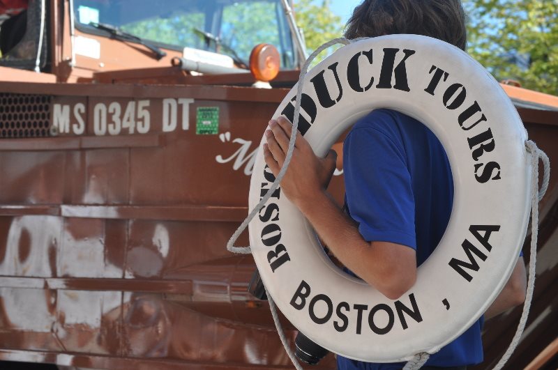
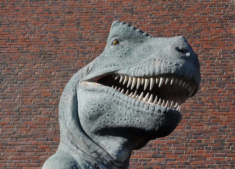
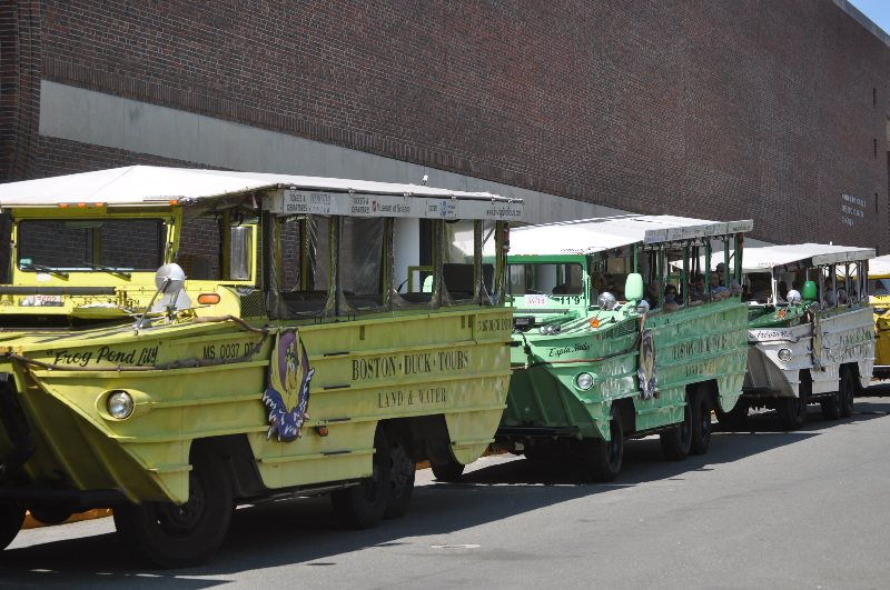

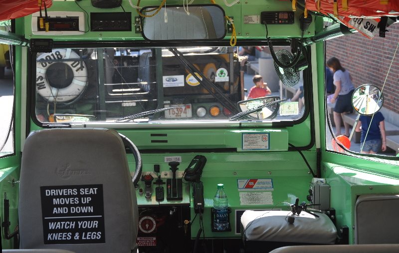
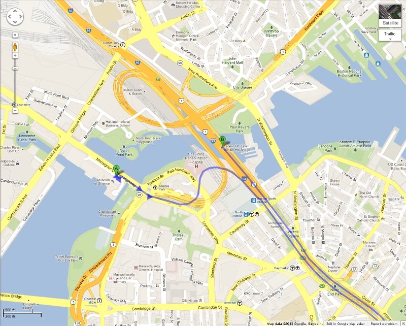


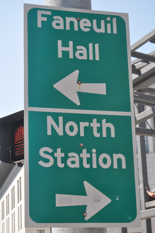


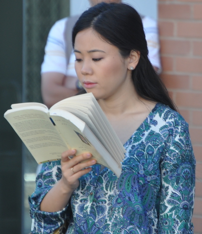
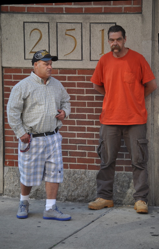


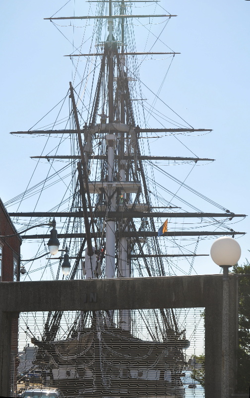
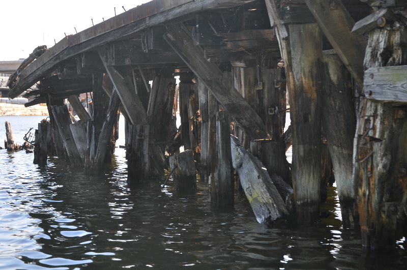
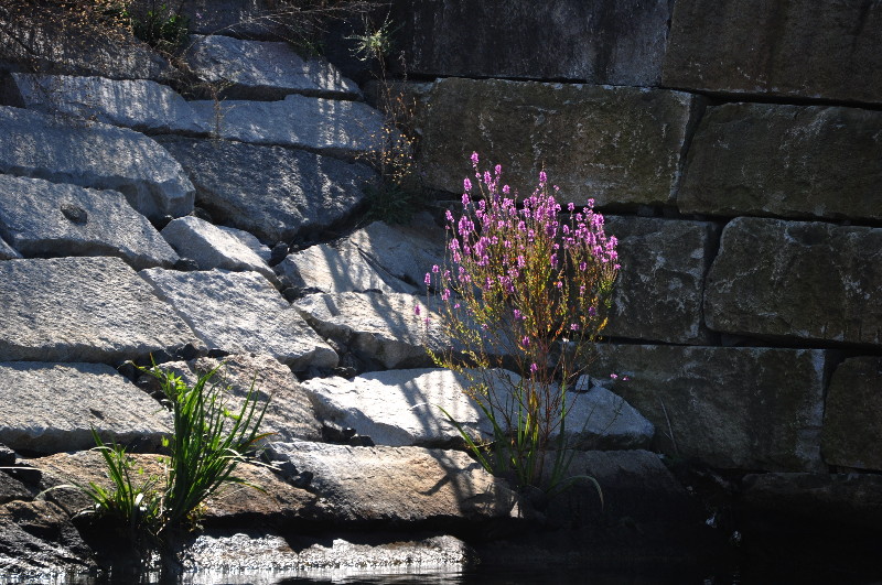

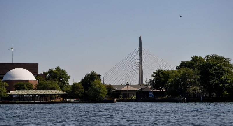
